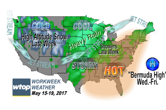
WASHINGTON — The D.C. area, along with most of the eastern part of the country, is about to undergo a few days of another summer weather preview.
The culprit is the area of high pressure that brought the beautiful weather on Monday and Tuesday — but now as it is moving away from the area out to sea, it is becoming the much talked-about “Bermuda High” weather pattern that can bring us our heat spells in the summer months.
All the colder weather is in the western parts of the country and storminess is in-between. This was talked about in this week’s edition of “Workweek Weather” from Monday morning.
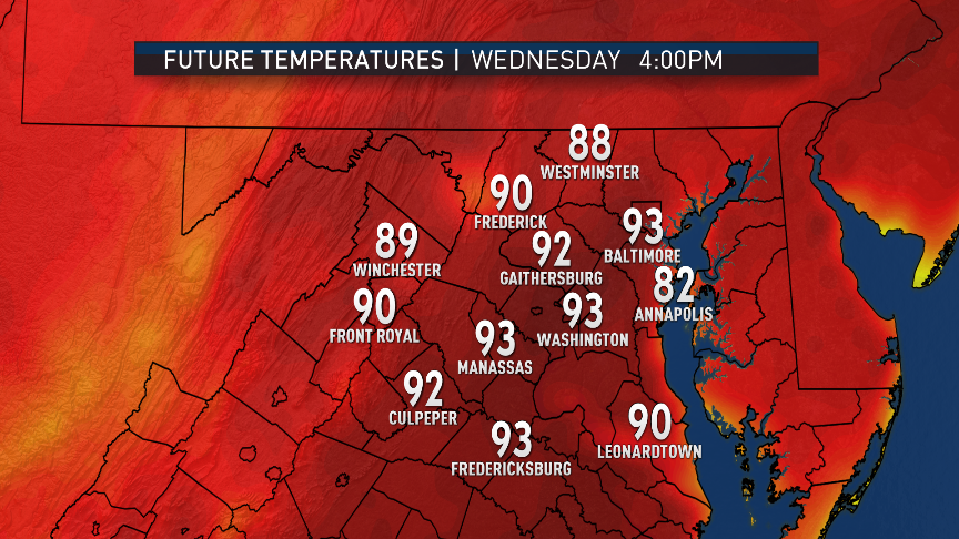
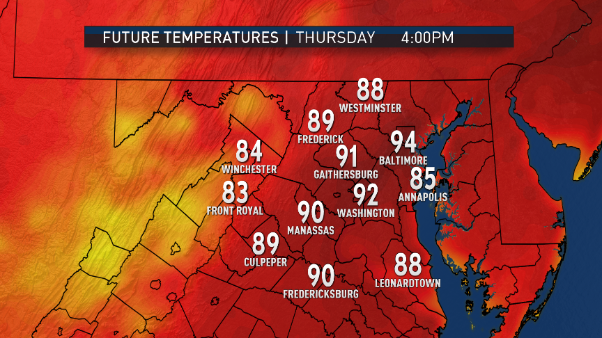
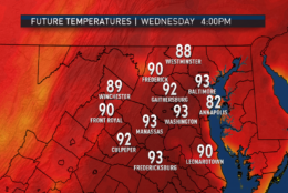
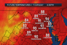
Some of the high temperatures the next few days could be record highs, and some of those go way back. The records and their years are listed as follows. Records that have the greatest chance of being tied or broken are starred and in italics.
| Dates | Reagan National Airport | Dulles International Airport | BWI Marshall Airport |
|---|---|---|---|
| Wednesday, May 17 | 91 degrees* — 1974 (and other years) | 89* — 1986 | 93* — 1896 |
| Thursday, May 18 | 96 — 1877 | 91* — 1987 | 97 — 1962 |
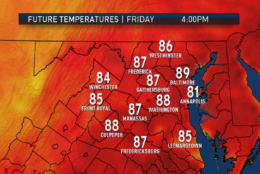
| Friday, May 19 | 96 — 1997 (and other years) | 92 — 1997 (and other years) | 98 — 1962 |
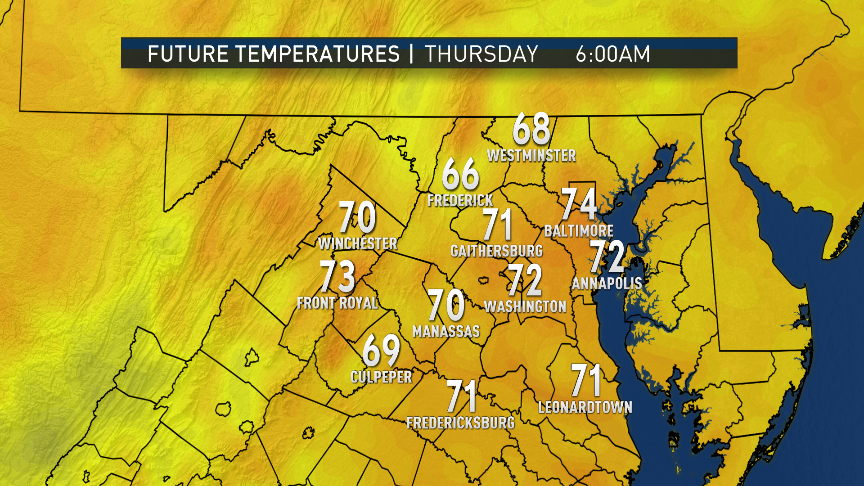
Most of the weather in this pattern for the next two days will be fairly quiet. Storm Team 4 radar will have to be tracked in the afternoons during prime heating, especially toward the mountains as the “uneven” heating of the terrain could produce an isolated thunderstorm or two.
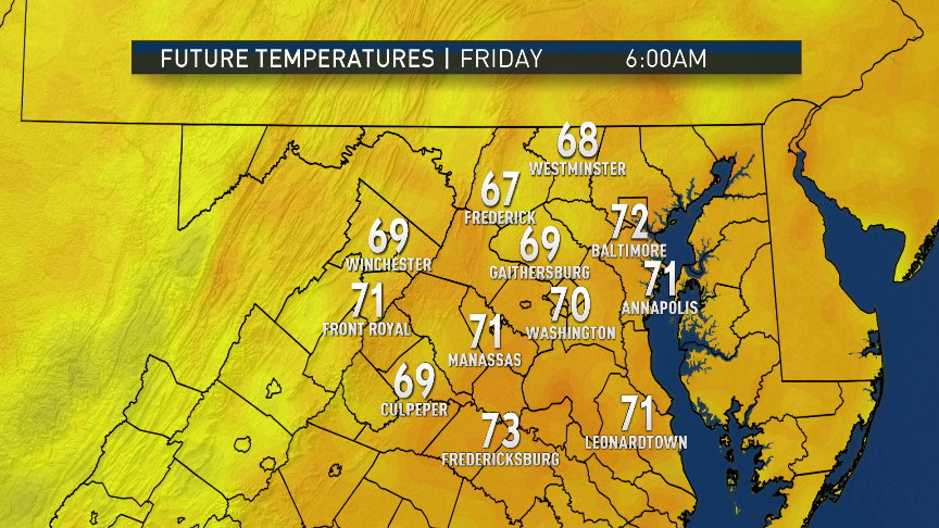
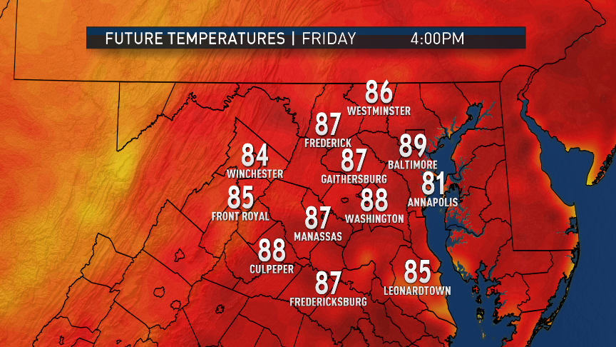
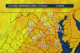
On Friday, clouds will be increasing quite a bit ahead of a cold front sliding down from Pennsylvania. The clouds will likely keep us out of the 90s and, therefore, nowhere near the records, although upper 80s will still be very warm for this time of year. The chances for scattered thunderstorms will also be high.
Throughout the next few days, dew point temperatures will be in the low to mid-60s. Remember that the higher the dew point, the higher the amount of moisture in the atmosphere. For most people, when the dew points are in the 60s, it starts to feel sticky and uncomfortable.
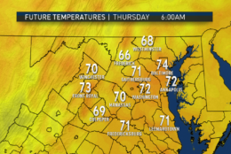
Behind the cold front, high pressure will nudge into New England, providing us with easterly winds under cloud cover. That combination will keep us much cooler and in the 70s, more seasonable by comparison.
Visit our weather page for the latest updates, follow us on Twitter @WTOP, and listen to live weather reports every 10 minutes on 103.5 FM or via our online stream.