WASHINGTON — It may be hard to believe, after the springlike temperatures Thursday, wintry precipitation could be coming in less than 24 hours.
But that’s the exact scenario that Storm Team4 is tracking: Colder, drier weather Friday, and moisture moving up and over and into that cold, dry air on Saturday. But temperatures at different levels of the atmosphere are in play, so it looks like a “wintry mix” is on the table.
A cold front passes through during the morning rush on Friday, meaning that highs will likely come in the wee hours of the morning. Then northerly winds will transport colder air all day and temperatures will fall to more seasonable daytime high temperatures in the afternoon. After that, they will fall even more and Friday’s high temperature for the day will likely occur at midnight.
And then comes the moisture for Saturday. It will be moisture transported aloft by the jet stream from a southerly direction. But here at the ground, our winds will be northerly and northeasterly. The colder air will be shoved up against the mountains, courtesy of Arctic high pressure anchored over New England. And it’s a “stable” atmosphere, slow to change.
Dry air aloft will ensure staying cold enough through most of the atmosphere for snow to reach the ground from the clouds, accumulating a couple of inches on mostly grassy and untreated surfaces. But then warmer air in the mid-levels will win out, and the snow will change to the wintry mix in the form of some sleet and patchy freezing rain. At the same time, however, it looks like precipitation rates, period, will be slowing down. So not a lot of ice is expected after the snow for right now.
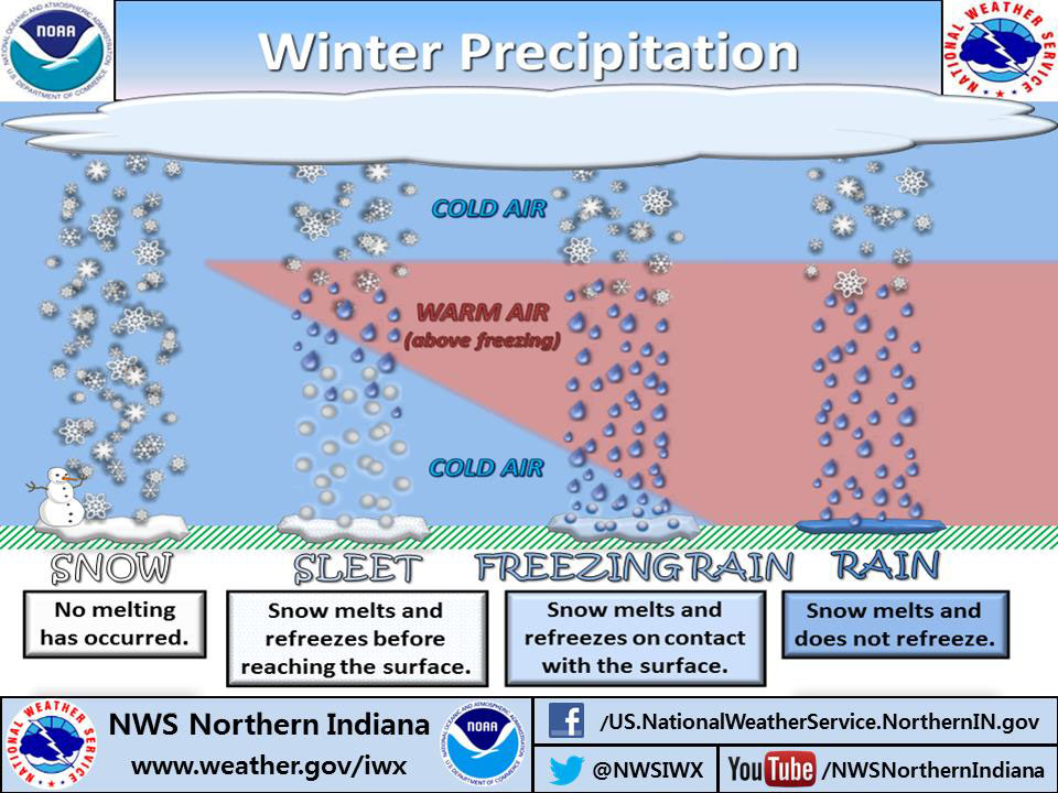
This image from the National Weather Service shows a highly idealized cross section of the atmosphere where the freezing point varies with height, and different types of precipitation reach the surface. The way they built this graphic, it resembles looking from the west to the east and a warm front is coming up from the south. Most of the day, we will generally be on the left side of the graphic. By the time we would get all the way to the right side, we will already be drying out.
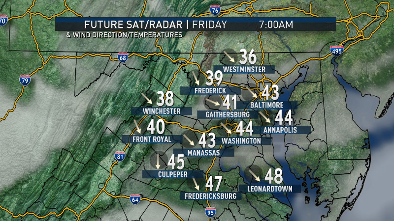
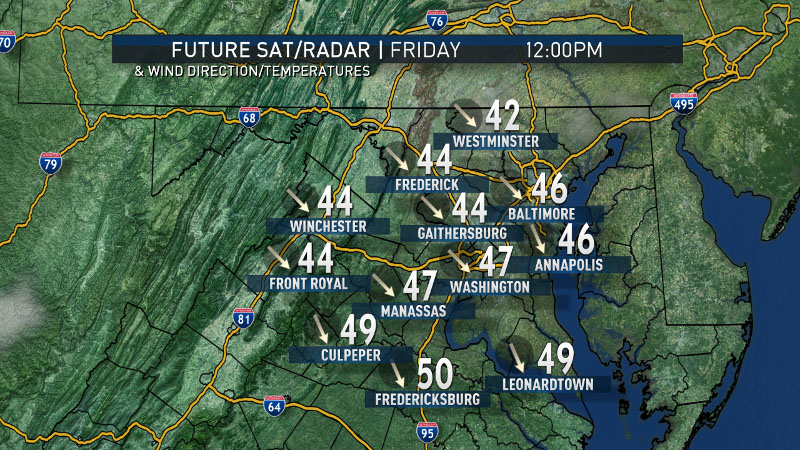
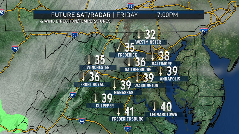
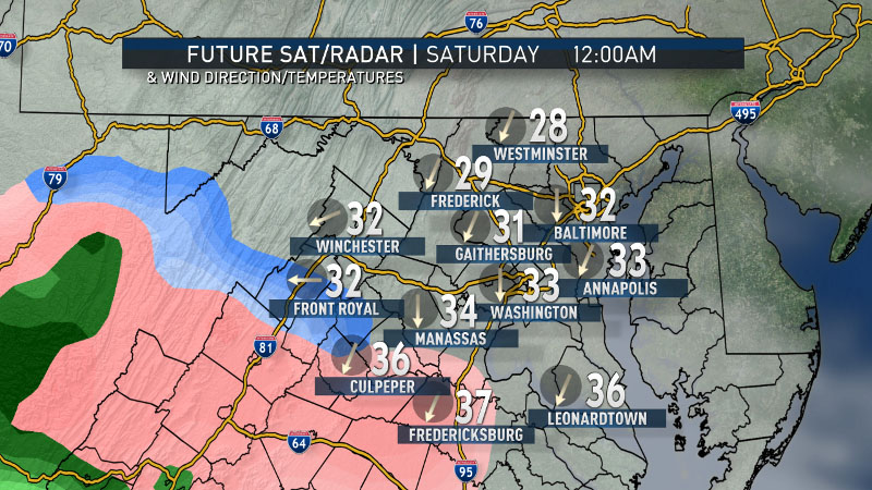
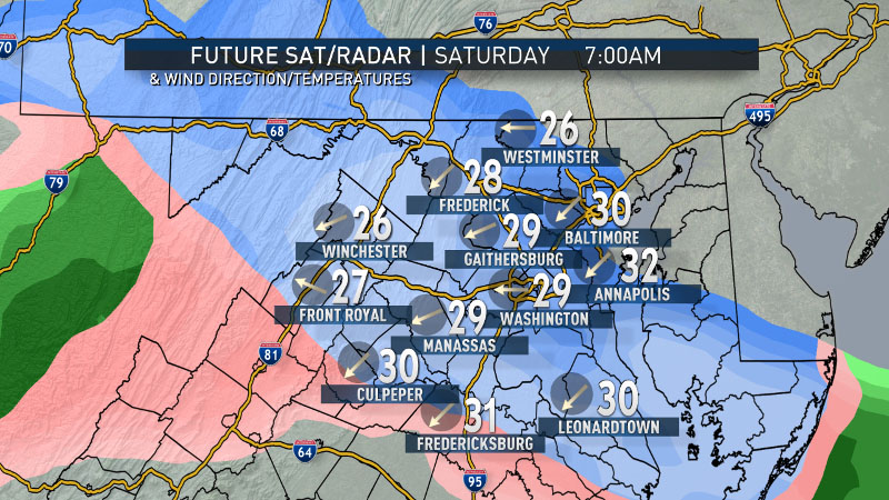
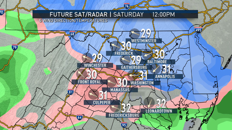
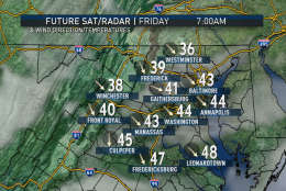
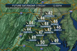
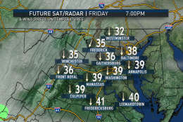
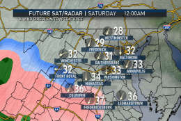
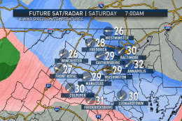
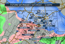
This series of images below is from the RPM computer model. The data shown are clouds and future winter-type radar. The station plot shows temperature and wind direction. Keep in mind this is just raw computer data from one particular model almost two days out, so the data will change and it may not completely jibe with the human Storm Team4 forecast. But it shows the scenario that’s on the table being considered: warm Thursday, colder Friday, cold with changing precipitation types Saturday — likely mostly light snow. The blue shaded areas are snow, the pink shades are sleet and/or freezing rain, and the greens are plain rain.
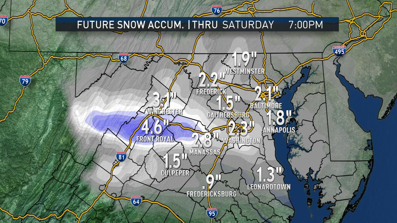
How does it all add up? For the same run of the RPM, the model believes there could be some slushy accumulations, most of it occurring before midmorning. We do not necessarily believe the highest amount bull’s-eye along Interstate 66 yet.
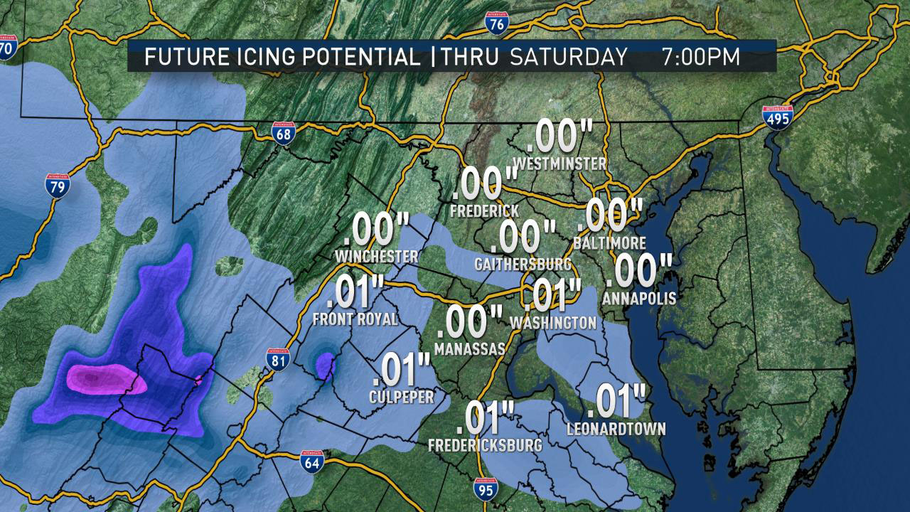
What about the ice? Will it add up to a significant amount? Probably not much for most of the area. The highest accretion of ice may remain in the southwestern areas where the warm air aloft arrives first, the colder air lasts longer in the valleys, all before the dry air shuts everything down.
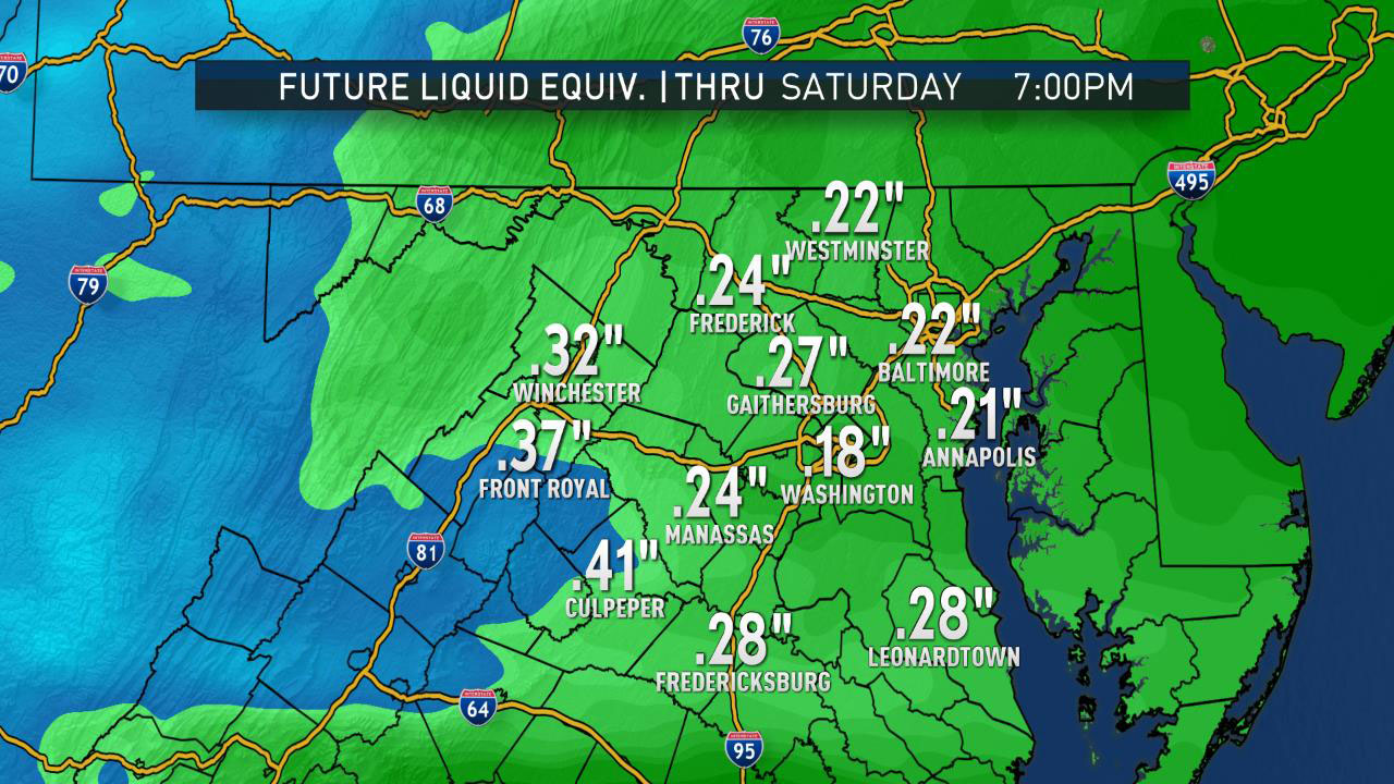
What values is the precipitation regarding the drought conditions? What is the liquid equivalent of this snow and sleet? If it were all rain, or rather, when this all melts, what would the amounts be? A few tenths, for sure. Not as much as we need overall to make up last year’s deficit, but it will help.
StormTeam 4 will continue to keep you updated from now through the storm on Saturday. The latest specific forecast details can always be found on WTOP’s weather page.