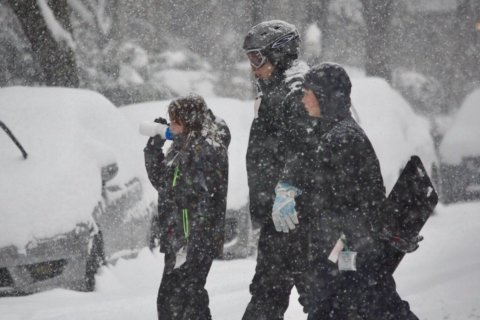
WASHINGTON — Even though the D.C. area saw itself thaw out Monday after the weekend snowstorm, subfreezing temperatures overnight froze everything that melted, making for patches of black ice and some mass transit delays.
- Listen to WTOP online and on the radio at 103.5 FM or 107.7 FM.
- Current traffic conditions
- Weather forecast
- Closings and delays
- Sign up for WTOP alerts
CLOSINGS AND DELAYS
Federal offices will open with a two-hour delay, the Office of Personnel Management said. This status does not apply to furloughed employees.
1/15: Federal agencies in the DC area will OPEN with a 2-hour delay on Tuesday, January 15, 2019. Employees should plan to arrive for work no more than 2 hours later than they would be expected to arrive. Employees should visit https://t.co/XNpFS40aXT to confirm their status. pic.twitter.com/drRG2rzDet
— OPM (@USOPM) January 15, 2019
A number of school systems across the region announced delays Tuesday. Some school systems in Virginia will still be closed. In Maryland, public schools in Prince George’s and Montgomery counties will open with a two-hour delay.
D.C. Public Schools will open on time Tuesday.
See the latest school closings and delays.
In Virginia, Arlington Public Schools will be closed Tuesday. Public schools in Culpeper, Fauquier, Stafford, Spotsylvania and Rappahannock counties are closed, as are public schools in Fredericksburg City.
A number of school systems in Maryland will open two hours late Tuesday. That includes public schools in Prince George’s, Montgomery, Howard, Charles, Calvert and Anne Arundel counties.
ROAD CONDITIONS: WATCH FOR BLACK ICE
“Lows will range from the upper teens in suburbs to the middle 20s in D.C., so there will be plenty of icy spots, especially secondary roads, bridges, overpasses and off/on ramps,” NBC Washington meteorologist Steve Prinzivalli said. Icy patches will be on sidewalks and in parking lots, so walk with caution.
Related Gallery
The Maryland State Highway Administration’s John Schofield said drivers need to do their part by driving defensively. Go slow, he told WTOP listeners — and clean off all the snow and ice before you start moving.
“If you haven’t been out in a couple of days, you’ve got a pretty good layer of snow on the top of your car,” he said. “That’ll become a projectile if you don’t brush it off.”
Schofield said that neighborhood roads were more likely to ice over than the region’s larger highways.
MASS TRANSIT
Metrobus service returns to normal Tuesday morning. Metrorail service Monday was not impacted by the weather. MetroAccess ran as usual but with delays.
Virginia Railway Express and MARC service are operating on a full schedule Tuesday.
VRE Manassas Line trains 332 and 321 are currently up to 40 minutes late due to a frozen switch just north of Broad Run. VRE Fredericksburg trains 304, 306 are now running up to 20 minutes late due to train traffic.
Fairfax Connector will run on a regular weekday schedule Tuesday.
ART will operate normal weekday service, but delays are possible on routes 45, 75 and 77 depending on road conditions.
FORECAST: MORE TO COME?
“Following this past weekend’s major snowstorm, a dry and chilly weather pattern is on tap for the middle of the workweek before it turns unsettled late-week and into the weekend,” said Prinzivalli.
Temperatures will continue to fluctuate above and below freezing the next few days, Storm Team 4 meteorologist Matt Ritter said.
“More sunshine on Tuesday means back up to near 40 degrees,” Ritter said. “Even more melting but below freezing Tuesday night means another refreeze. Back into the low 40s on Wednesday, with lots more sunshine so even more melting, but Wednesday night will probably stay above freezing.”
See the snow totals in the D.C. area.
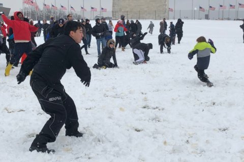
After digging out after the record-setting winter storm, which dropped nearly a foot of snow, winter is far from over — and forecasts were highlighting the possibility of more wintry weather late this week.
“We still have two quiet weather days in front of us to recover, once and for all, from the weekend snowstorm,” NBC Washington chief meteorologist Chuck Bell said.
Two more storm systems could impact the area before the week is out, the next chapter in what forecasters are calling an “active pattern” of low-pressure systems moving through a freezing air mass descending from subarctic Canada.
The first will likely be a rain event starting Thursday evening, with a short-lived wintry mix possible early Friday — especially in the Shenandoah Valley and Northern Maryland. Still, even a brief icing could cause travel woes for Friday morning commute, and Bell said this storm will need to be monitored carefully as it forms over the next two days.
Yet another weekend storm is looking to be the larger of the two — though Tuesday’s model runs had trended away from an all-snow event in favor of rain or a wintry mix starting Saturday night and lasting through Sunday.
“As Arctic air dives into the middle of the country, warmer air will be pushed up the East Coast,” Bell said. “This should keep most of the area above freezing Saturday night but we still can’t rule out at least some ice or sleet in the pre-dawn hours of Sunday morning.”
Regardless of what happens, that system will give way to a strong northwesterly wind that could bring with it some of the coldest air of the season next week.
TUESDAY: Mostly sunny and chilly.
Highs: near 40WEDNESDAY: Partly sunny and seasonably chilly.
Highs: mid-40sTHURSDAY: Increasing clouds, colder; chance of rains/snow showers at night.
Highs: mid- to upper 30sFRIDAY: Chance for some morning rain/snow showers, then clearing and milder.
Highs: mid-40s
Current conditions
WTOP’s Alejandro Alvarez, Tiffany Arnold and Dick Uliano contributed to this report.