PHOTOS: Top 10 DC-area weather events in 2018

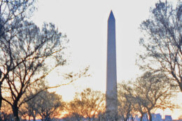
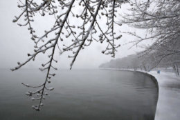
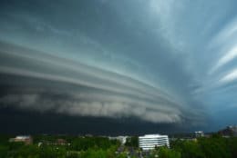
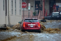
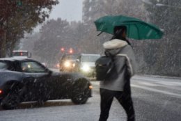
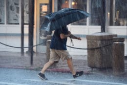
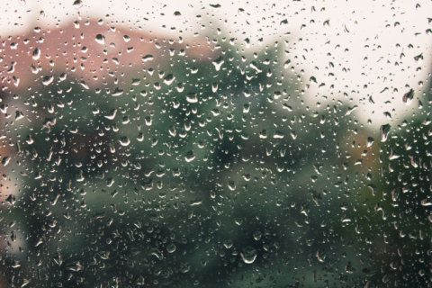
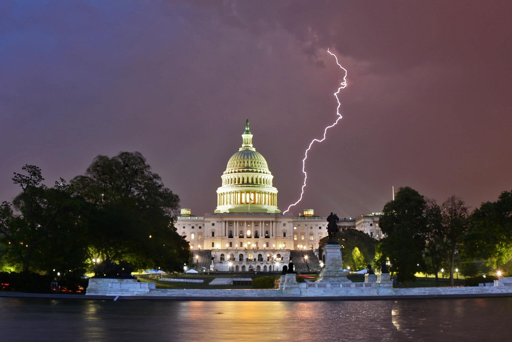
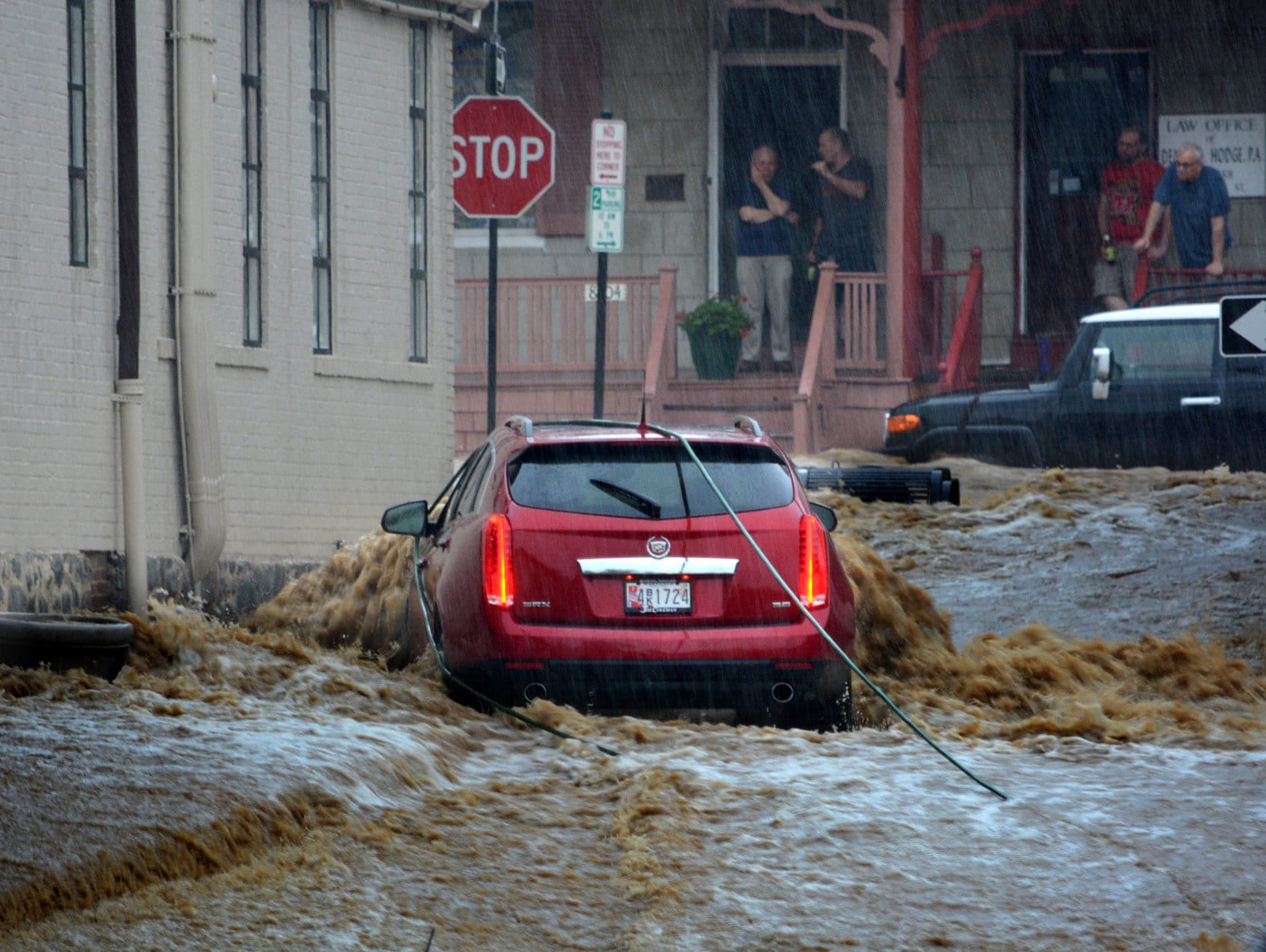
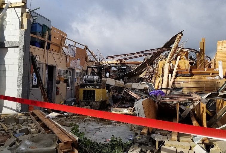
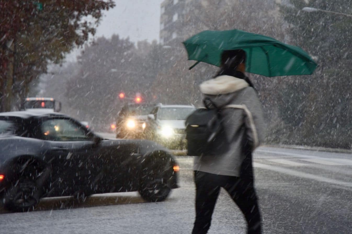
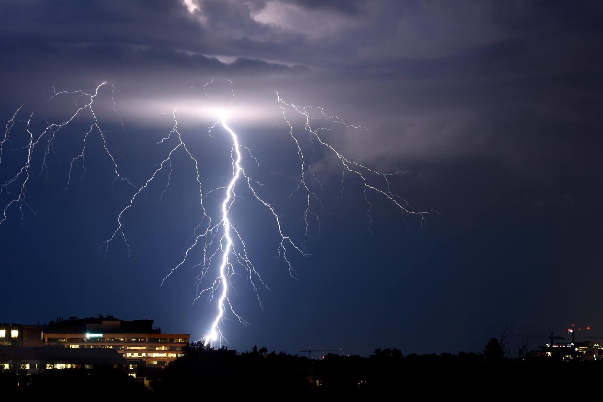
WASHINGTON — If the weather in 2018 could be summed up in one word that word would be “wet.”

After repeated downpours during the spring, summer and fall, D.C.’s precipitation total for the year reached an all-time high in mid-December, surpassing 61.33 inches, breaking a record set in 1889.

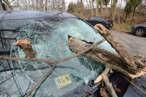
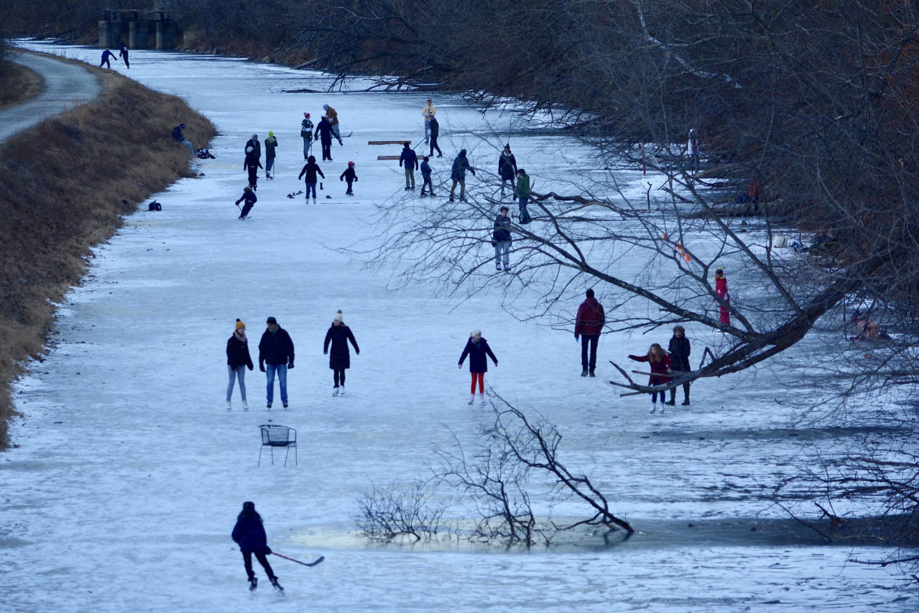
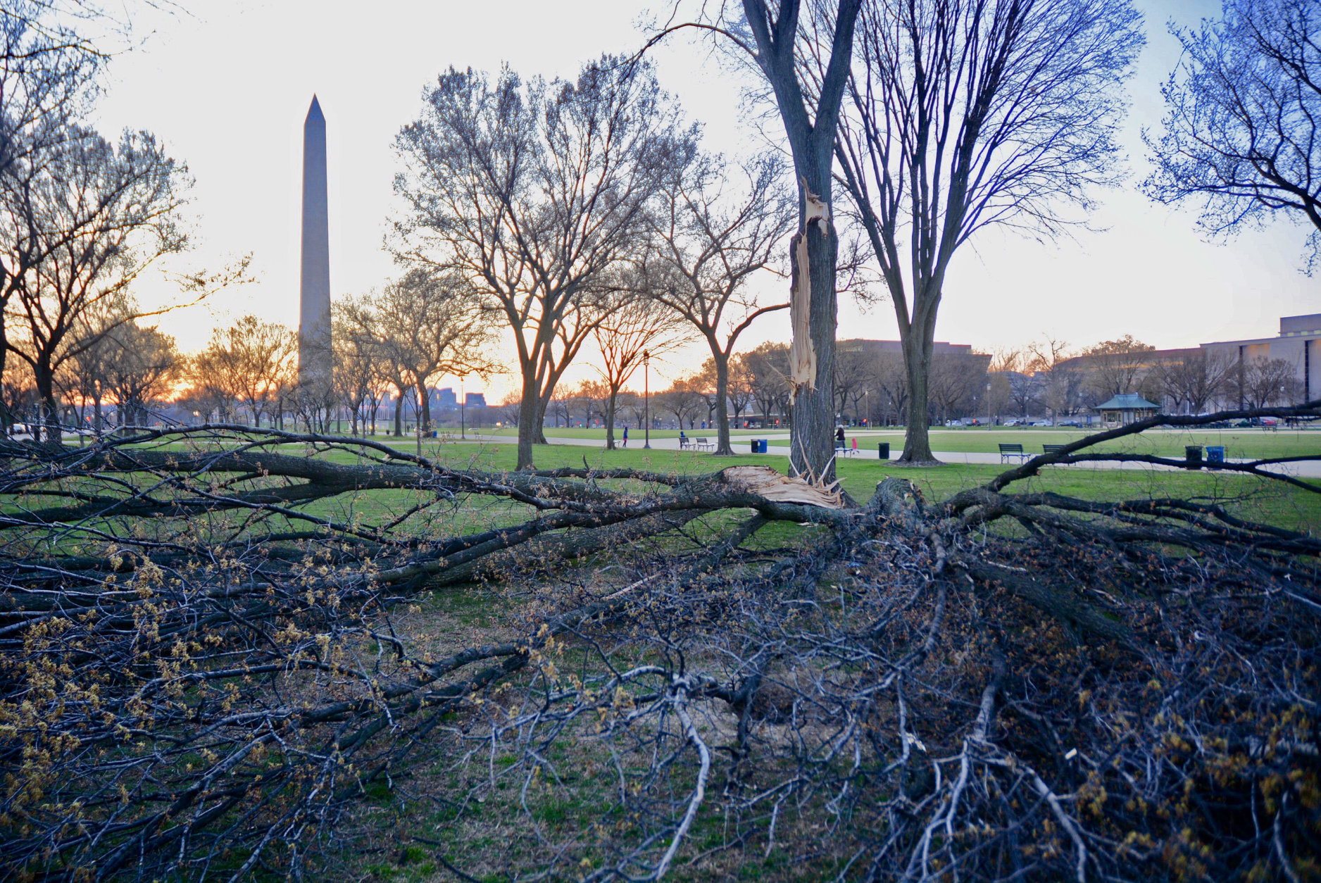
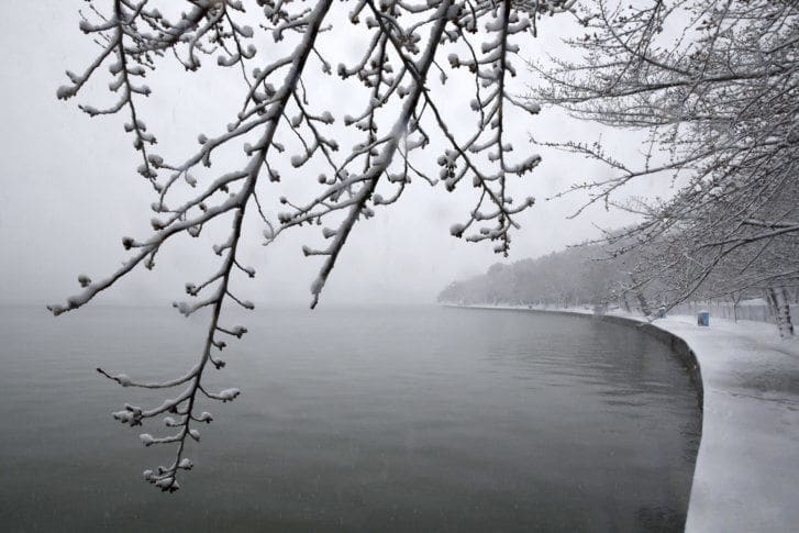
The year will also be remembered for its frigid beginning, ferocious windstorm and curiously timed spring and fall snow.

Click through the gallery for a look back at the remarkable weather that bellowed through the nation’s capital in 2018.

The year began at the height of a remarkable cold snap. It was the coldest stretch of weather in Washington since 1989. Powerful cold fronts pushed arctic air into the region during the final week of 2017. From Christmas through the first week of the new year, highs remained near or below freezing for 12 consecutive days. Lows in the single digits and teens were common. (WTOP/Dave Dildine)
1) A frigid beginning The year began at the height of a remarkable cold snap. It was the coldest stretch of weather in the D.C. area since 1989. Powerful cold fronts pushed arctic air into the region during the final week of 2017. From Christmas through the first week of the new year, highs remained near or below freezing for 12 consecutive days. Lows in the single digits and teens were common. (WTOP/Dave Dildine)
During the prolonged cold snap at the beginning of the year, the Potomac River froze from the Virginia to the District shoreline. Many other rivers, ponds and waterways froze solid. The average high temperature for the first week of the year was a bone-chilling 25.6 degrees. An extreme temperature swing and warm weather in the final weeks of January led to near a near average monthly temperature. (WTOP/Dave Dildine)
1) A frigid beginning (cont.) During the prolonged cold snap at the beginning of the year, the Potomac River froze from the Virginia to the District shoreline. Many other rivers, ponds and waterways froze solid. The average high temperature for the first week of the year was a bone-chilling 25.6 degrees. An extreme temperature swing and warm weather in the final weeks of January led to near a near average monthly temperature. (WTOP/Dave Dildine)
Washington Monument
2) Windstorm of 2018 One of the most dramatic weather events of the year stormed into the area early on March 2. An unusually powerful and prolonged high-wind event bellowed under partly cloudy skies for hours on end. Winds relentlessly gusted above 50 miles per hour. A peak gust of 71 miles per hour was recorded at Dulles International Airport shortly before noon. The March windstorm led to hundreds of thousands of power outages and countless downed trees. (WTOP/Dave Dildine)
A late winter storm brought the year's deepest snowfall on March 23. Most of the area saw between 3 to 6 inches of snow, although the National Weather Service reported more than a foot of snow fell in some parts of Frederick County, Maryland. All three D.C. area airports recorded at least 4 inches of snow as well. (AP/Jacquelyn Martin)
3) Spring snow A late winter storm brought the year’s deepest snowfall on March 23. Most of the area saw between 3 to 6 inches of snow, although the National Weather Service reported more than a foot of snow fell in some parts of Frederick County, Maryland. All three D.C. area airports recorded at least 4 inches of snow as well. (AP/Jacquelyn Martin)
Spring thunderstorms danced across the skies during a stormy period beginning on Mother's Day weekend. Lightning flickered behind the U.S. Capitol late that Saturday. High winds ahead of the storms forced officials to stop traffic on Route 50 at the Bay Bridge for a time. (WTOP/Dave Dildine)
4) Succession of spring storms Spring thunderstorms danced across the skies during a stormy period beginning on Mother’s Day weekend. Lightning flickered behind the U.S. Capitol late that Saturday. High winds ahead of the storms forced officials to stop traffic on Route 50 at the Bay Bridge for a time. (WTOP/Dave Dildine)
The stormy conditions culminated on Monday afternoon as a giant squall line swept across the region. An ominous shelf cloud and gusty winds raced across the western suburbs. Trees were toppled and heavy rain and wind-driven hail pelted drivers during the afternoon rush hour. (WTOP/Dave Dildine)
4) Succession of spring storms (cont.) The stormy conditions culminated on Monday afternoon as a giant squall line swept across the region. An ominous shelf cloud and gusty winds bombarded the western suburbs. Trees were toppled and heavy rain and wind-driven hail pelted drivers during the afternoon rush hour. (WTOP/Dave Dildine)
Tragedy struck Ellicott City, Md. for the second time in two years on May 27. Between 6 and 12 inches of rain fell in just a few hours. The exceptionally heavy rain led to flash flooding on historic Main Street late the afternoon. Buildings were inundated by water, roads were torn apart, and one person was killed after being swept away. (WTOP/Dave Dildine)
5) Ellicott City under water again Tragedy struck Ellicott City, Maryland, for the second time in two years on May 27. Between 6 and 12 inches of rain fell in just a few hours. The exceptionally heavy rain led to flash flooding on historic Main Street late in the afternoon. Buildings were inundated by water, roads were torn apart, and one person was killed after being swept away. (WTOP/Dave Dildine)
The year will be well remembered for its repeated volleys of heavy rainfall. A storm on July 26 unloaded more than three inches of rain in just a couple of hours in Northwest Washington. Flash flooding quickly enveloped Broad Branch Road in Northwest Washington as the nearby stream and Rock Creek spilled over its banks. The damage caused by the flooding was so extensive, the road was closed for nearly a month while repairs were made. (WTOP/Dave Dildine)
6) D.C. deluge The year will be well remembered for its repeated volleys of heavy rainfall. A storm on July 26 unloaded more than 3 inches of rain in just a couple of hours in Northwest Washington. Flash flooding quickly enveloped Broad Branch Road in Northwest Washington as the nearby stream and Rock Creek spilled over its banks. The damage caused by the flooding was so extensive, the road was closed for nearly a month while repairs were made. (WTOP/Dave Dildine)
A swarm of damaging tornadoes struck central Virginia on September 17. The tornadoes were spawned by the remnant swirl of Hurricane Florence and came 14 years to the day after Virginia’s largest tornado outbreak on record. An EF-2 tornado with winds estimated around 120 was responsible for the death of a Chesterfield man when the warehouse he was in collapsed. (NWS Wakefield, Va.)
7) Virginia tornado outbreak A swarm of damaging tornadoes struck central Virginia on Sept. 17. The tornadoes were spawned by the remnant swirl of Hurricane Florence and came 14 years to the day after Virginia’s largest tornado outbreak on record. An EF-2 tornado with winds estimated around 120 was responsible for the death of a Chesterfield man when the warehouse he was in collapsed. (NWS Wakefield, Va.)
At nightfall, two tornadoes touched down in northern Maryland late on November 2. One of the twisters, with an estimated wind speed of 105 miles per hour, struck an Amazon sorting facility in Baltimore. Two people were killed and another injured as a wall gave way. Another tornado, rated an EF-0, touched down in Mt. Airy, damaging a few buildings.  (Baltimore Fire)
8) Maryland tornadoes Just after nightfall on Nov. 2, two tornadoes touched down in northern Maryland. One of the twisters, with an estimated wind speed of 105 miles per hour, struck an Amazon sorting facility in Baltimore. Two people were killed and another injured as a wall gave way. Another tornado, rated an EF-0, touched down in Mt. Airy, damaging a few buildings. (Baltimore Fire)
An unusual early season snowfall plastered the D.C. area on November 15. With 1.4 inches of snow measured at Reagan National Airport, it was the deepest November snowfall for Washington since 1989. The weather closed and delayed many school systems. More than 6 inches fell in Frederick County, Md. and Interstate 70 was impassable for a time with snow blamed for several accidents involving trucks. (WTOP/Dave Dildine)
9) Rare November snowfall An unusual early season snowfall plastered the D.C. area on Nov. 15. With 1.4 inches of snow measured at Reagan National Airport, it was the deepest November snowfall for Washington since 1989. The weather closed and delayed many school systems. More than 6 inches fell in Frederick County, Maryland, and Interstate 70 was impassable for a time with snow blamed for several accidents involving trucks. (WTOP/Dave Dildine)
If the year’s weather in the Washington area could be summed up in one word it would be "wet." And it wasn't just abnormally wet. Another soaking round of rain from a nor'easter on Saturday, December 15, nudged the total precipitation for the year to an all-time high in Washington. The total observed precipitation at Reagan National Airport eclipsed 61.33 inches, besting a record set in 1889 and securing 2018 as the wettest year on record. (WTOP/Dave Dildine)
10) Record-breaking rainfall If the year’s weather in the area could be summed up in one word it would be “wet.” And it wasn’t just abnormally wet. Another soaking round of rain from a nor’easter on Saturday, Dec. 15, pushed the precipitation total for the year to an all-time high. The total observed precipitation at Reagan National Airport eclipsed 61.33 inches, besting a record set in 1889, and secured 2018 as the wettest year on record. (WTOP/Dave Dildine)
thunderstorm flooding dildine
10) Record-breaking rainfall (cont.) An electrified storm threw bolts of lightning toward the Bethesda skyline and soaked parts of Montgomery County in early September 2018. A day later, more rain drenched the District and suburbs. It ended up being the fifth wettest September on record for D.C. By late December, the rainfall total for the year surpassed 64 inches, exceeding the previous record by over 3 inches. (WTOP/Dave Dildine)
(1/13)
The year began at the height of a remarkable cold snap. It was the coldest stretch of weather in Washington since 1989. Powerful cold fronts pushed arctic air into the region during the final week of 2017. From Christmas through the first week of the new year, highs remained near or below freezing for 12 consecutive days. Lows in the single digits and teens were common. (WTOP/Dave Dildine)
During the prolonged cold snap at the beginning of the year, the Potomac River froze from the Virginia to the District shoreline. Many other rivers, ponds and waterways froze solid. The average high temperature for the first week of the year was a bone-chilling 25.6 degrees. An extreme temperature swing and warm weather in the final weeks of January led to near a near average monthly temperature. (WTOP/Dave Dildine)
Washington Monument
A late winter storm brought the year's deepest snowfall on March 23. Most of the area saw between 3 to 6 inches of snow, although the National Weather Service reported more than a foot of snow fell in some parts of Frederick County, Maryland. All three D.C. area airports recorded at least 4 inches of snow as well. (AP/Jacquelyn Martin)
Spring thunderstorms danced across the skies during a stormy period beginning on Mother's Day weekend. Lightning flickered behind the U.S. Capitol late that Saturday. High winds ahead of the storms forced officials to stop traffic on Route 50 at the Bay Bridge for a time. (WTOP/Dave Dildine)
The stormy conditions culminated on Monday afternoon as a giant squall line swept across the region. An ominous shelf cloud and gusty winds raced across the western suburbs. Trees were toppled and heavy rain and wind-driven hail pelted drivers during the afternoon rush hour. (WTOP/Dave Dildine)
Tragedy struck Ellicott City, Md. for the second time in two years on May 27. Between 6 and 12 inches of rain fell in just a few hours. The exceptionally heavy rain led to flash flooding on historic Main Street late the afternoon. Buildings were inundated by water, roads were torn apart, and one person was killed after being swept away. (WTOP/Dave Dildine)
The year will be well remembered for its repeated volleys of heavy rainfall. A storm on July 26 unloaded more than three inches of rain in just a couple of hours in Northwest Washington. Flash flooding quickly enveloped Broad Branch Road in Northwest Washington as the nearby stream and Rock Creek spilled over its banks. The damage caused by the flooding was so extensive, the road was closed for nearly a month while repairs were made. (WTOP/Dave Dildine)
A swarm of damaging tornadoes struck central Virginia on September 17. The tornadoes were spawned by the remnant swirl of Hurricane Florence and came 14 years to the day after Virginia’s largest tornado outbreak on record. An EF-2 tornado with winds estimated around 120 was responsible for the death of a Chesterfield man when the warehouse he was in collapsed. (NWS Wakefield, Va.)
At nightfall, two tornadoes touched down in northern Maryland late on November 2. One of the twisters, with an estimated wind speed of 105 miles per hour, struck an Amazon sorting facility in Baltimore. Two people were killed and another injured as a wall gave way. Another tornado, rated an EF-0, touched down in Mt. Airy, damaging a few buildings.  (Baltimore Fire)
An unusual early season snowfall plastered the D.C. area on November 15. With 1.4 inches of snow measured at Reagan National Airport, it was the deepest November snowfall for Washington since 1989. The weather closed and delayed many school systems. More than 6 inches fell in Frederick County, Md. and Interstate 70 was impassable for a time with snow blamed for several accidents involving trucks. (WTOP/Dave Dildine)
If the year’s weather in the Washington area could be summed up in one word it would be "wet." And it wasn't just abnormally wet. Another soaking round of rain from a nor'easter on Saturday, December 15, nudged the total precipitation for the year to an all-time high in Washington. The total observed precipitation at Reagan National Airport eclipsed 61.33 inches, besting a record set in 1889 and securing 2018 as the wettest year on record. (WTOP/Dave Dildine)
thunderstorm flooding dildine

RELATED STORIES

Dave Dildine

A native to the Washington area, Dave Dildine is no stranger to the region's complex traffic and weather patterns. Dave joined WTOP in 2010 when the station launched its very own in-house traffic service. You can hear him "on the 8s and when it breaks" from 2 p.m. to 7 p.m. on weekdays.

Federal News Network Logo
Log in to your WTOP account for notifications and alerts customized for you.

Sign up