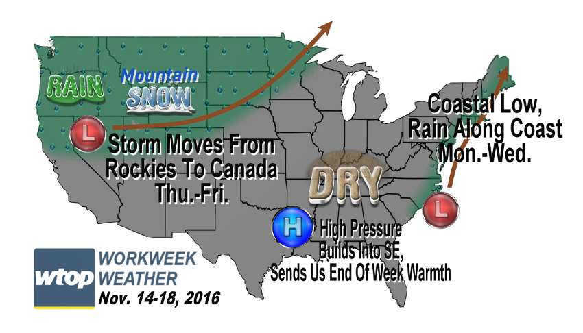
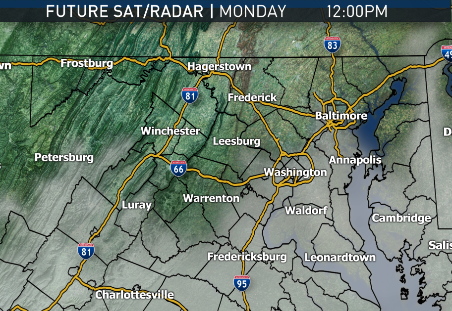
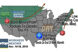
WASHINGTON — The workweek will be dominated by a ridge of high pressure in the eastern United States, extending the dry spell again. But at the beginning of the week, the area will be oh-so close to a coastal area of low pressure, which will form early Monday along the Carolina coast and move up the eastern seaboard very slowly.
Most of the computer model guidance and experience indicate that this will probably mean real umbrella weather near the Coastal Plain, but the good soaking rains will likely stay mainly east of the area. Still, a little bit of rain is expected here, and the clouds will most likely interfere with the viewing of the supermoon on Monday night.
That low will head up into New England by midweek, and the ridge of high pressure will settle just to the south, sending a weak disturbance through on Wednesday with some clouds and maybe a few sprinkles. The feature is really a decaying cold front, and the changes behind the front aren’t dramatically cooler. In fact, temperatures will start warming back up on Thursday.
At the same time, a strong storm system will form in the Rockies, bringing them soaking rains with high elevation snow. All indications show that storm center will lift north into central Canada in the Thursday-Friday time frame. There’s a good chance its associated band of showers will get here, but it wouldn’t be until over the weekend. Incidentally, this is the same storm system I mentioned last week that the various computer models had as a hope for a big rainmaker during this week, but that has now changed in the scenario.
So, once again, umbrellas won’t be needed much this week; jackets for the morning commutes, not as necessary for the afternoons. Nights will be chilly at worst.
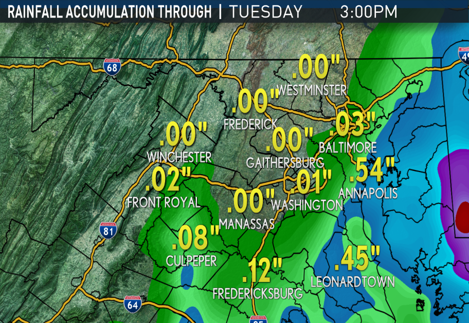
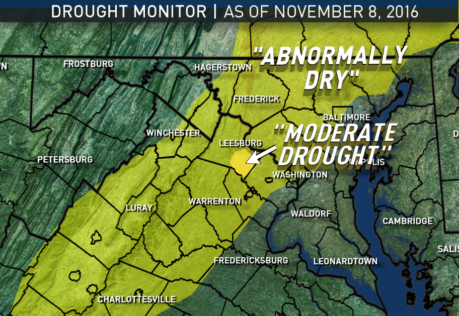
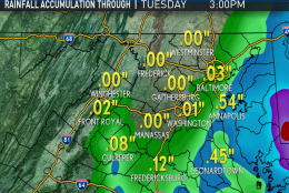
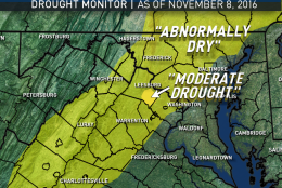
Here’s the official rainfall shortfall for the year at Reagan National Airport, as of the late Sunday afternoon update from the National Weather Service: “6.36 inches and 4.89 inches of that shortage came from Sept. 1 to now, during what’s normally a somewhat dry period of the year anyway. November itself so far is 1.17 inches below average.”
Daily weather highlights
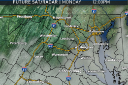
MONDAY
• Becoming cloudy
• Seasonable high temperatures
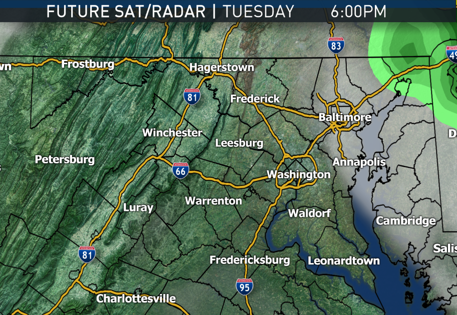
• Light rain/drizzle arriving late afternoon/evening, not much west of Interstate 95
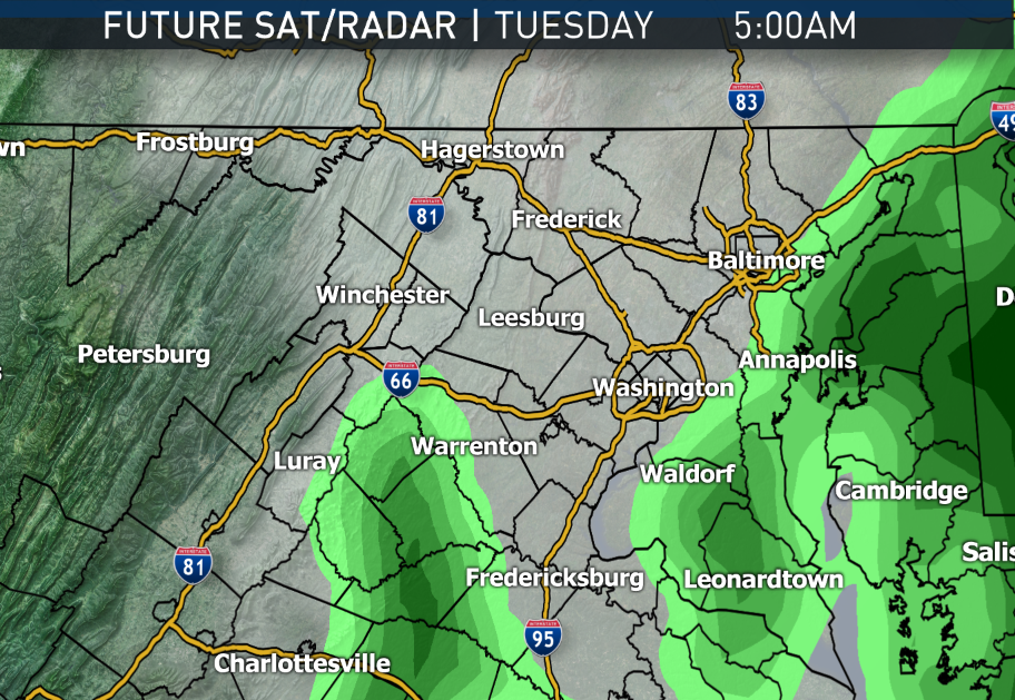
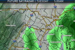
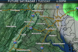
TUESDAY
• Cloudy with light rain/drizzle ending, still not much — if any — west of I-95
• Seasonable high temperatures
• Easterly winds become more westerly, skies start clearing late
WEDNESDAY
• A few hours of clouds and a chance of very light showers or sprinkles
• Seasonable high temperatures
THURSDAY & FRIDAY
• Mostly sunny skies
• High level clouds
• Southwesterly breezes
• Above average temperatures for highs and lows. Friday likely getting close to 70.
NOTE: The WTOP Workweek Weather Blog is intended as an in-depth yet plain language summary of the business week’s weather potential in the D.C. area along with an explanation of the contingencies and uncertainties that exist at the time of publication. For the latest Storm Team 4 forecast, check out the main WTOP Weather page.