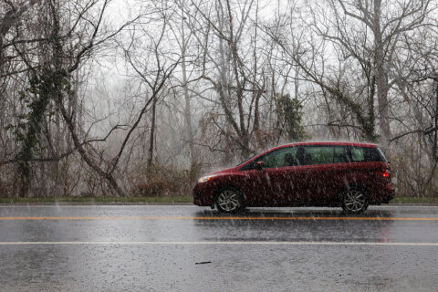
WASHINGTON — Snow and sleet gave way to rain and freezing rain Wednesday across the D.C. area, leaving surfaces slick and increasing the risk of power outages.
Storm Team4 Meteorologist Mike Stinneford said Wednesday afternoon that freezing temperatures had been hanging on across the area. Indeed, the National Weather Service has extended the winter storm warning for the areas north and west of D.C. until 1 a.m. Thursday, as temperatures had gone up more slowly than projected.
Stinneford said just before 6 p.m. that a few pockets of snow were still falling in the southern suburbs of D.C., and that what he called the “messy mix” of sleet and freezing rain would continue, with plain rain moving south to north, and ice forming to varying degrees across the region.
With the majority of the snow now changed over to sleet/ freezing rain, attention is turned to ice accumulations as temperatures only gradually warm above freezing. Advisories & Warnings continue through the evening, with the greatest ice accumulations north/west of I-95. pic.twitter.com/uNqXPPgPyB
— NWS DC/Baltimore (@NWS_BaltWash) February 20, 2019
Warnings and advisories
Winter storm warnings and weather advisories have been in effect for much of the area Wednesday, but some have been canceled while others have been extended.
Winter Storm Warning are in effect for areas in:
Virginia until 1 a.m.: Prince William, Fairfax, Alexandria City, Loudoun, Arlington, Rappahannock, Fauquier counties.
D.C. until 1 a.m.
Maryland until 1 a.m.: Prince George’s, Howard, Montgomery, Anne Arundel, Baltimore City, Baltimore, Caroll, Frederick counties.
Here’s what you need to know.
- Listen to WTOP online and on the radio at 103.5 FM or 107.7 FM.
- Current traffic conditions
- Weather forecast
- Closings and delays
- Sign up for WTOP alerts
Roads and transit
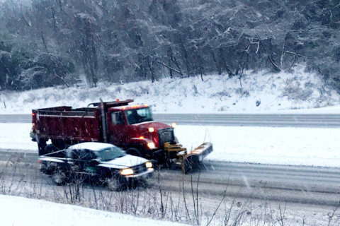
It was all making driving difficult. WTOPs Neal Augenstein said that about 5 inches of snow fell on the Loudoun County Parkway, and ice pellets were falling in the early afternoon. Plows had gotten the main road “down to mostly pavement,” but freezing could still happen, especially on the side roads.
In Calvert County, Maryland, WTOP’s Michelle Basch said that about 2 inches of snow had turned to slush, with rain falling. Conditions on Maryland Route 4 were OK, but when she pulled over into a parking lot in Huntingtown, “I hit the brakes but didn’t stop initially.”
Storm Team4 Meteorologist Lauryn Ricketts added that up to a quarter-inch of ice could accumulate north and west of D.C., with a bit of a coating in the south and in D.C.
Temperatures will cool down a bit more before climbing slowly to the mid-30s in the evening, changing the precipitation over to “a soaking rain” that will continue to the late morning hours of Thursday, Ritter said.
Ricketts added that refreezing, normally a big fear with winter weather, shouldn’t be much of a factor this time around, as temperatures will rise overnight, hitting 40 degrees by the Thursday-morning rush hour.
Between 6 a.m. and 3 p.m. Wednesday, the Maryland State Police said, they responded to 205 crashes and 138 disabled or unattended vehicles. The Fairfax County police said via Twitter that roads “are worse than they look.”
We are seeing an increasing number of accidents on roadways. Neighborhood roads like this one in Burke and around the county are worse then they look. Please stay off the roads – we want you to be safe and warm at home!https://t.co/vct6fVcvGg pic.twitter.com/zhEbqqOM8Z
— Fairfax County Police (@FairfaxCountyPD) February 20, 2019
It is NOT a winter wonderland out there – driving conditions are dangerous! Our officers responded to these accidents that occurred in Fairfax Station and there are more across the county. Please follow everyone’s advice and stay off the roads!! pic.twitter.com/SXc5FF2l9O
— Fairfax County Police (@FairfaxCountyPD) February 20, 2019
Charlie Gischlar, with the Maryland State Highway Administration, said the combination of heavy ice on tree limbs and saturated ground could lead to falling trees and limbs. “We’re kind of expecting that to come later,” he said, adding that tree contractors are on call.
For those and other reasons, Gischlar said, power outages are possible in the afternoon, and they could take out traffic signals. If you see such an intersection, “treat that as a four-way stop,” he said.
A lot of people are staying off the roads, which is helping the clearing process. If you are out, “drive below the speed limit and give yourself plenty of time,” Gischlar said.
The snow is coming down here in Montgomery County, drive safely and slowly! @WTOP ❄️❄️❄️ pic.twitter.com/OIDukN9CjP
— Melissa Howell (@Mhowell003) February 20, 2019
Lotsa white. Tough to drive on Rt 15. Visibility strained. Periodically plowed lane. @WTOPtraffic @WTOP pic.twitter.com/PPtBm9ey0v
— Neal Augenstein (@AugensteinWTOP) February 20, 2019
Beauty, meet treachery. Fast-falling snow in Warrenton. Lousy driving in northern Virginia this morning. @WTOPtraffic @WTOP pic.twitter.com/3argVmrTd3
— Neal Augenstein (@AugensteinWTOP) February 20, 2019
Considerable snow in historic Warrenton, Virginia. @WTOPtraffic @WTOP pic.twitter.com/ew1AwZ7Xo8
— Neal Augenstein (@AugensteinWTOP) February 20, 2019
I'm no Pat Collins, but I'm calling this a quarter-inch in Fauquier Co, near the Prince William line on 29. @WTOPtraffic @WTOP @nbcwashington @patcollins4 pic.twitter.com/j1H2lq5SPu
— Neal Augenstein (@AugensteinWTOP) February 20, 2019
Despite being treated before the snow’s arrival, some roads are covered in snow, some are slushy and some are slick, according to WTOP’s Traffic Center.
On the George Washington Parkway south of Alexandria, WTOP’s Kristi King said the sound of sleet on her windshield was like “hamburgers frying on the grill.” The parkway was plowed, but already slushy.
In Prince William County, an inch of snow had accumulated in a short period of time. U.S. Route 29 was slushy as snow continued to fall, making changing lanes slippery, reported WTOP’s Neal Augenstein.
All roads in Warrenton were snow-covered, reported Warrenton’s Police Department. Although crews were working to clear and treat the roads, “lasting progress won’t be possible until the snow stops,” police said in a Facebook post.
On Tuesday, Maryland Gov. Larry Hogan asked residents to stay home if possible while crews clean roads. And local mass transit agencies had canceled or changed Wednesday’s service.
Find out how Metro, MARC, VRE and bus services have changed in light of the inclement weather.
Timing
Snow began reaching the ground in northern Maryland at around 6:30 a.m. Frederick, Maryland, and the nearby airport were both seeing light snow.
As of 6 a.m. Wednesday, 2 inches had already fallen in Fauquier County, Virginia, and around a quarter-inch had fallen near the Prince William County line.
The snow started falling as early as 4 a.m. Wednesday, reaching central Virginia and eastern West Virginia; snow fell to the south and west of D.C., including Fredericksburg, Virginia, at around 4:30 a.m., Ricketts reported.
We’ve got reports of #thundersnow just to the north and west through Western Maryland! Whoo-hoo! The lightning bolts are showing up on our system… @JimCantore @dougkammerer @amelia_draper @ChuckBell4 @nbcwashington #washingtonDC pic.twitter.com/aHmOyM9Pnp
— Lauryn Ricketts (@laurynricketts) February 20, 2019
What are YOU seeing out there? We are seeing snow piling up right now and will continue to see that through lunchtime. Sleet & FRZ RN will move in during the midday. Warm air wins out later this afternoon/tonight changing everything to rain. pic.twitter.com/AaC6Y6Y3M0
— Lauryn Ricketts (@laurynricketts) February 20, 2019
Accumulation
The forecast for the area was predicted to be between 4 to 6 inches. For the snow totals in D.C., Virginia and Maryland, click here.
Airports
There were 15 cancellations reported at Reagan National Airport, 106 at BWI Marshall Airport and almost 100 in Dulles International Airport. Check whether your flight is canceled through Flight Aware’s cancellation tool.
Interruptions to other services
The heavy snowfall caused interruptions to trash and recycling collection in Montgomery County. County-provided trash and recycling collection was canceled and will slide two days later than normal. The Transfer Station is closed.
In Annapolis, yard waste and bulk trash collection is rescheduled for next Wednesday.
Forecast
Wednesday:
Evening: Freezing rain becoming drizzle, with fog possible — temperatures slowly rising through the 30sThursday: Showers possible until 8 a.m. Clouds giving way to some sun
Highs in the 50sFriday: Partly to mostly cloudy
Highs around 50Saturday: Some rain likely otherwise cloudy
High in the 40s
Current conditions:
Power outages in the area
See the power outage map below for the latest reports on outages.


