Dozens of tornadoes and hail the size of grapefruits pummeled parts of the Central Plains on Monday, leaving at least two people injured. WTOP reporter and photographer Dave Dildine snapped stunning photos of the stormscapes.
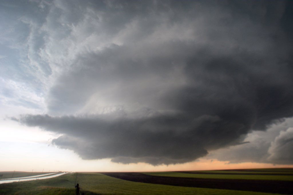
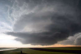
This photo shows a supercell thunderstorm pinwheeling through the skies above Harrisburg, Nebraska. The rotating storm spawned a couple of brief tornadoes minutes later.
(WTOP/Dave Dildine)
WTOP/Dave Dildine
The National Weather Service Storm Prediction Center received 32 reports of tornadoes across northeast Colorado, southeast Wyoming and western Nebraska as of early Tuesday.
(WTOP/Dave Dildine)
WTOP/Dave Dildine
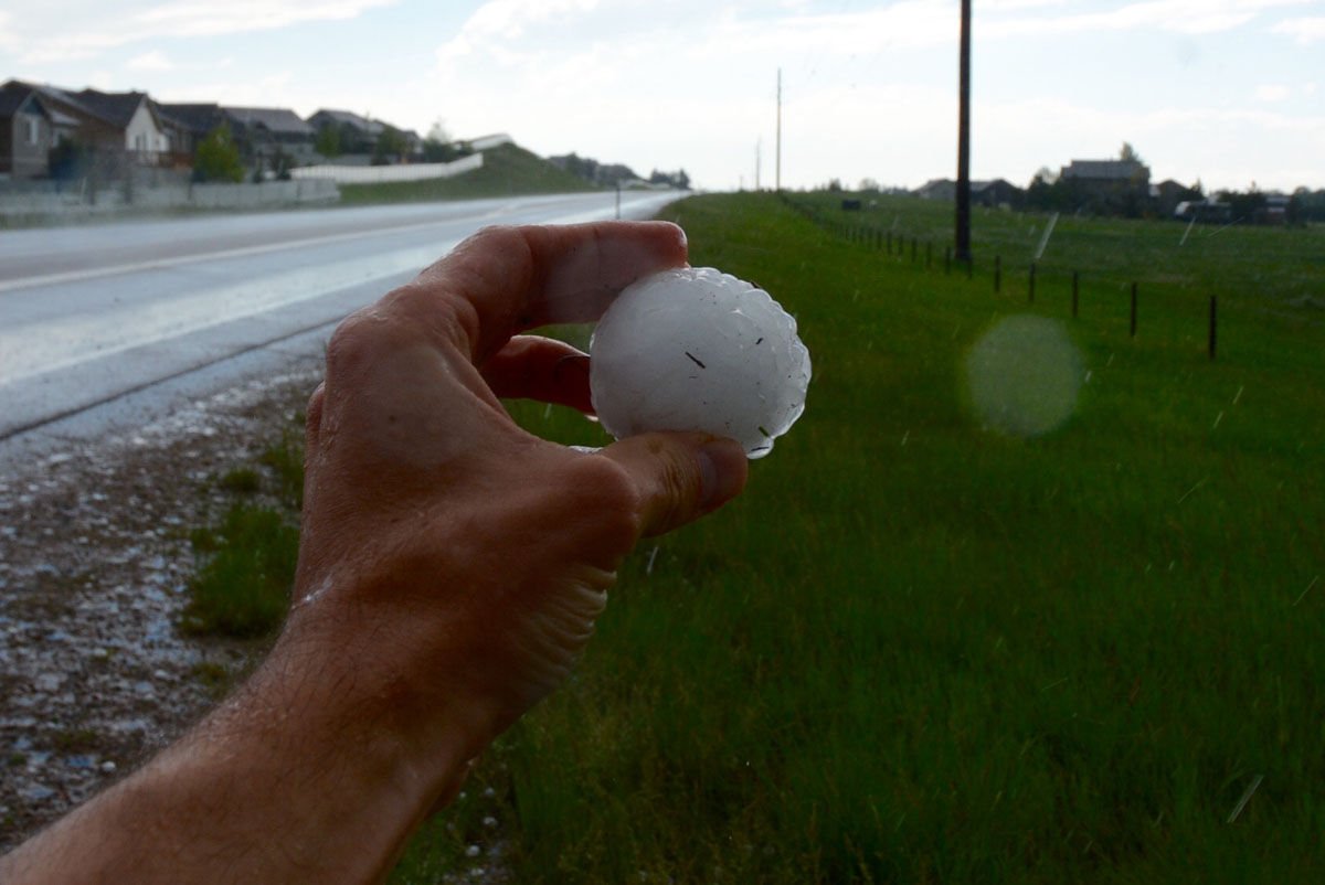
A storm near Cheyenne produced this hailstone and others up to 4.25 inches in diameter, the size of grapefruits.
(WTOP/Dave Dildine)
WTOP/Dave Dildine
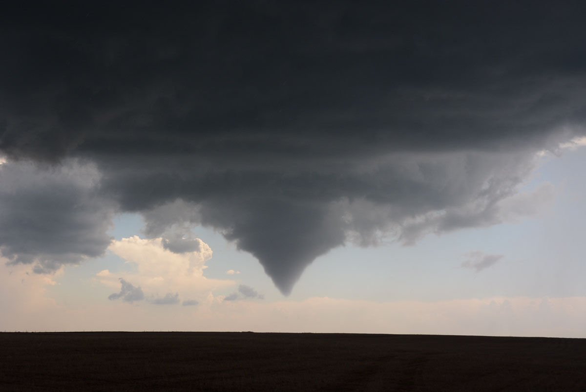
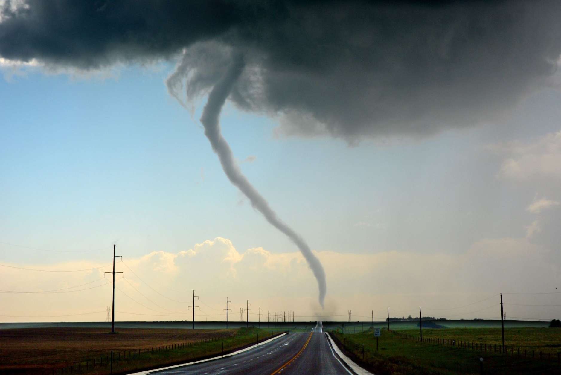
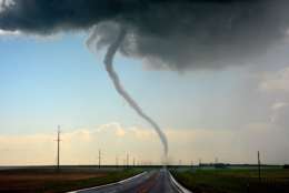
A tornado touched down about 10 miles northeast of Cheyenne along U.S. Highway 85 on Monday afternoon. Like many of the tornadoes during the severe weather outbreak, it remained on the ground for only a few minutes before lifting.
(WTOP/Dave Dildine)
WTOP/Dave Dildine
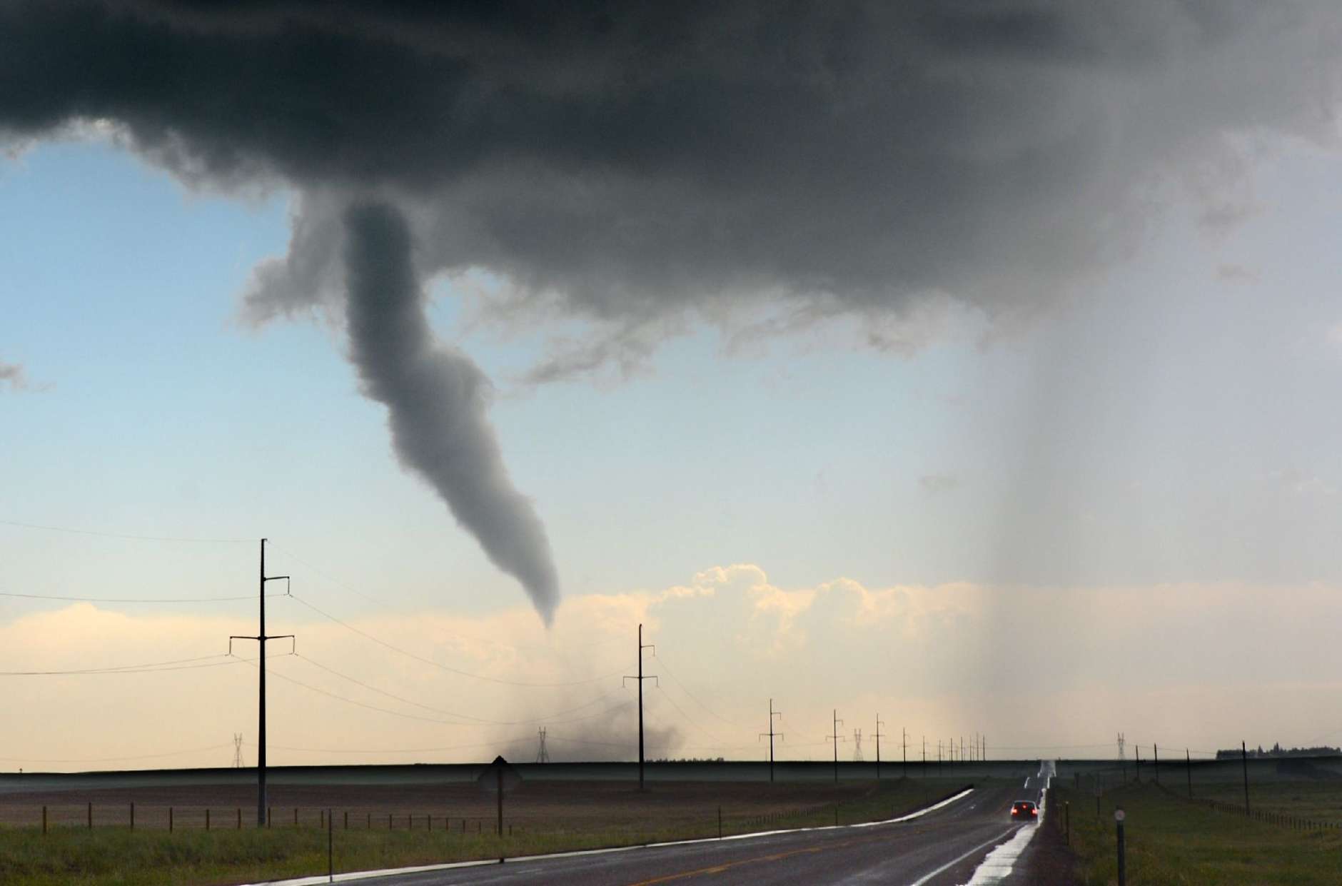
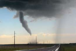
A tornado along U.S. Highway 84 northeast of Cheyenne begins to rope-out during a severe weather outbreak in the Central Plains. The underbelly of the storm’s churning updraft briefly resembled an octopus with dangling tentacles as funnels formed and lifted.
(WTOP/Dave Dildine)
WTOP/Dave Dildine
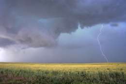
An intense storm churned across the High Plains from the Pawnee Grasslands in Colorado to the Sandhills in Nebraska. The storm produced numerous tornadoes and vivid cloud-to-ground lightning.
(WTOP/Dave Dildine)
Editor’s note: WTOP reporter and photographer Dave Dildine snapped these photos and filed this report from Wyoming and Nebraska earlier this week. Dildine travels to the Front Range to take in the natural sights and sounds every year or so, and he said he always brings his camera along for the ride to capture the landscapes and stormscapes.
CHEYENNE, Wyo. — Dozens of tornadoes and hail the size of grapefruits pummeled parts of the Central Plains on Monday, leaving at least two people injured.
The National Weather Service Storm Prediction Center received 32 reports of tornadoes across northeast Colorado, southeast Wyoming and western Nebraska as of early Tuesday.
A severe thunderstorm formed just outside of Cheyenne by mid-afternoon, unleashing giant hail stones over 4 inches in diameter and several weak twisters. Another storm developed over the Laramie Range in Goshen County, spawning a powerful tornado that overturned tractors and damaged a home, according to the weather service.
A long-lived supercell thunderstorm moved off the Pawnee National Grassland and into Nebraska later in the afternoon. The storm produced a tornado that damaged two homesteads near Kimball, Nebraska. The storm later went on to produce additional twisters that caused power line damage and overturned trucks and a freight train along U.S. Highway 385.
A native to the Washington area, Dave Dildine is no stranger to the region's complex traffic and weather patterns. Dave joined WTOP in 2010 when the station launched its very own in-house traffic service. You can hear him "on the 8s and when it breaks" from 2 p.m. to 7 p.m. on weekdays.