Cursed and crumbling ghost roads of the DC region
 1/11
1/11
(WTOP/Dave Dildine)
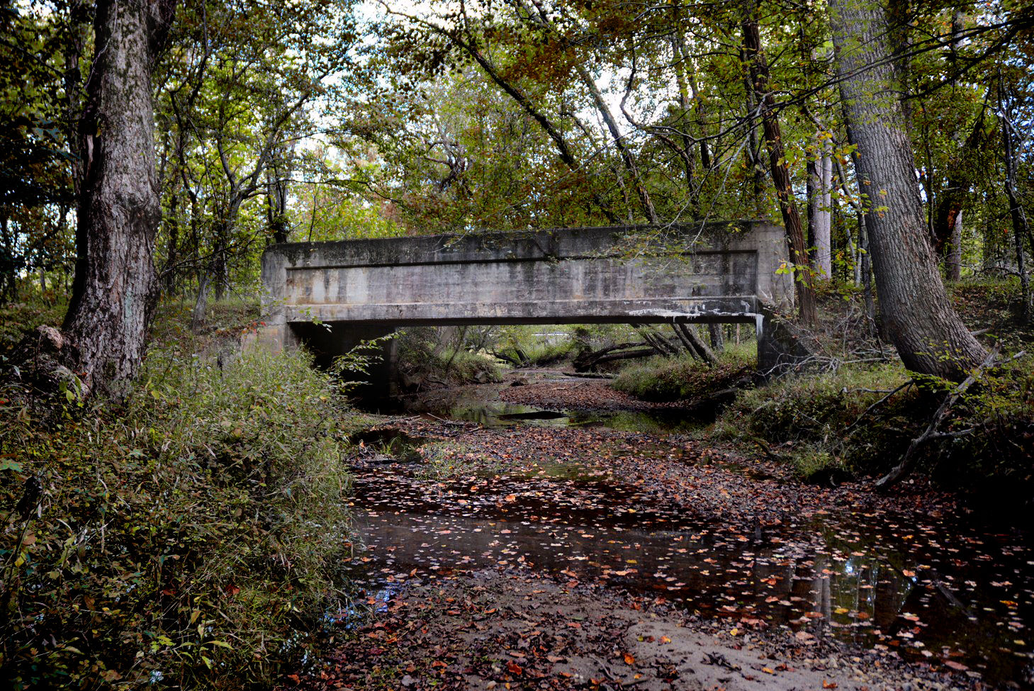
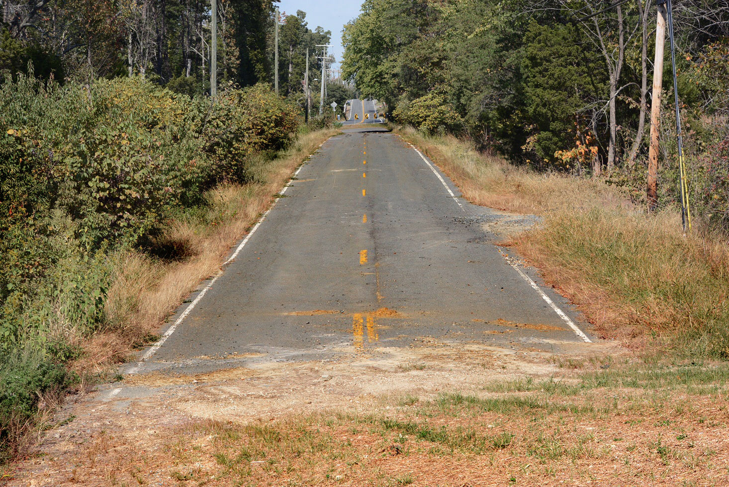
A twisty section of Route 1, originally numbered Va. Route 31, was straightened through Stafford County during the late 1930s. Fractured segments of the old highway would later become residential streets such as Jumping Branch Road and State Shop Road. An old two-lane bridge above Accokeek Creek marks the spot where Route 1 used to be. Thick vines have latched onto the structure’s walls and mature trees grow from its abutments. Remarkably, it has remained upright for nearly 90 years.
 2/11
2/11
(WTOP/Dave Dildine)
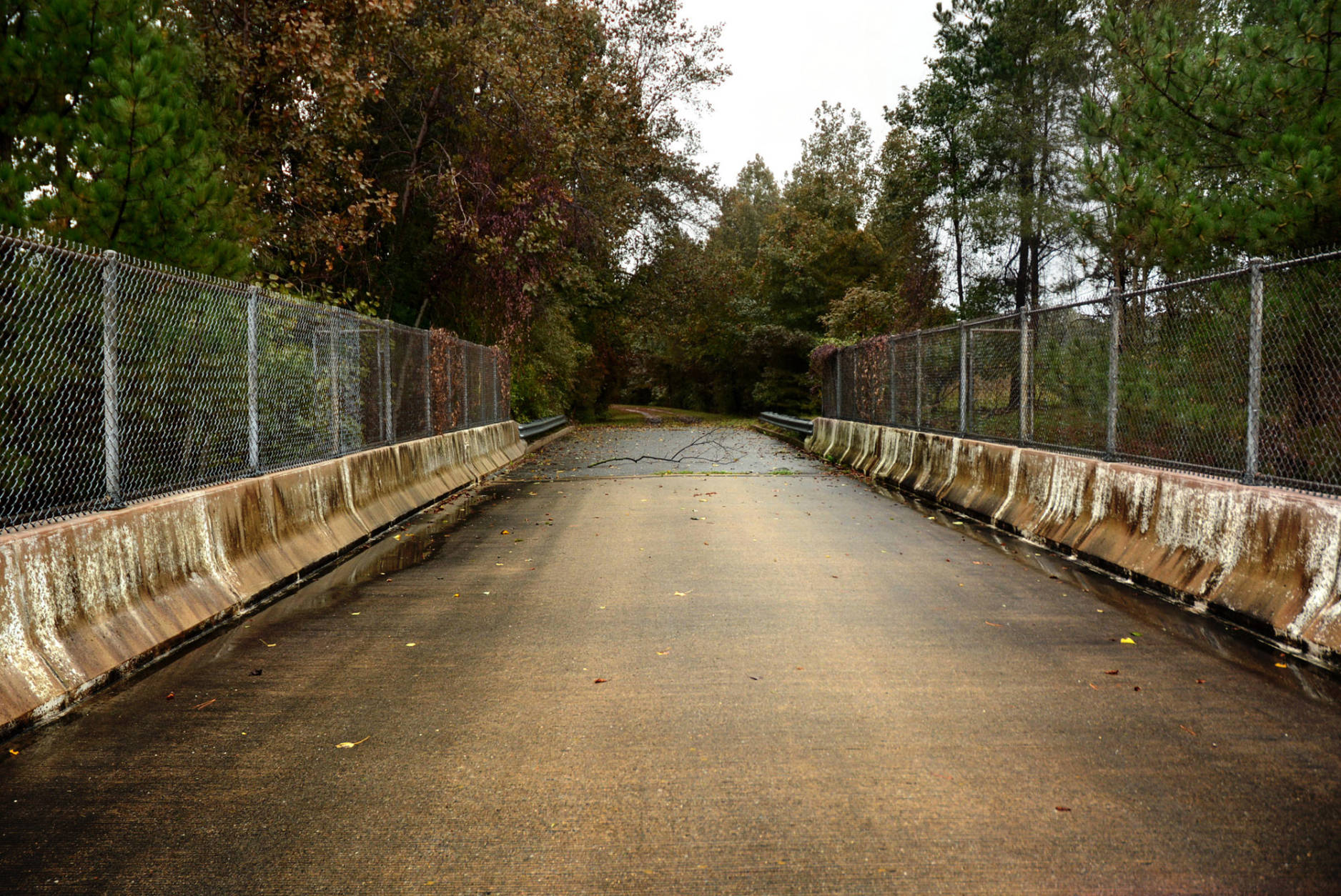
Near Glen Echo Park in Maryland, an out-of-place overpass spans the outbound lanes of the Clara Barton Parkway. The bridge was completed and immediately abandoned more than 60 years ago. Outbound traffic on the parkway was supposed to use the bridge to reach the cantilevered lanes built beneath Glen Echo in a straight line, but the National Capital Planning Commission was unable to acquire sufficient land near the Glen Echo trolley corridor to accommodate the beginning of this alignment. The commission was ultimately forced to settle on a lower approach with a kink under the obsolete overpass.
 3/11
3/11
(WTOP/Dave Dildine)
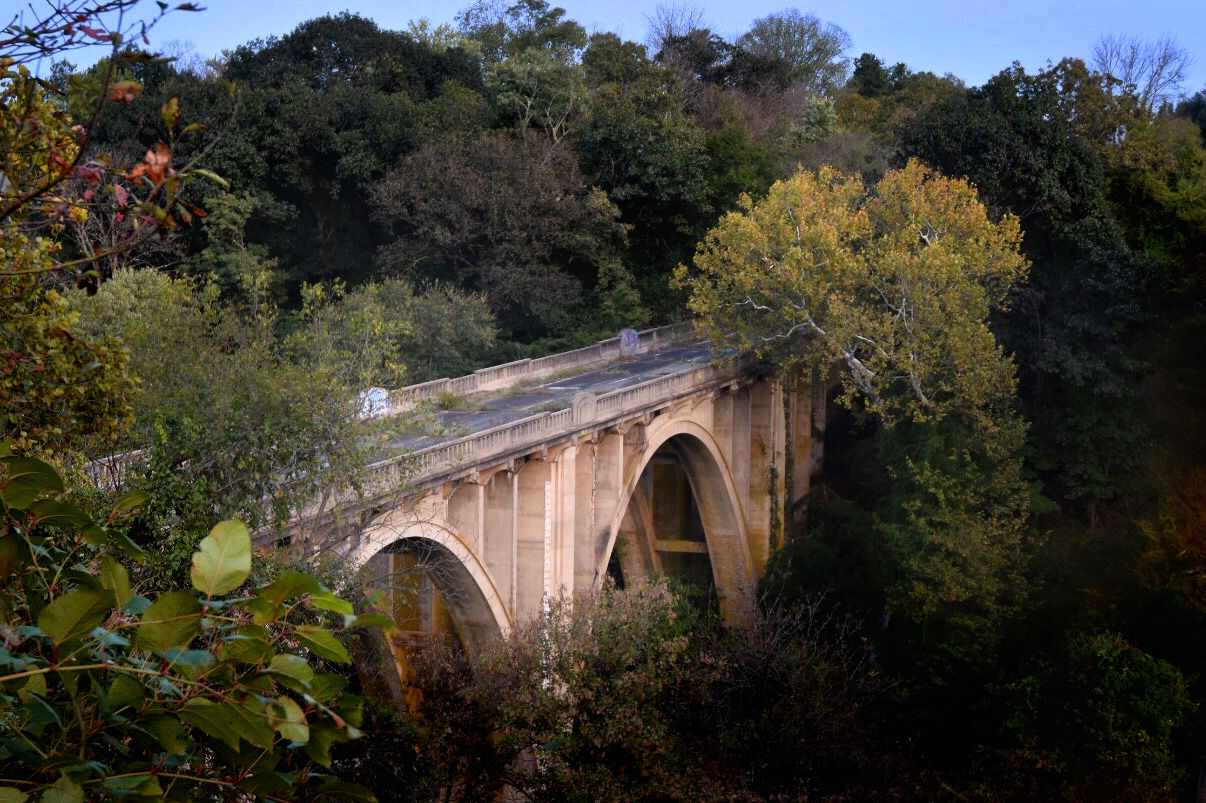
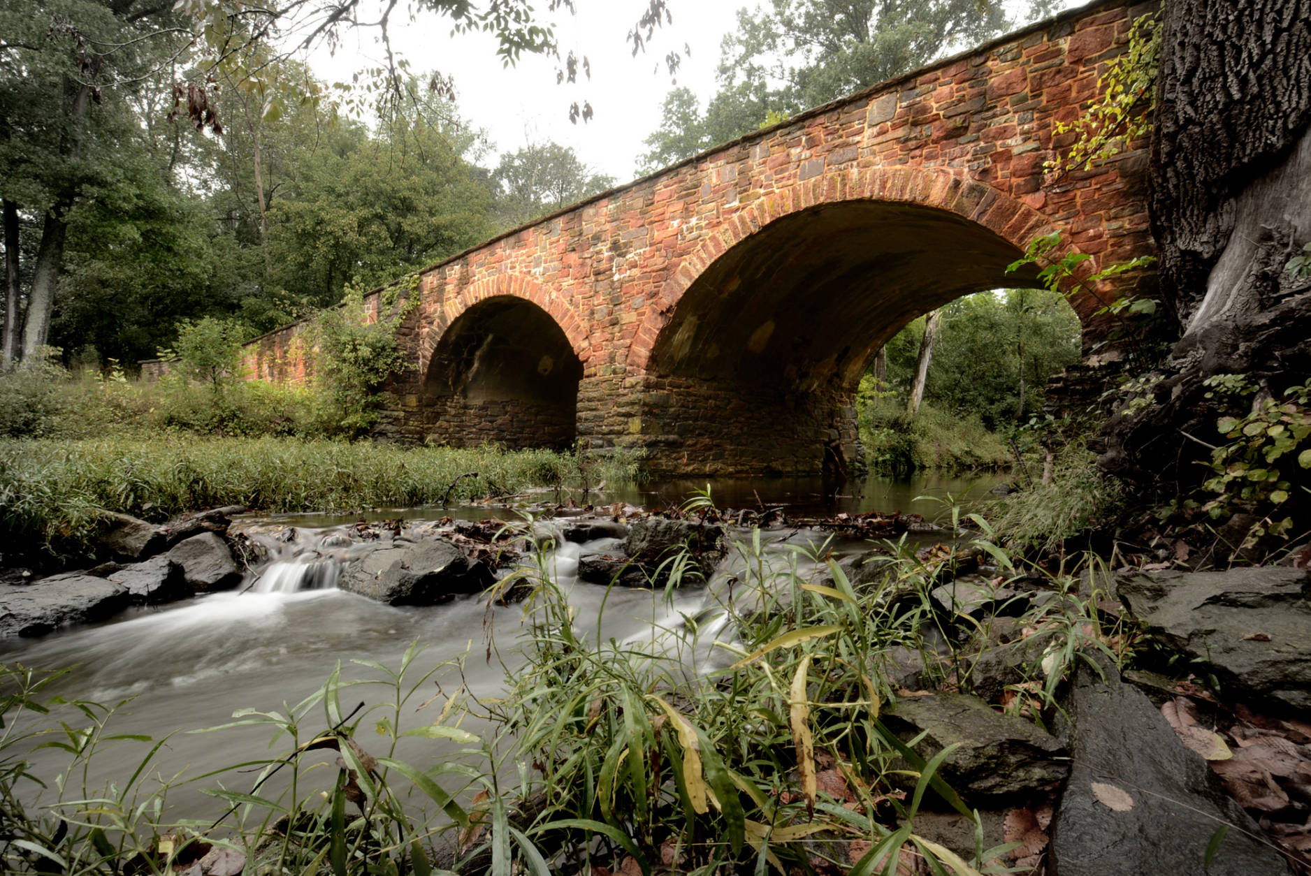
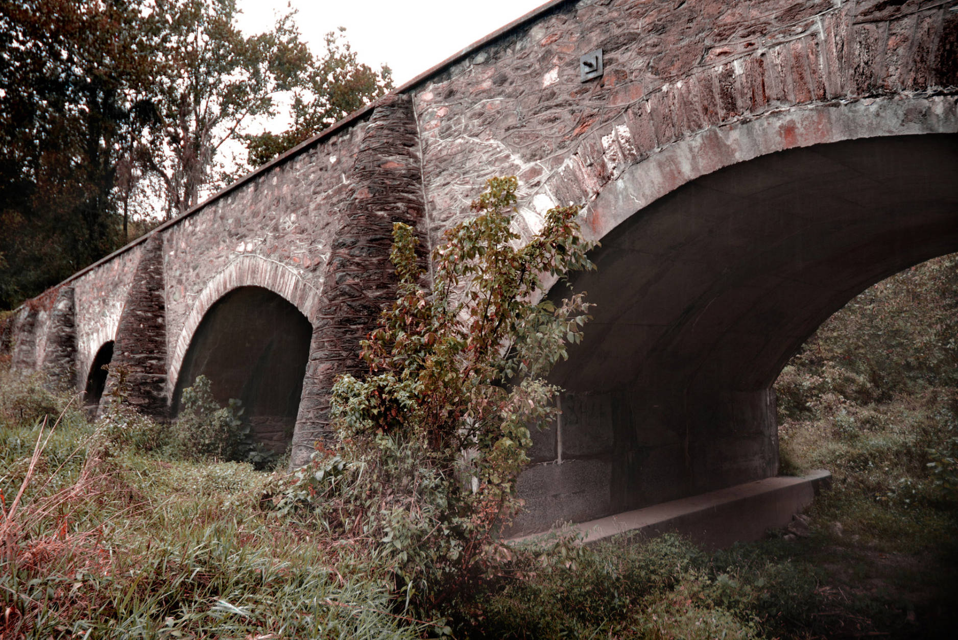
A mile-long ghost road on the outskirts of Frederick, Maryland, still rests on a remarkable arch bridge. Wind whisks through its hollow spandrels. The gnarly branches of sycamores claw at its haunches. Toppled trees and tenacious vines encroach on the ghost road’s faded skip line. The road was decommissioned in 1985, not long after a charter bus careened out of control on the bridge, ejecting most of its passengers in one of Maryland’s most horrific highway crashes.
 4/11
4/11
(WTOP/Dave Dildine)
An urban legend suggests that a child was murdered in the murky waters of the Patuxent River below Governor’s Bridge. The century-old structure, sometimes referred to as Crybaby Bridge, sits in a lonely hollow on the fringes of Bowie, Maryland. Locals have heard the lonesome wail of an infant under the bridge.
The mother, as the story goes, killed her baby then ended her own life by jumping into the water.
Governor’s Bridge was barricaded for safety reasons in early 2015 after an inspection revealed significant steel corrosion. A stretch of windy Governor’s Bridge Road is also closed through the river valley.
 5/11
5/11
(WTOP/Dave Dildine)
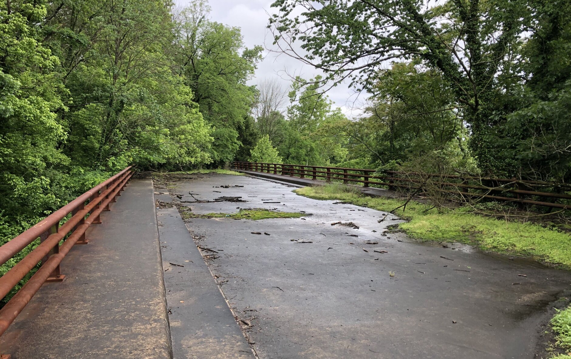
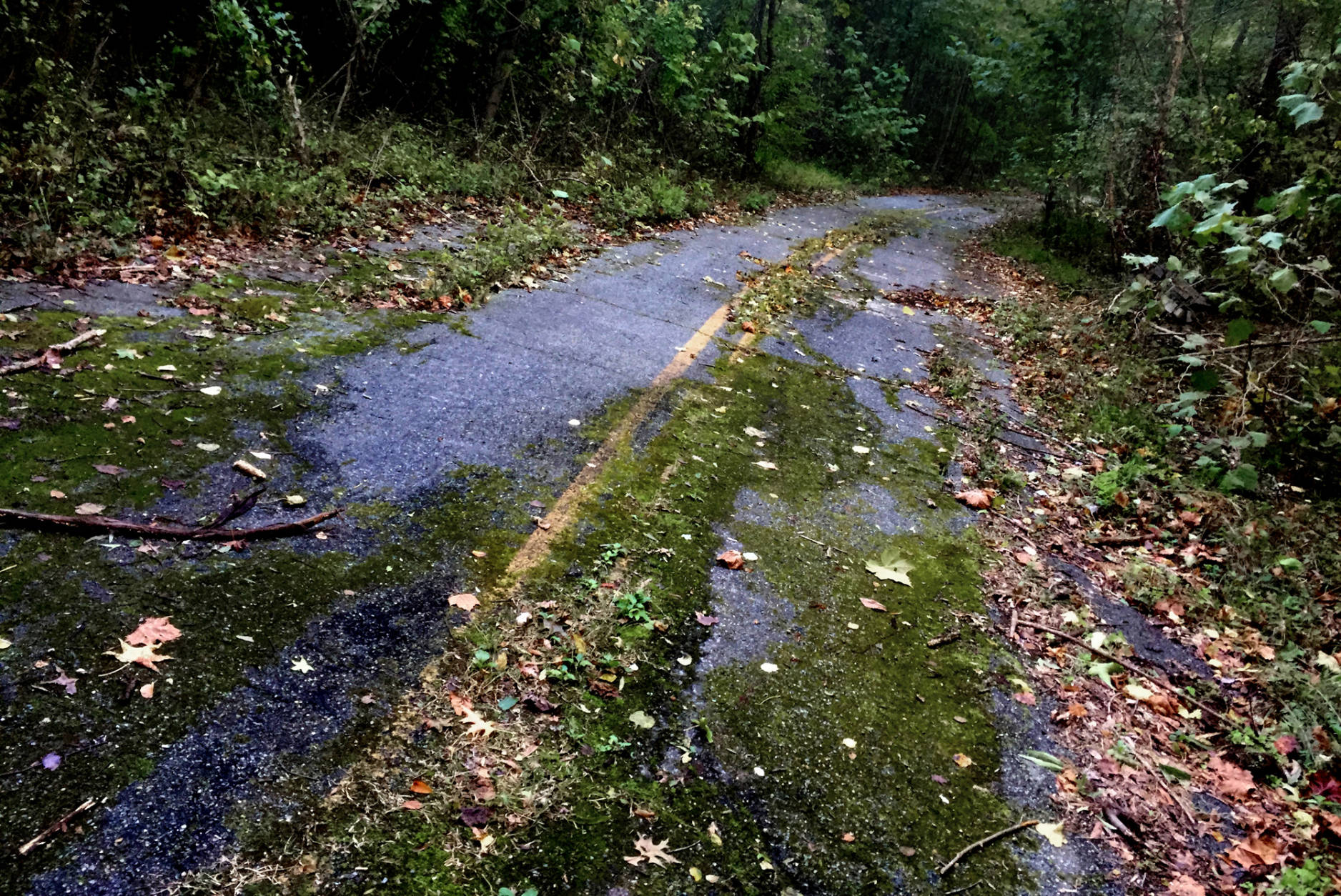
A mile-long section of Sharperville Road near Accokeek, Maryland, was closed in the early aughts. Trees have since taken root in large cracks through the roadbed. Before it was shuttered, the road was known for being dangerous: The average number of yearly crashes was more than three times the statewide average. Highway engineers attributed the abnormally high number of crashes to substandard road geometry. Others believed the road was cursed. The old, low bridge over Mattawoman Creek was reportedly a location where dead bodies were found.
 6/11
6/11
(WTOP/Dave Dildine)
The Farm Road overpass above Interstate 97 was once the route on which patients from the shuttered Crownsville Mental Hospital were taken to burial. The asylum operated from 1911 to 2004. Farm Road dead-ends west of the bridge. Beyond the overpass, the old hospital’s cemetery mottles a secluded knoll. The road and cemetery are gated off and closed to the public.
 7/11
7/11
(WTOP/Dave Dildine)
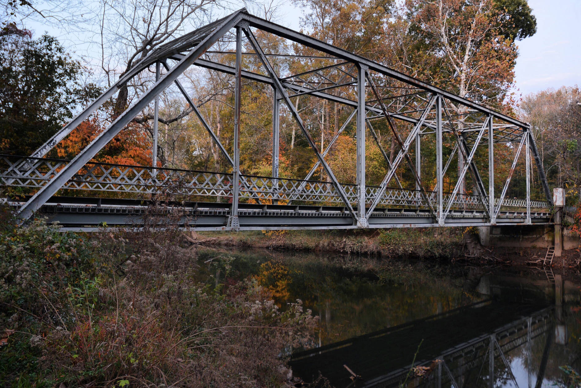
Built in 1884, the Bull Run Stone Bridge sits quietly beside present-day Route 29 in the Manassas Battlefield. The original structure was destroyed by the Confederacy and rebuilt several years after the war. The current dual arch bridge marks the old alignment of the Warrenton Turnpike.
 8/11
8/11
(WTOP/Dave Dildine)
The Goose Creek Bridge, hidden in dense woods outside of Upperville, is all that remains of Ashby’s Gap Turnpike. The four-arch stone bridge was built during the Jefferson presidency and was the setting for another Civil War battle.
 9/11
9/11
(WTOP/Dave Dildine)
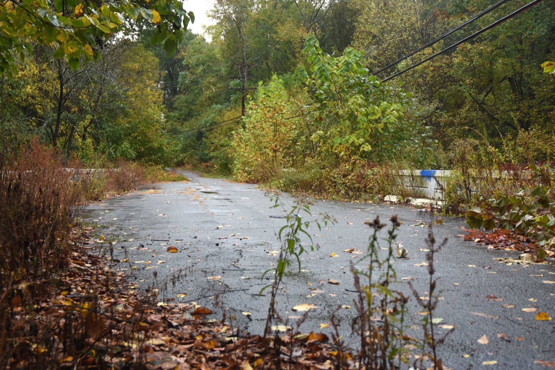
A fragmented chunk of Gum Spring Road wastes away in South Riding. The construction of a new access road for Stone Springs Hospital Center absorbed part of Gum Spring Road. Between the hospital and Arcola, Gum Spring Road was renamed Stone Springs Boulevard. Loudoun County forfeited the leftover stretch of Gum Spring Road near Route 50. The severed segment remains behind a stand of trees east of Medical Drive but will likely be erased by developers in the coming years.
 10/11
10/11
(WTOP/Dave Dildine)
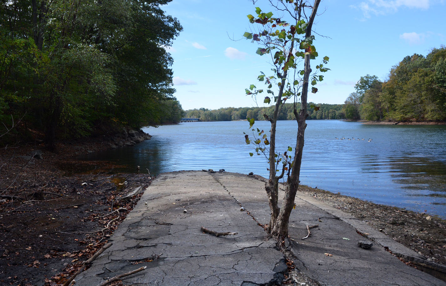
On the outskirts of Eldersburg, Maryland, is a mile-long section of Old Liberty Road that disappears under 100 feet of murky water. When the North Branch Patapsco River was dammed in the early 1950s, the reservoir that formed overtook a section of the main highway, better known as Oakland Mills Road, between Libertytown and Baltimore. The rising water also submerged a significant portion of Oakland Mills, a small mill town. The stubs of the old road can still be seen on both ends of Liberty Lake.
 11/11
11/11
(WTOP/Dave Dildine)
Near White Oak, Maryland, a portion of Old Columbia Pike and a mammoth bridge sit quietly in the woods, closed to vehicle traffic for about half a century. The spandrel arch bridge on stone abutments was completed in 1912 and remained in service through the late 1950s until an upgraded section of Route 29 opened over Paint Branch nearby.
The centenarian bridges over Paint Branch, Bull Run and others stand as informal monuments to generations of skilled laborers and engineers. The retired roads that lead up to their abutments are important reminders of how we got to where we are today — on the ways of decades past.
More from WTOP’s “Ghost Roads” series:
Dave Dildine
A native to the Washington area, Dave Dildine is no stranger to the region's complex traffic and weather patterns. Dave joined WTOP in 2010 when the station launched its very own in-house traffic service. You can hear him "on the 8s and when it breaks" from 2 p.m. to 7 p.m. on weekdays.


