WASHINGTON — Oh boy. Get ready for some cold air. Mother Nature certainly reminded us Tuesday morning that winter is not over yet, even after our 68 degree temperature in D.C. on Sunday.
For the upcoming days, we are not talking about a lot of cold rain and a wintry mix, which seems to be the common theme this year. We are talking about a huge tumble in temperatures as a series of arctic fronts push through the area.
Thursday will begin with maybe a little sun but clouds will be increasing quickly ahead of a strong cold front. Temperatures will make it to right around 40 degrees in D.C. before noon before a rapid fall. The cold front will then push east, clearing the region by midday on Thursday. Precipitation wise it will just bring a few flurries. However, the drop in temperatures and the winds will be the main story on Thursday afternoon and into the weekend.
Behind this front, temperatures will steadily drop and winds will rapidly increase. Temperatures will fall from around 40 in the midday on Thursday into the teens and 20s for overnight lows. As winds pick up and temperatures drop, wind chills will make it feel more like the single digits and even below zero overnight leading into Friday morning.
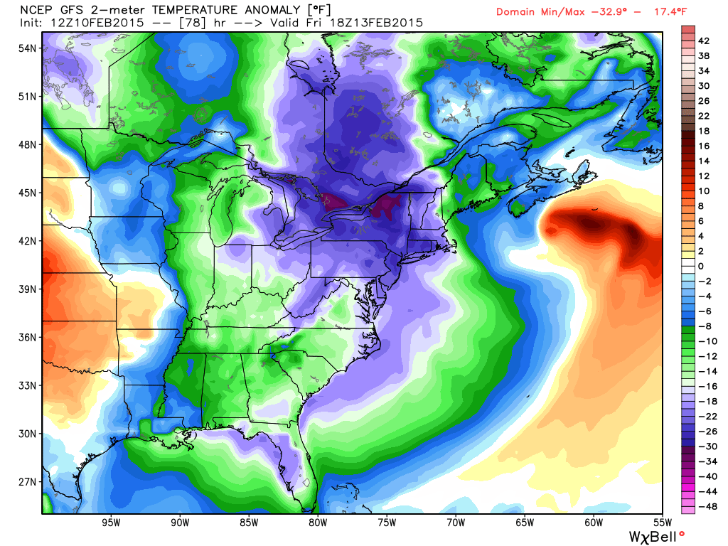
Daytime highs on Friday will be well below our average daytime high and below our average low temperature for this time of year. Our average high temperature is around 46 degrees in D.C. and our average low is 30 degrees.
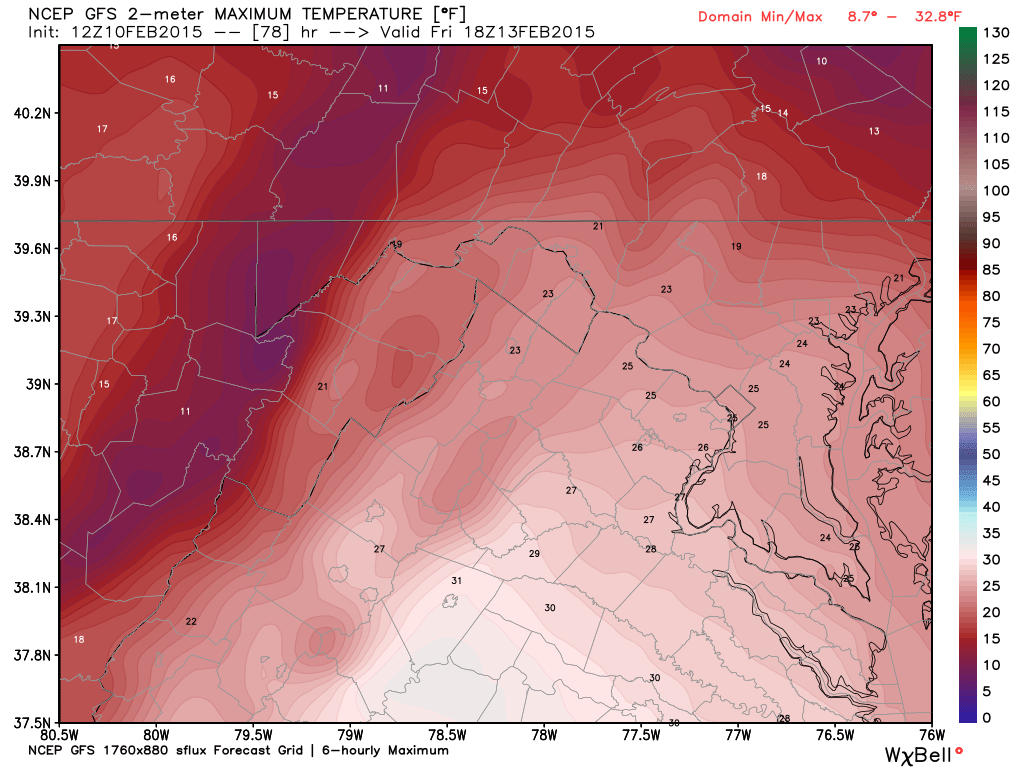
Most temperatures on Friday will remain in the 20s but with northwest winds blowing between 10-20 mph, it is going to make it feel like we are in the upper single digits and lower teens for much of the day. Winds will calm slightly as we head into Friday evening and continue to lighten up overnight. It’s not looking too bad for your Valentine’s Day. Winds will turn south by Saturday, pumping some “mild” air back into the region. Temperatures on Saturday should make it into the lower to mid-30s. That is until our next arctic cold front moves through.
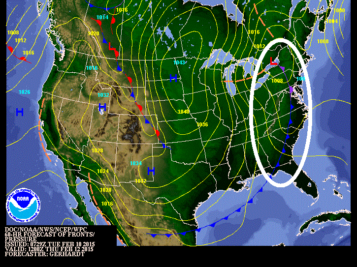
That next arctic front and its associated area of low pressure should move through the region Saturday night into Sunday, kicking up our winds once again and dropping our temperatures. There could also be a few snow showers on Saturday that we will have to watch. Any snow showers look to be on the light side at this point but there could be some problem areas as roadways will be cold enough to support some minor accumulation. This will be something to monitor Saturday night, especially for those heading out for any Valentine’s Day celebrations.
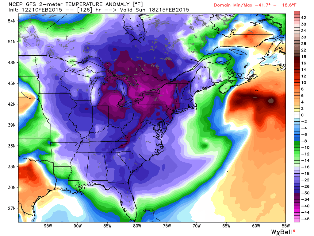
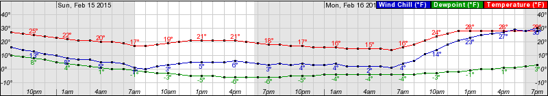
Then we head into Sunday. Temperatures will drop more than 20 to 25 degrees below freezing across our region. Daytime highs on Sunday will range from the mid-teens to the lower 20s on Sunday afternoon. There will be some sunshine but with breezy northwest winds, it will be dangerously cold if you are out and about.
By Monday, temperatures climb back to around 30 degrees with a much lighter wind but it looks like there is a good chance that we stay chilly for much of the next work week.
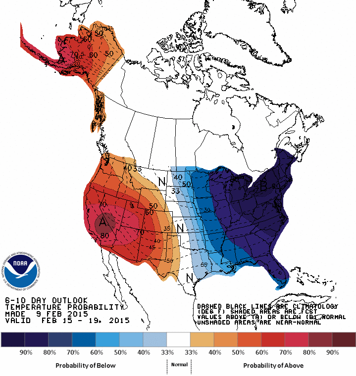
Climate Prediction Center forecasts that there is about a 90 percent chance that temperatures will stay below normal through Fe. 19. In fact, there is a good chance that temperatures stay below normal through the end of February. So grab that Valentine and bundle up this weekend, it is going to be a brutal cold snap.