
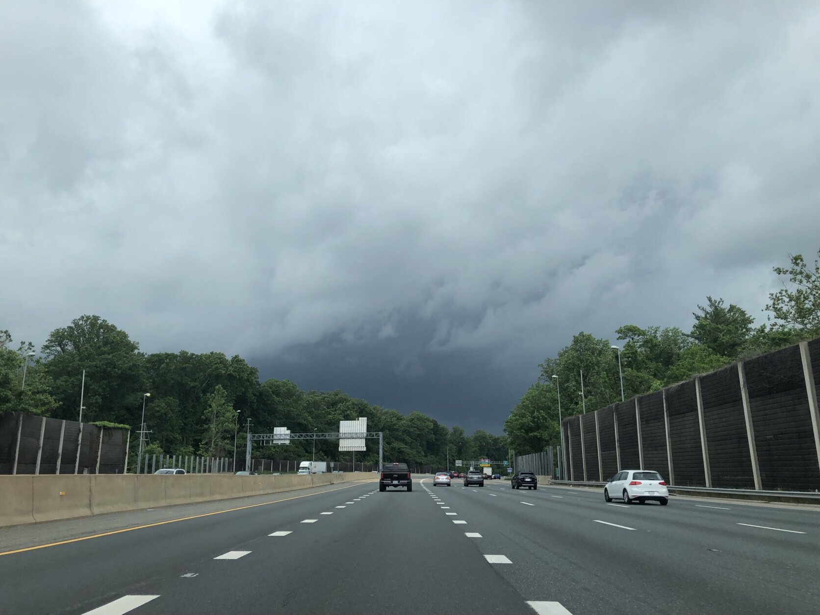


A second round of rain drenched the D.C. area Friday evening, and the severe weather prompted several alerts, including a tornado warning. Here’s what you need to know.
Earlier Friday evening, a tornado warning was issued for parts of St. Mary’s, Prince George’s, Charles and Calvert counties in Maryland, which has since expired. A flash flood watch for most of the area also expired early.
Storm Team4 meteorologist Steve Prinzivalli reported that there was extensive damage around Benedict, Maryland, where a tornadic storm came through Friday just before 8:45 p.m. About a dozen trees were knocked down near Maryland state Route 231. Whether a tornado touched down has not yet been confirmed by the National Weather Service.
The National Weather Service also issued a severe thunderstorm watch, which ended at 10 p.m., for most of the D.C. area. A flood watch for central and northern Maryland ended at 11 p.m. Friday, with concerns of flooding in streams, creeks and urban areas.
The stormy weather is courtesy of a cold front marching to the area. Storms are expected to diminish after midnight, with lingering clouds and lows in the 50s.
Saturday will see a brightening sky that should help boost temperatures into the lower 80s by the afternoon, Prinzivalli said.
However, there is an upper-atmospheric disturbance that will swing through the area, bringing a risk of a shower or thunderstorm.
“But not a wash as the bulk of the day is dry,” Prinzivalli said.
The rest of the holiday weekend will bring sunshine and a warming trend. High pressure will settle into the area Sunday, providing a gorgeous day with sun and highs in the middle 80s.
As the high-pressure cell slides eastward, the winds will become southwesterly, bringing hotter and more humid air into the area for the Memorial Day holiday.
Temperatures will soar to near 90 on Monday, and it will feel like the middle 90s with the humidity.
Strong storms leave behind damage from downed trees
Strong storms in the early afternoon put a tornado watch in effect for the WTOP listening area. More serious tornado warnings also popped up in the early afternoon. It’s not known yet whether any tornadoes actually touched down, but there’s been some damage in the area.
StormTeam 4 meteorologist Somara Theodore said just before 2 p.m. that more rain was on the way, and meteorologist Mike Stinneford agreed. He had his eyes on “breaks in the overcast,” which sound like signs of clearing but actually “could destabilize the atmosphere.”
Much better weather is on the way for the long weekend proper, he added.
A tornado watch for the D.C. area expired at 2 p.m., but the early afternoon storms left a mark in the area while they were here.
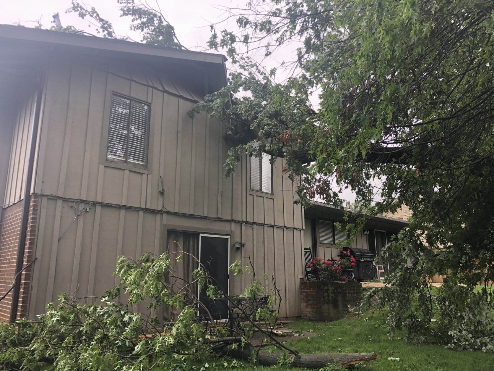
Pete Piringer, of the Montgomery County Fire and Rescue, documented the damage to several houses off Queen Elizabeth Drive in Olney. He said “I’m not a meteorologist,” but he said it looked like a tornado or a microburst to him, and he might be right: The National Weather Service is headed to the area to check it out.
Olney,MD https://t.co/yTMySOvGFX
— Pete Piringer (@mcfrsPIO) May 27, 2022
An Olney family was making early dinner preparations when they heard the tornado warning and headed to the basement. Stephanie Kirshon said she heard a loud noise and felt shaking. When she and her family went back upstairs, they found damage to their home from a fallen tree.
This video is no longer available.
WTOP’s Liz Anderson reported that the National Weather Service is aware of the damage in Olney, and plans are to send a team to the area to investigate.
Other reports of downed trees:
- Also in Montgomery County, in the area of Forest Glen Road and Dameron Drive.
- In Fairfax County at Red Maple Lane and Glade Drive; on South Lakes Drive between Pinecrest Road and Reston Parkway, and into a house in Chantilly;
- Along Route 210 in Prince George’s County, Maryland, near Palmer and Livingston roads;
- Trees down on Huntingtown Road and Ward Road in Calvert County, Maryland;
There were more than 100 delays and cancellations at the region’s airports, and travelers were urged to contact their airlines before heading out.
- Listen to WTOP online and on the radio at 103.5 FM or 107.7 FM.
- Current traffic conditions
- Weather forecast
- Beach traffic and weather
- WTOP’s Summer Beach Guide
- Sign up for WTOP alerts
Forecast
Saturday: Sun and clouds. Midafternoon showers. Steady breeze. Highs in upper 70s to lower 80s.
Sunday: Mostly sunny. Warm, but not too humid. Highs in the low to mid-80s.
Memorial Day/Monday: Mostly sunny. Hot, more humid. Light breeze. Highs in the upper 80s to low 90s.
WTOP’s Liz Anderson contributed to this report.