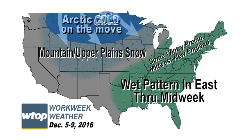
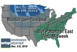

WASHINGTON — The new workweek will feature three distinct storm systems that will affect us in different ways.
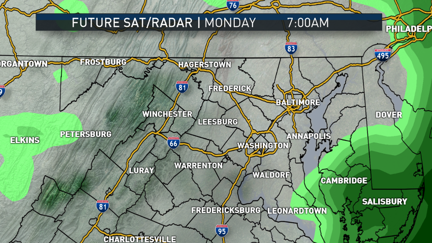
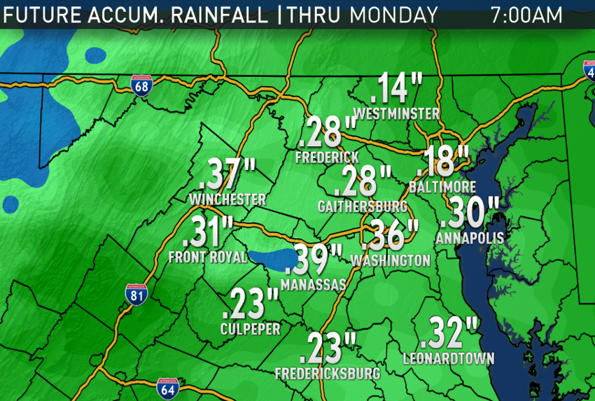
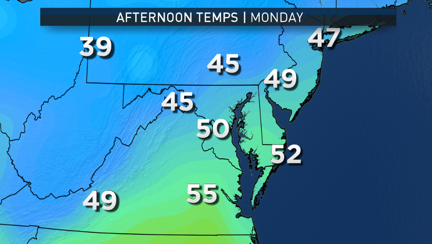
The first system, which will have been producing some light rain, will already be wrapping up during or shortly before the Monday morning rush, amounting to only a few tenths of an inch of rainfall. High pressure will dry us out during the day on Monday and bring some clearing with a brisk breeze.
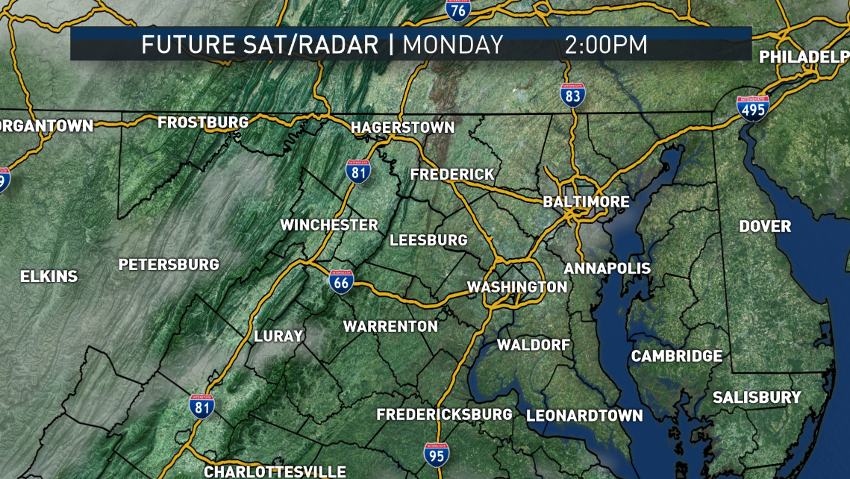
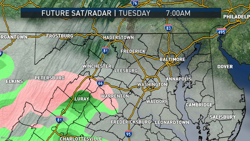
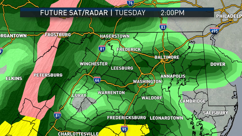
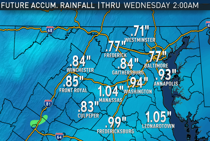
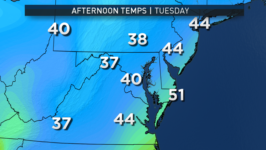
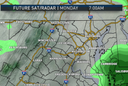
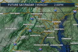
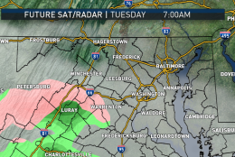
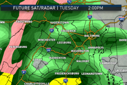
But the next system, which we’ve known since last week would be the more significant rainmaker, will already be sending us some more cloud cover for Tuesday morning’s rush, followed by rain shortly thereafter. It’s possible that there will be enough cold, dry air at the rain’s onset to have a bit of a wintry mix with the rain, but that’s really only likely in the higher elevations of the Blue Ridge and the Shenandoah Valley. With a warm ground, not much of an impact is anticipated from any wintry precipitation, and it won’t last long anyway as this system is associated with a big push of warmer, moisture-laden air from the Gulf of Mexico. Temperatures will likely rise slowly while it’s raining.
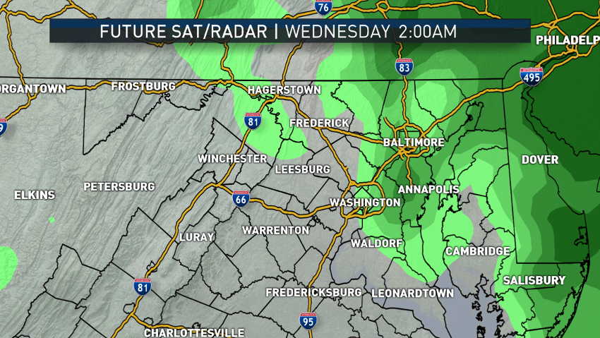
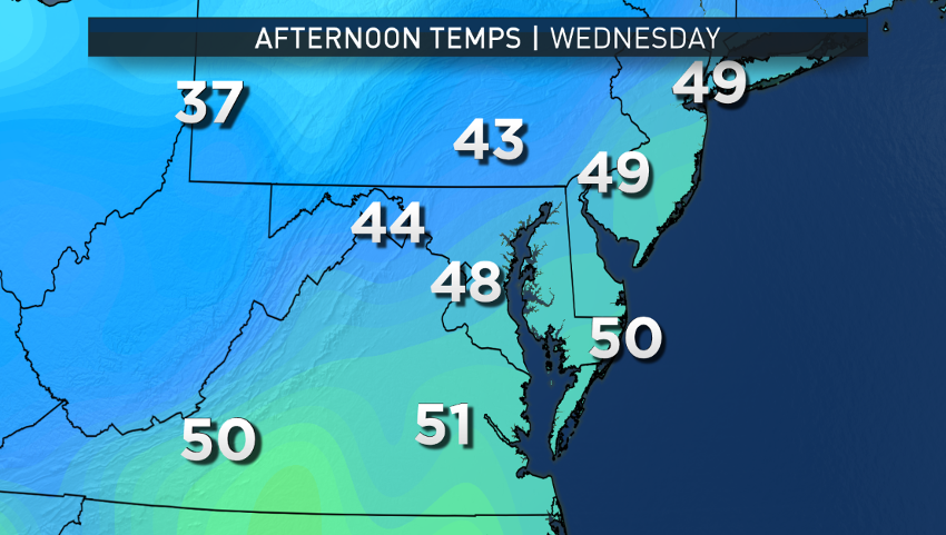
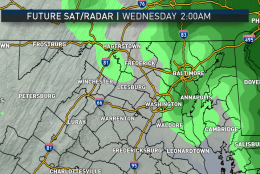
That system will scoot to the east and offshore Tuesday night, and skies will start clearing again on Wednesday behind a cold front that will dry us out more than cool us down. Temperatures will likely already be in the upper 40s Wednesday morning, and westerly winds will act with lots of sunshine to get temperatures close to or slightly above average. High pressure will build in Wednesday night, settling down the winds.
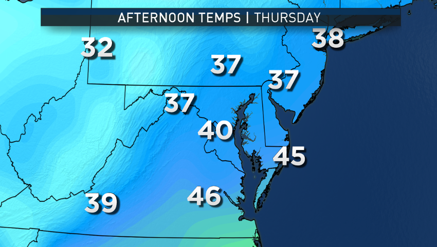
On Thursday, a deep trough (or dip) in the jet stream in the east will form, sending an arctic cold front our way, the third system of the week. Clouds will build and some showers will accompany the front around midday. This will be a strong front with a lot of dynamics and the showers may go through with some strong wind gusts, and it wouldn’t be surprising if the showers ended as some wet snowflakes Thursday evening (not overly clear at this point, but we’re relying on past experience with similar setups). Then arctic air will pour in through Thursday night, dropping us to near freezing Friday morning, and then Friday’s temperatures will only be able to rise a few degrees into the afternoon, with winds making it feel even colder and lots of low-level clouds will be blocking the sun from time to time.
Daily weather highlights
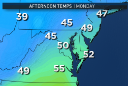
MONDAY
• Some lingering showers/drizzle and clouds in the morning
• Becoming mostly sunny through midday
• A little breezy and cool
• Seasonable high temperatures (low 50s)
• Clouds increasing again in the evening
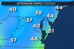
TUESDAY
• Periods of rain, possibly starting mixed in with some sleet or wet snowflakes in the higher elevations along the Interstate 81 corridor
• Temperatures near 40 most of the day, climbing into the upper 40s later in the day and evening
• Areas of fog
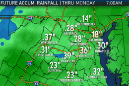
• On the order of an inch of beneficial rainfall
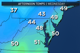
WEDNESDAY
• Becoming mostly sunny
• Seasonable high temperatures
• A little breezy
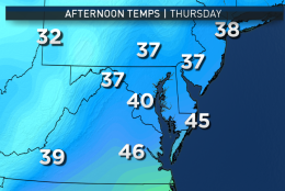
THURSDAY
• Becoming cloudy and windy
• A quick few hours of showers, possibly ending as some wet snowflakes
• Blustery and turning sharply colder in the evening
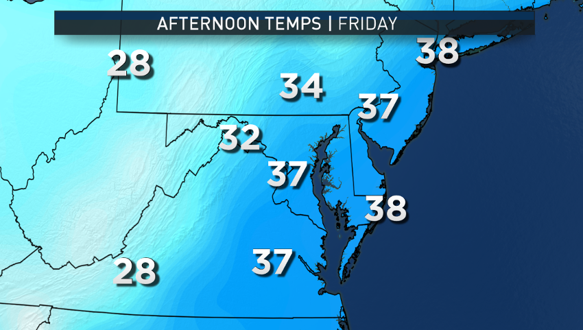
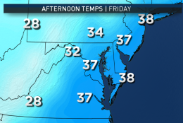
FRIDAY
• Blustery and cold
• Sun going in and out of clouds
• Temperatures struggle to reach 40, well below average for this time of year
Despite the rainfall of last week, barely a dent has been made in the drought conditions, although having a moister topsoil and wetter brush has improved the brushfire scenario. The upcoming precipitation will have a similar effect. We need a good 6 inches of rainfall or snowmelt/icemelt equivalent to make up the deficit since Sept. 1. There is no change in the Drought Monitor map from last week and most of our area is still in a “Moderate Drought.”
Editor’s Note: The WTOP Workweek Weather Blog is intended as an in-depth yet plain language summary of the business week’s weather potential in the D.C. area along with an explanation of the contingencies and uncertainties that exist at the time of publication. For the latest actual Storm Team 4 forecast, check out the main WTOP Weather Page.