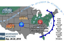
WASHINGTON — As if on cue, now that we’re officially in autumn, the summer doldrums are transitioning into a very active, amplified pattern — more on that later — across North America and that could mean a few systems that have the potential to bring some beneficial rainfall.
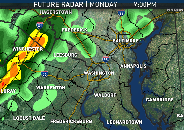
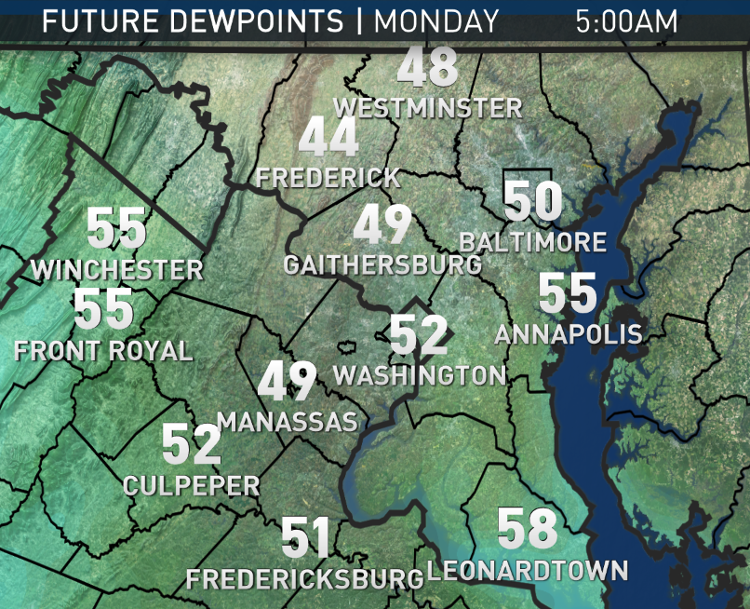
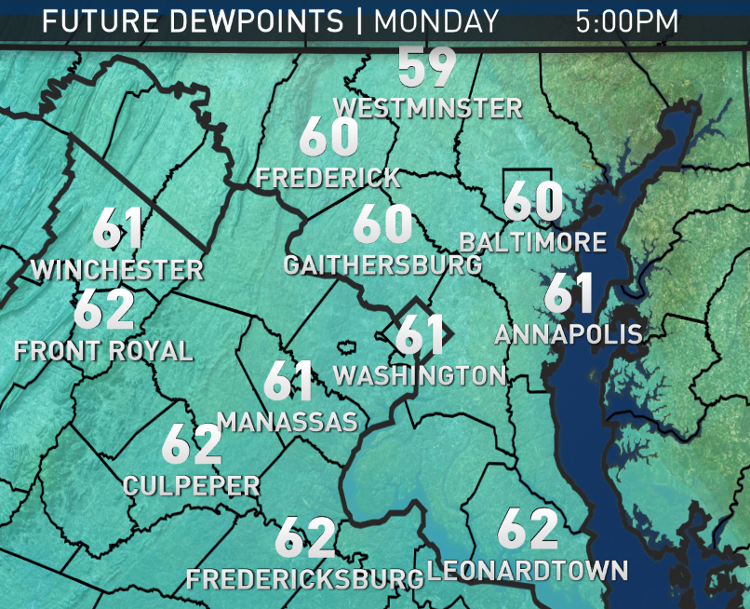
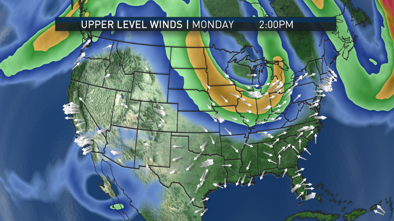
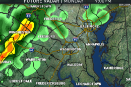
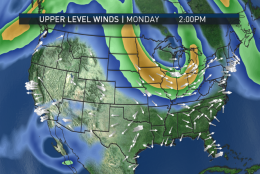
High pressure that provided the dry, comfortable weekend will be moving away on Monday, allowing southerly flow to intensify as a warm front moves through Monday evening. Showers will not be far behind. It will be a close call for the evening rush and maybe getting in some patio dining before the showers get here. The showers may arrive before the end of the Washington Nationals’ game, the beginning of the last regular homestand of the season. Regardless, the showers will continue and pick up in intensity Monday night.
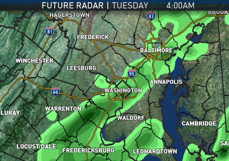
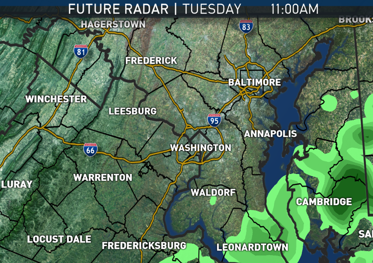
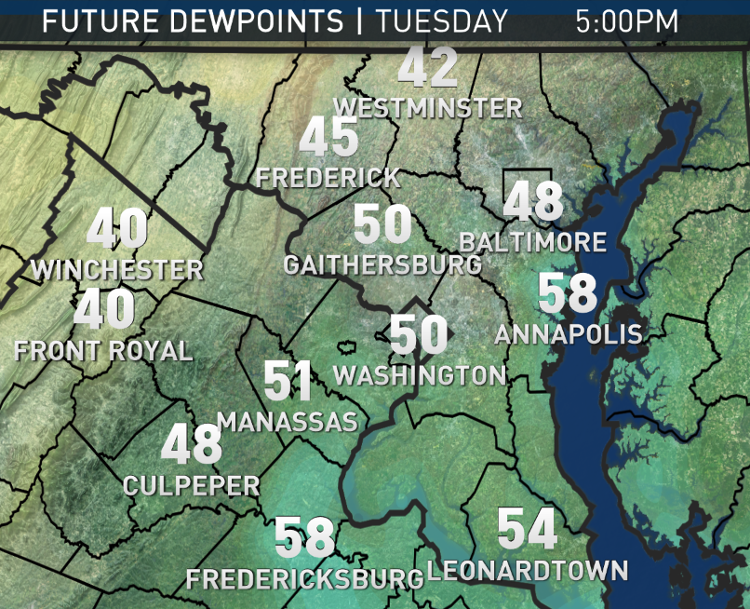
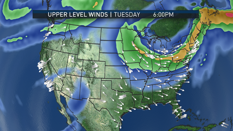
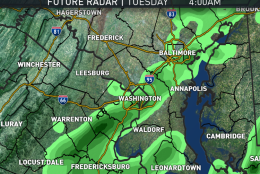
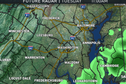
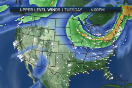
Tuesday morning’s rush should be a slower one than usual because of wet roadways. Then a cold front will push the moisture off to the east during the afternoon hours.
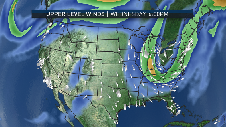
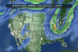
Wednesday will be a quiet day for the most part. But then the pattern quickly changes for the end of the week and it has real implications for possible rainfall.
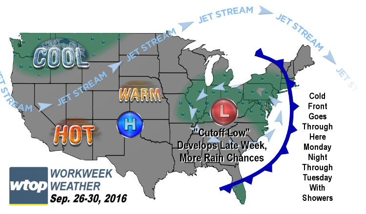
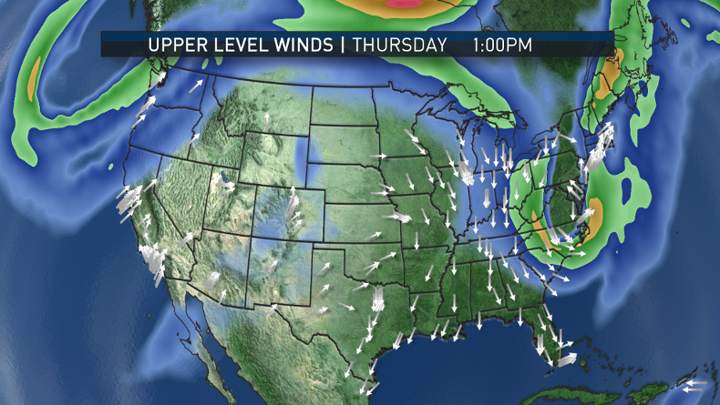
The pattern is called “amplified” because when you look at the configuration of the dips and ridges in the jet stream maps, you see some big “waves.” The ridges will be acting as blocks to the systems and the troughs (the dips) dig in response. That’s where the storminess will happen. Sometime the troughs become so deep that a wave of low pressure will cut itself off from the steering winds in the jet stream and just meander for a few days in a general area. That is precisely what the majority of computer models are now doing for the end of the week, coming into a good consensus this past weekend. (That gives forecasters increased confidence).
Low pressure will exist in the upper levels and directly underneath at the surface and the circulation will tap moisture off the Atlantic, sending it back into the Mid-Atlantic states, the Northeast, and the Ohio and Tennessee valleys. Subtle differences in the low pressure center location will mean big differences in where each individual batch of rain will go.
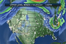
So it’s unclear who exactly will get the most rainfall amounts at this point, but the pattern suggests some will get very welcome amounts. This scenario would start Wednesday night and last into at least Friday, possibly into the weekend as well.
Incidentally, these patterns happen often in autumn and spring as the contrast in temperatures and moisture from the arctic to the equator grows, intensifying the activity of the jet stream.
As of Sunday evening, the rainfall “deficit” for the year for Reagan National Airport was 4.04 inches. More than half of that deficit is from September alone, as we are short 2.57 inches for the month. If everything does manage to fall into place, a significant dent could be made into that deficit by the weekend.
The day-to-day details will be determined all week as we get closer, so check in often for the forecast updates. But no matter what, it looks like the extended backyard pool season is over if for no other reason the temperatures this week being average at their highest, not even counting the wet weather.
DAILY WEATHER HIGHLIGHTS
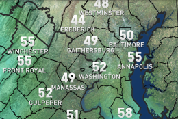
MONDAY
• Starting out cloudy and cool, some patchy fog and/or drizzle possible during the morning rush
• Staying mostly cloudy all day
• A warmer feel through the day as a warm front moves through and the humidity rises to sticky levels, almost muggy by late September standards
• Showers on the doorstep, moving through West Virginia during the evening rush
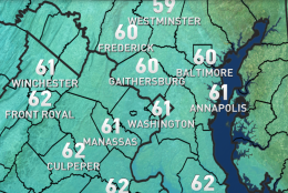
TUESDAY
• Showers through the morning rush, tapering off midday through the afternoon
• Wind changes direction to northwesterly behind cold front, dropping humidity late in the day
• Showers should be out in time for the Nats game
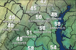
WEDNESDAY
• Some sun, but clouds come back quickly
• Rainbands will be tracked already late in the day, possibly arriving as early as evening
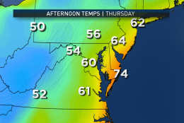
THURSDAY
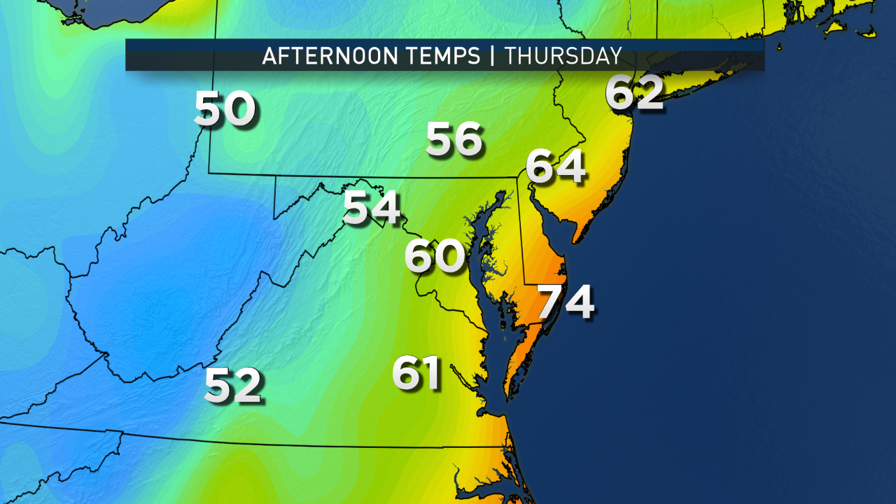
• Overcast and rainy, just a matter of how much
• Potential for big temperature differences from the Blue Ridge to central Virginia, southern Maryland and the Coastal Plain
FRIDAY
• Unsettled with mostly cloudy skies and maybe a peek of sun at a few intervals
• Strong southeasterly breezes making it feel rather humid
• On-and-off showers with some choosy areas getting much more than others
Editor’s note: The WTOP Workweek Weather Blog is intended as an in-depth yet plain language summary of the business week’s weather potential in the D.C. area along with an explanation of the contingencies and uncertainties that exist at the time of publication. For the latest actual Storm Team 4 Forecast, check out the WTOP Weather Page.