The official high at Reagan National Airport on Sunday was 91 degrees, but it was the last day of the latest heat wave. The new workweek will feature some of the most comfortable weather the area has had recently.
For several days in a row, the region will have seasonable temperatures — close to area averages — and much more comfortable humidity levels. Overall, it looks like a fantastic weather pattern for outdoor plans.
(WTOP/Storm Team 4)
WTOP/Storm Team 4
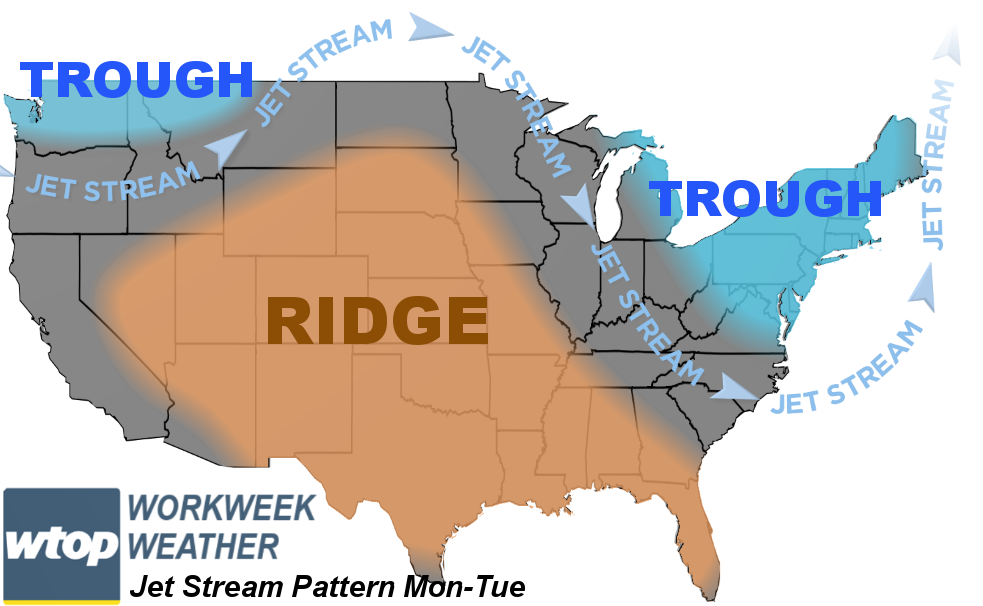
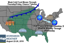
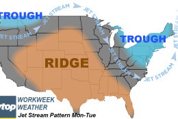
The new weather pattern is characterized by the ridge of high pressure in the jet stream shifting back into the nation’s midsection. This is a breakdown of the “Bermuda High” that brought us our latest heat wave. For the start of the workweek, there will be a trough — or a dip — in the jet stream in the Pacific Northwest and in the Great Lakes through the mid-Atlantic. This is a cooler, drier configuration for us and the high pressure system at the surface is also associated with this.
The oppressive heat and humidity will be south of the jet stream in the Rockies and central Plains. The trough in the east will flatten out by the end of the week and we will be back in the ridge, pumping in hotter temperatures and allowing the return of some humidity.
(WTOP/Storm Team 4)
WTOP/Storm Team 4
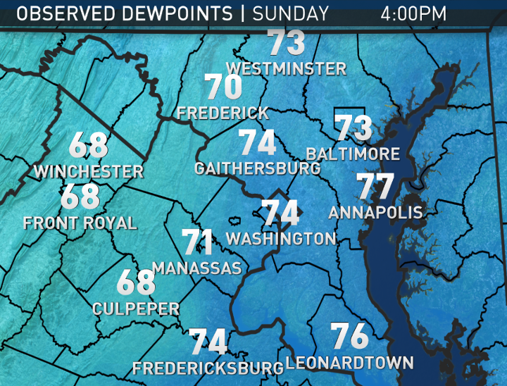
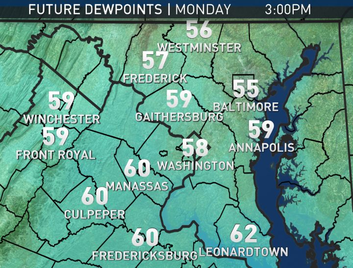
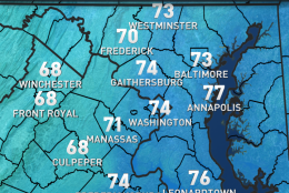
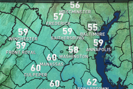
These next two maps show the changes in dew points from Sunday — before and during the thunderstorms — to Monday afternoon. The RPM forecast model is showing a substantial drop to levels most will find delightful.
(Data: The Weather Company; Graphics: Storm Team4)
Data: The Weather Company; Graphics: Storm Team4
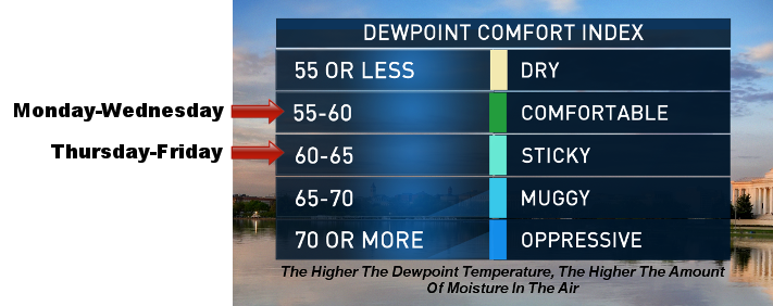
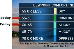
Conditions will be similar Tuesday and Wednesday before the dew points creep back up into the upper 60s, making it feel a bit sticky again, but not oppressive.
(Data: The Weather Company; Graphics: Storm Team4)
Data: The Weather Company; Graphics: Storm Team4
Here’s what dew points of a certain degree generally feel like around this area.
(WTOP/Storm Team 4)
WTOP/Storm Team 4
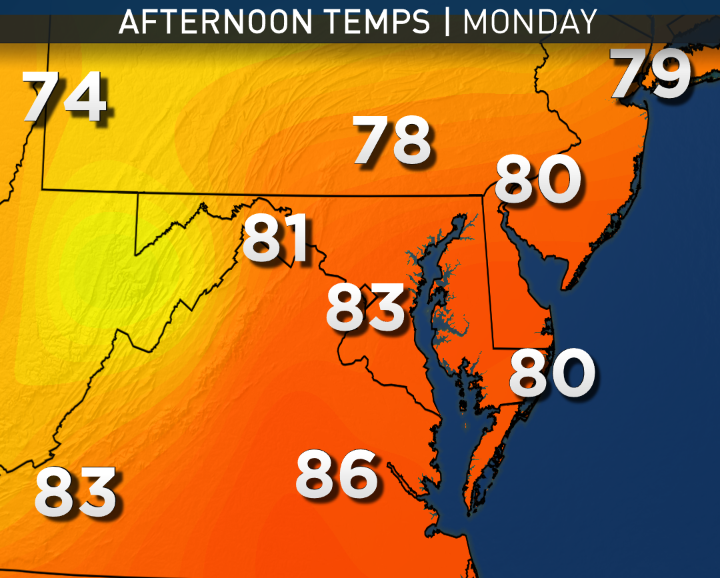
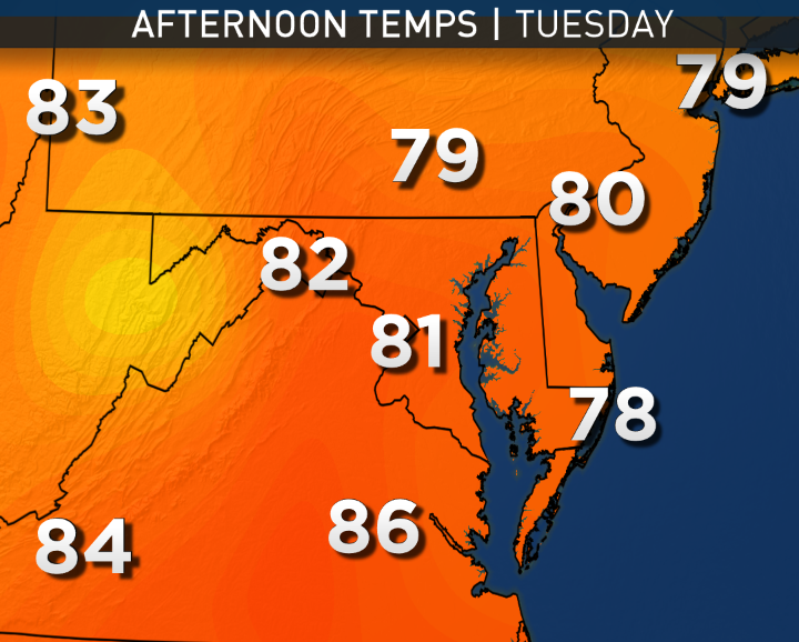
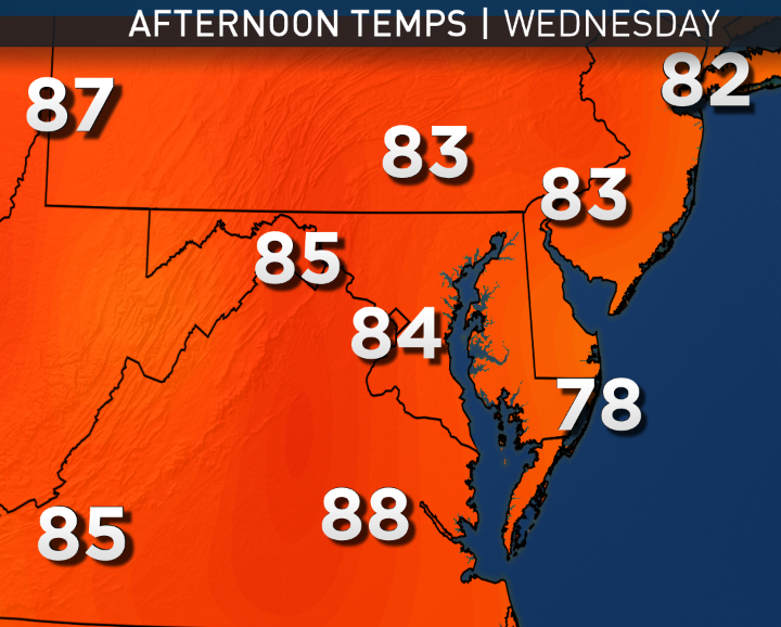
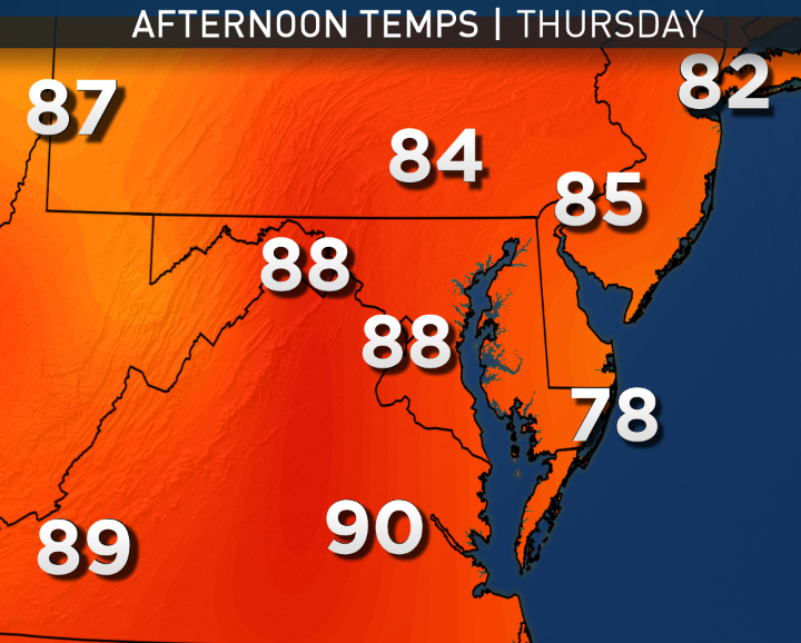
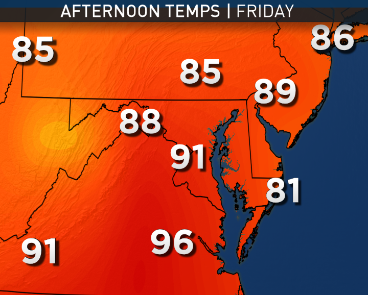
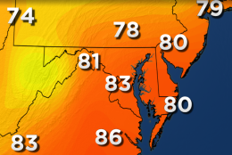
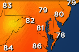
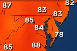
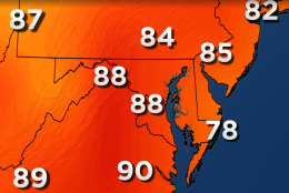
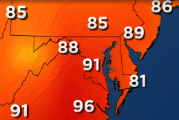
These next five maps show the American GFS model’s projections for potential high temperatures this week. Note the gradual progression back to the hot weather, but it won’t be extreme heat. Average high temperatures this week for Reagan National Airport are in the mid 80s.
(Data: NOAA; Graphics: Storm Team4)
WASHINGTON — The official high at Reagan National Airport on Sunday was 91 degrees, but it was the last day of the latest heat wave. The new workweek will feature some of the most comfortable weather the area has had recently.
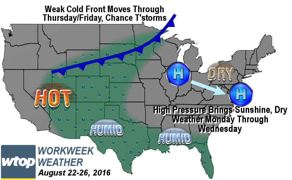
The cold front, which sparked the thunderstorms and heavy rains, was part of a total pattern change across North America. For several days in a row, the region will have seasonable temperatures — close to area averages — and much more comfortable humidity levels. Overall, it looks like a fantastic weather pattern for outdoor plans.
Road and rail crews will get a lot of cooperation from this pattern and a lack of rain, plus comfortable conditions during the day and at night. The weather will be ideal for the Nationals/Orioles series both at Nationals Park and at Camden Yards.
Hotter temperatures and higher humidity will return before the weekend, but it does not look like it will be too extreme. The next chance for thunderstorms won’t be until it gets more humid again Thursday and Friday with the best chance being along a weak cold front, which will pass through possibly as early as Thursday, but most likely Friday.
Daily weather highlights
MONDAY
• Lots of fair weather cumulus clouds moving from northwest to southeast but overall mostly sunny
• A bit of a breeze
• Humidity dropping during the day
• High temperatures stay in the low 80s
TUESDAY
• Near total sunshine
• Almost as good as it gets in August
WEDNESDAY
• Temperatures warm back up a little bit above average, but not too hot
• Humidity still at relatively comfortable levels
• More fair weather clouds as the high begins to move away
THURSDAY
• Humidity creeps back up to “sticky” levels
• High temperatures get closer to 90 again
• Lots of high level clouds
• Slim chance of a shower or thunderstorm late in the day
FRIDAY
• Feeling hot and a bit muggy again
• Could get into low 90s for highs
• Good chance for scattered showers or thunderstorms but timing and coverage still uncertain
NOTE: The WTOP Workweek Weather Blog is intended as an in-depth yet plain language summary of the business week’s weather potential in the D.C. area along with an explanation of the contingencies and uncertainties that exist at the time of publication. For the latest actual Storm Team 4 Forecast, check out WTOP’s weather page.