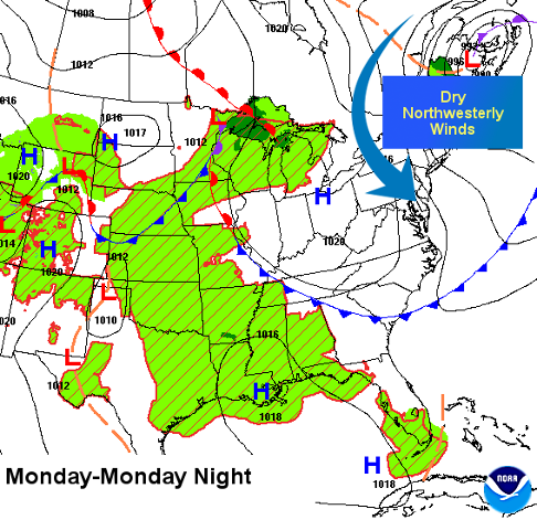
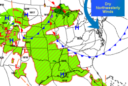

WASHINGTON — High pressure building in from Canada pushed a cold front through Sunday. Many probably didn’t even notice since it had zero showers or thunderstorms with it. But the strong northwesterly breezes brought in drier air all day, setting up a comfortable start to the new workweek. (And it’s a real bonus when you can dislodge hot temperatures and high humidity levels without any severe weather).
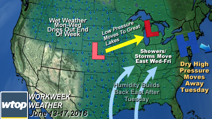
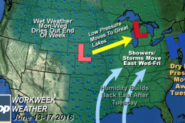
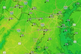
At any rate, the center of the high pressure system will settle in Monday, keeping it dry with seasonably warm temperatures. The heat and humidity have temporarily relocated into the nation’s midsection. Naturally, as we get closer and closer to summer and the weather is this nice, you know it’s just a matter of time before the heat and humidity try to “force” their way back east. That change will start as a warm front coming at us Tuesday.
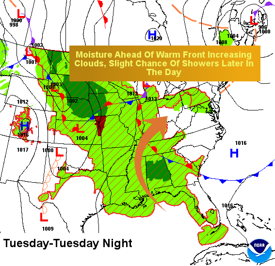
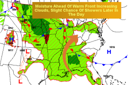
Moisture from the Gulf of Mexico will ride up and over the warm front at the surface, so at first we will see an increase in cloud cover and a slight chance for some showers late in the day. But here at the surface, the temperatures will only be slightly higher and the humidity levels won’t climb too much yet.
It will be a gradual change. When the front gets even closer Wednesday, the humidity will get back up to the levels where it starts to feel a bit sticky. Disturbances in the winds aloft along the front could touch off a storm or two Wednesday. The warm front will make its closest approach Thursday.
With a wave of low pressure coming up from the southwest, showers and thunderstorms will become more numerous Thursday afternoon. Then the boundary will slide a bit farther south Friday, bringing in cooler temperatures.
But with the front still nearby, more numerous showers and thunderstorms will be possible, even though we will be on the cooler side. The early outlook for the weekend is for drier weather and sunshine.
None of these opportunities for showers look like they will be big, soaking rains. When they all add up through Friday, we’re likely looking at about half an inch to a little more than an inch of rainfall, most of which would be falling Thursday night and Friday. If the front slows up on Friday, there will be an opportunity for a bit more.
Daily weather highlights
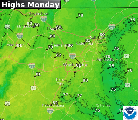
Monday
- Cool and comfortable start
- Abundant sunshine
- Seasonably warm temperatures
- Very dry dew points, so extremely comfortable
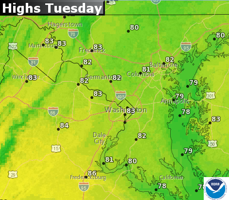
Tuesday
- Early sunshine fading behind increasing mid and high-level clouds
- Temperatures slightly higher
- Dew points back in the 50s, so more humid but still not uncomfortable
- A slight chance of a shower late in the day
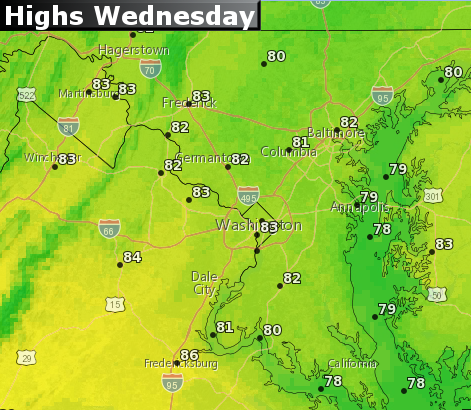
Wednesday
- Mostly cloudy with only peeks of sunshine
- Temperatures back above average for highs
- Dew points back in the low 60s, feeling sticky
- Also a slight chance of a shower, mainly late in the day
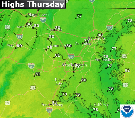
Thursday
- Mostly cloudy with scattered showers and thunderstorms, especially late in the day
- Dew points in upper 60s,starting to feel muggy again
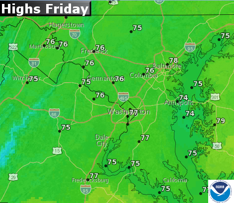
Friday
- Temperatures back below average for highs
- Showers and occasional thunderstorms throughout the day
- Humidity starts dropping in the evening as showers end
Editor’s note: The WTOP Workweek Weather Blog is intended as an in-depth yet plain language summary of the business week’s weather potential in the Washington, DC, area along with an explanation of the contingencies and uncertainties. For the latest actual Storm Team 4 Forecast, check out the WTOP Weather Page.


