WASHINGTON — After a dreary, rainy weekend, some big changes are on the way this week, changes that a lot of people have been wanting for a while — especially warm weather fans.
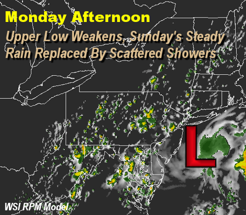
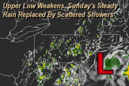
First, the upper area of low pressure that provided the rainfall, limited sunshine and high temperatures that were more like the average low temperatures for this time of year will begin to “fill in” and weaken on Monday. So this means there won’t be as much rain Monday in terms of the entire listening area, but, rather, it will be more of a hit-and-miss showers scenario. A few spots will even get some peeks of sunshine through the mostly cloudy skies. And, with the sun angle being what it is this time of year, that’s all the difference that will be needed to get milder temperatures.
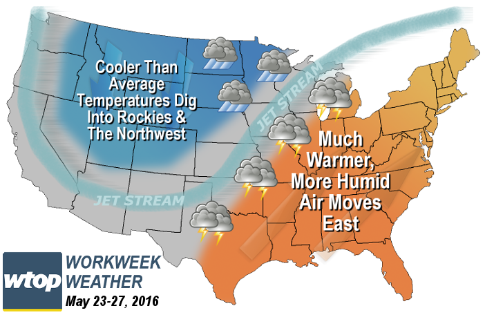
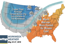
Right on the heels of this first change will be the overall pattern across North America shifting to a pattern with a trough (or dip) in the jet stream (the steering winds) out west and a strong ridge (or rise) setting up here in the eastern half of the country. That means cooler temperatures west and warmer east.
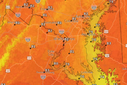
In fact, the pattern will be pronounced enough for temperatures to warm well above the averages, making it feel like summer. Along with the very warm air, moisture will be tapped from the Gulf of Mexico in the form of increased humidity, making it feel sticky by the end of the week. In this type of pattern, most of the storm systems and most of the showers and thunderstorms will be in the Plains and the Midwest. So the region won’t see much precipitation except from isolated or scattered thunderstorms that pop up on their own in the heat and humidity, mainly in the late afternoons and evenings. This pattern will likely last all the way through the upcoming holiday weekend.
It also means great baseball weather for the Washington Nationals’ home stand this week, except for having to keep an eye to the sky Monday and, perhaps, Thursday and Friday for showers or an isolated thunderstorm.
Weather highlights:
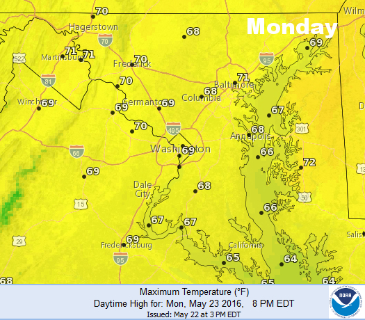
Monday
- Morning clouds, fog, and drizzle.
- Mostly cloudy the rest of the day with some sun here or there.
- Scattered showers develop and drift from north to south during the afternoon and weaken overnight.
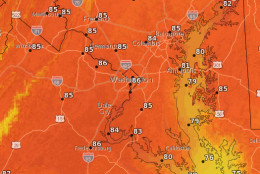
- Temperatures getting closer to 70 again, feeling milder but still below average for late May.
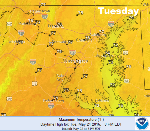
Tuesday
- Morning clouds and a stray shower still possible.
- Skies becoming mostly or partly sunny by afternoon.
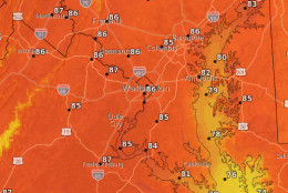
- Much more seasonable warmth for late May.
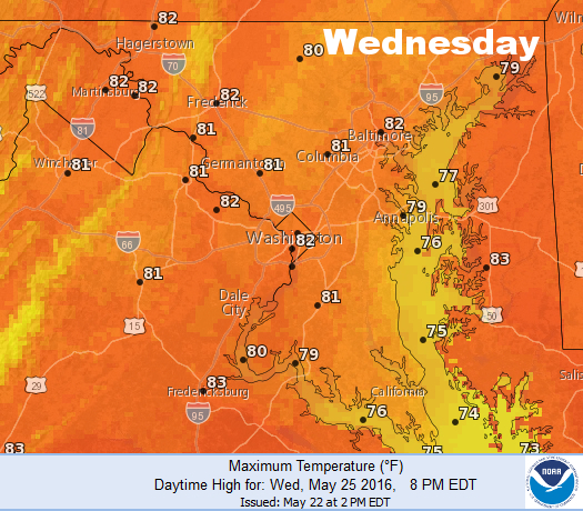
Wednesday
- Center of high pressure builds directly into the area.
- Lots of sunshine.
- Very warm but dry and pleasant.
- Best day of the week for outdoor activities.
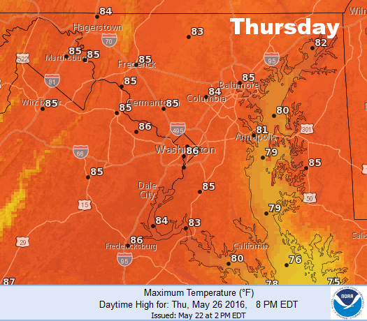
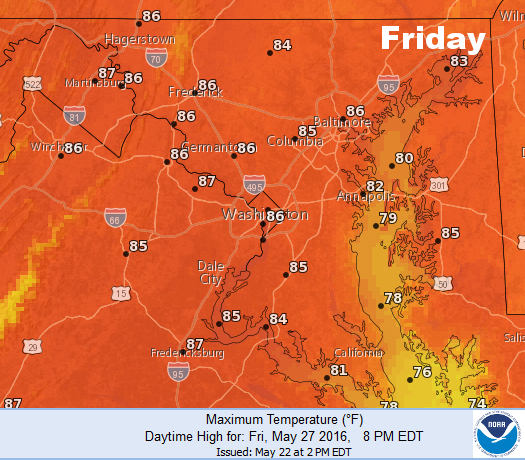
Thursday and Friday
- The surface high moves to our east, building the ridge.
- Southwest flow at the surface and aloft pumps in very warm temperatures.
- Humidity levels rise to when it starts to feel sticky to most people.
- Very warm air + humidity = “pop-up” isolated or scattered late-day thunderstorms.
A side note: As of the Sunday evening daily climate report, at Washington-Reagan National, there has been 9.34 inches of rainfall/snowmelt since March 1 and 14.77 inches for the year. That means the region still has a deficit of 1.31 inches since March 1, but only a deficit of 0.27 inches for the year. The rainy month has been beneficial, but it’s hard to believe there is still a deficit of any kind, but it’s true. That’s how dry March and April were around here, and shows how important it is to get precipitation in the cold season and beginning of spring. But the area is no longer considered “abnormally dry” in terms of topsoil. A few more all-day soaking rainstorms would give the region some more cushion as summer approaches. But perhaps after a series of dry days, lots of sunshine would be most people’s preference right now.