WASHINGTON — Spring arrived at 12:30 a.m. on Sunday. Two low pressure systems affected us somewhat over the weekend, with a cold rain and some wet snow and sleet. But as expected, the ground and the lowest layer of the atmosphere were too warm to have much of an impact.
So, as we welcome the first full day of spring on Monday, the last of a couple of wintry storm systems that affected our area will be pulling away, up toward coastal New England. While this happens, a pattern shift over the United States will send more cold, stormy weather to the Northwest and the Rockies. A ridge of high pressure will build east, eventually pumping in some unseasonable warmth. The new weather pattern will move slowly, so the warm and dry conditions will be with us for a few days. The storm systems will mainly be diverted to our north until about Friday at the earliest, which will be the next chance for any significant precipitation. That cold front could bring us some showers and/or thunderstorms.
MONDAY: The day of transition. The coastal low over New England will intensify as it moves away and high pressure begins to build our way. The difference in pressure will stir up the wind, but also dry us out.
- Gusty winds.
- Seasonable high temperatures.
- Winds won’t really let it feel like we’re milder than we were over the weekend.
TUESDAY: The warm-up will begin.
- Temperatures back to near average.
- Less wind so it feels even warmer.
WEDNESDAY: Best day of the week, for those — of course — who love the season.
- Temperatures well above average but nowhere close to records.
- Lots of sunshine.
THURSDAY: Still quite warm, but weather deteriorates a bit.
- Temperatures as warm as Wednesday.
- More cloud cover, not as sunny.
FRIDAY: Back to reality. It is early in the season, so Canadian cold air still has some muscle.
- Much more cloud cover.
- Depending on speed of next cold front, showers and thunderstorms likely.
- Colder, more seasonable air moves in for the weekend.
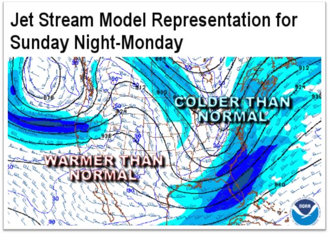
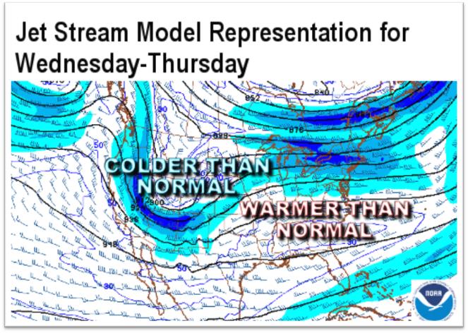
As mentioned, the weather pattern is changing for this week. The changes in the jet stream — the upper-level winds which steer the weather systems across the hemisphere — demonstrate what’s happening. Generally speaking, when there’s a trough or a dip in the East, we’re getting the colder air from Canada, if not the Arctic. But when a ridge is in place in the East, our air mass is from the Pacific, if not the tropics. A relatively flat ridge will set up here for the midweek, so temperatures will be on the increase.
For all the forecast details from StormTeam 4, check out WTOP’s Weather page.