By Devon Lucie, ABC7 Meteorologist
WASHINGTON — A Winter Weather Advisory has been issued for the D.C. metro area from 7 a.m. Sunday through 3 a.m. Monday.
The pattern persists with another weekend system that’s expected to affect the region, but as opposed to last weekend where it snowed on Saturday, this storm is forecast for Sunday. There are some similarities, but also some notable differences with this system compared to this last one. A similar cold air mass is already in place with lows in the teens, and highs only in the 20s to near freezing, but that’s even a bit above the air mass last weekend where we experienced record cold.
This next storm track is also riding the “Southern Stream,” located in Texas right now, and will move closer to the region on Sunday. But, it will set-up just west of the Mid-Atlantic instead of moving completely south of the region. The strength of the high pressure also associated with the cold air is very strong, which could influence the track of the system, and is of similar strength to this past significant snow event.
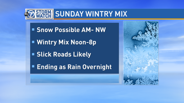
The latest information points to mostly wintry precipitation on Sunday, before an eventual changeover to all rain overnight Sunday into early Monday morning.

Timing: Forecasts are showing precipitation entering the region as early as Sunday morning, and lasting all day.
Precipitation Type: Possible snow at onset, then a melt layer that will change the snow to sleet, possibly changing to freezing rain by afternoon, then finally changing to all rain late Sunday into early Monday.
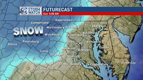
The ABC7 Futurecast forecast shows possible snow at onset early Sunday morning. The Futurecast then shows the possible mix of wintry weather, that in this case would most likely be freezing rain, or ice that would build up on trees, power lines, your car, the sidewalk, and untreated roads.

Summary: The overall picture is turning more towards a significant wintry event on Sunday that will impact travel conditions. Our advice, at this point, is to plan on running errands or getting in activities on Saturday as Sunday is beginning to show the potential for a day that would be very difficult traveling on regional roads.


