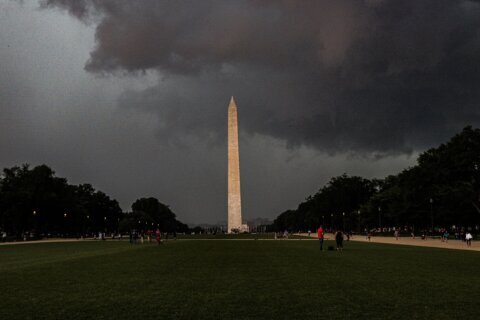
The weekend getaway in the D.C. area may be a bit more difficult Friday, as storms are expected to move toward the Interstate 95 corridor in the early evening.
Just like Thursday, afternoon temperatures are surging past the 90s, with heat index values climbing above 100, which could provide more fuel to evening storms.
The National Weather Service has issued a severe thunderstorm watch until 9 p.m. for the entire immediate D.C. metro area. Southern Maryland and areas farther south of D.C. in Virginia, such as Culpeper and Fredericksburg, are not included in the watch.
Scattered thunderstorms are expected to develop Friday after 3 p.m., according to 7News First Alert Meteorologist Jordan Evans.
“There is a slight risk for damaging wind gusts up to 65 mph with any of the storms that develop. Storms should move out of the region after sunset,” Evans said.
It could be a repeat on Saturday, with similar high temperatures and heat index values and another possibility of afternoon and evening storms with damaging wind gusts, according to Evans.
Sunday likely provides a break from stormy weather, Evans said, but temperatures are again expected to reach the low 90s, with heat index values near 100.
Full forecast
FRIDAY EVENING: WEATHER ALERT UNTIL 8 P.M.
Partly cloudy with afternoon storms
Temperatures: 80s
Winds: Southwest 5-10 mph
Another summer sizzler for the D.C. region. Highs range from the 80s to lower 90s east of the Blue Ridge and heat index values around 100. Thunderstorms are expected and the Storm Prediction Center has the I-95 corridor from the D.C. area north toward Baltimore under a “slight” risk, Level 2 out of 5 for damaging wind gusts, hail and pockets of moderate to heavy rainfall. Storms should be somewhat faster-moving and more organized than Thursday, which lowers the flooding threat.
FRIDAY NIGHT: Scattered clouds and patchy fog
Lows: 72-78
Winds: Southwest 5 mph
It will remain warm and muggy overnight, with high humidity and areas of patchy fog possible toward Saturday morning.
SATURDAY: Partly cloudy with afternoon storms
Highs: 87-92 with a heat index of 95-100
Winds: Southwest 5-10 mph
Another hot and humid day with highs in the upper 80s to lower 90s east of the Blue Ridge and heat index values near 100. A weather maker will bring thunderstorms during the afternoon and evening. Storms may become more organized, with the greater severe weather potential focused along and north of I-66 and Route 50. Damaging wind gusts will again be the primary concern.
SUNDAY: Mostly sunny
Highs: 89-93 with a heat index of 95-100
Winds: West 5-10 mph
The hot and humid pattern continues, but thunderstorm coverage should ease somewhat compared with Friday and Saturday. Highs will reach the upper 80s and lower 90s east of the Blue Ridge, with Sunday beginning the hottest stretch of the forecast as the subtropical ridge strengthens over the region.
MONDAY: Partly cloudy
Highs: Around 95
Winds: West 5-10 mph
Hot and humid conditions continue with highs climbing into the lower to middle 90s east of the Blue Ridge. Heat index values could once again approach 100. Thunderstorm coverage remains somewhat lower initially, although additional disturbances will begin increasing storm chances again.
TUESDAY: Partly sunny with storms
Highs: 92-97
Winds: West 10-15 mph
Another very hot and humid day with highs in the lower to middle 90s and heat index values around 100 east of the Blue Ridge. Thunderstorm chances increase again as another upper-level disturbance moves through, beginning a period of greater storm coverage into the middle of the week.
Current conditions
Get breaking news and daily headlines delivered to your email inbox by signing up here.
© 2026 WTOP. All Rights Reserved. This website is not intended for users located within the European Economic Area.