Listen live to WTOP for traffic and weather updates on the 8s.
After the fourth hottest July on record comes to a close, the D.C. region will be entering its fifth heat wave of the year with the potential to last a week at or above 90 degrees. But not before severe storms began rolling through. Here’s what you need to know.
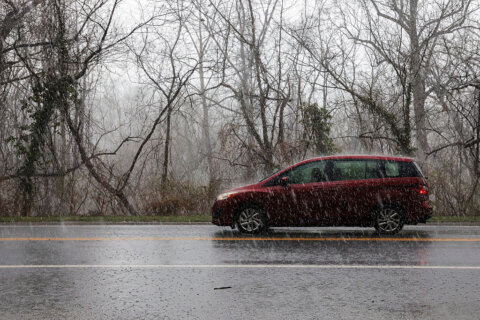
Storms rolled through the area Wednesday afternoon prompting a severe thunderstorm warning for D.C. and the parts of Maryland and Northern Virginia until 6:30 p.m.
The National Weather Service said damaging wind gusts were the primary threat with 70 mph gusts and some possible hail, while nearly an inch of rain was expected to blanket the area until the evening. The 7News First Alert Weather Center put a “storm alert” in effect until 7 p.m.
Flights out of Ronald Reagan National Airport are no longer under a ground stop, but passengers may still face delays due to the weather.
The hottest parts of the week will be Thursday and Friday, with soaring temperatures nearing the century mark.
- Listen to WTOP online and on the radio at 103.5 FM or 107.7 FM.
- Current traffic conditions
- Weather forecast
- Closings and Delays
- Sign up for WTOP alerts
Some downed wires closed both directions of Maryland Route 185 at Connecticut Avenue and Underwood Street. Officials from Montgomery County are telling the public to seek alternate routes as this will be an extended closure.
Some trees were knocked down in Prince George’s County between Silver Hill Road and Branch Avenue near the Suitland Metro station, according to U.S. Park Police. All traffic in both directions is blocked as police are on the scene, and motorists should be aware of changes to traffic.
Several lanes of Kenilworth Avenue were flooded at the Eastern Avenue underpass. The area received over an inch of rainfall in less than an hour.
A northbound lane of the George Washington Parkway was flooded near the CIA building. The drainage is poor along parts of the parkway because of concrete barriers setup for roadwork.
As always, D.C. Fire and EMS officials want to make the public aware that all downed wires should be assumed live. They recommend using precaution, never touch or drive over a live wire and call 911.
Looking ahead
Over the past two weeks, the D.C. area has felt relief from the oppressive heat. But it returned Wednesday, with temperatures creeping toward the triple digits — highs around 97 and feels-like temperatures sitting right around 100.
Thursday’s highs will sit in the upper 90s, with uncomfortable heat index values from 97-103 degrees and some isolated showers and storms.
The 7News First Alert Weather Center has put a heat alert in effect for the afternoon. The NWS has also issued a Heat Advisory for Thursday from noon to 8 p.m. for the entire area.
Friday will be even hotter, with the high at 98 and feels-like temperatures between 100 and 105 degrees. The 7News First Alert Weather Center heat alert continues.
“Strong to severe thunderstorms may be possible on Friday and Saturday during the afternoon and evening hours,” the NWS forecast.
The weekend, while more tolerable, will still be uncomfortable, with temperatures staying in the 90s and a heat index value over 100 degrees Saturday.
The D.C. area has already seen 35 days at or above 90 degrees, almost reaching the annual average, which is 40. Last year through July 31, there were 19 days at or over 90 degrees, and for the whole year there were 32.
Current weather
Forecast:
WEDNESDAY: Scattered clouds, isolated showers and storms
Highs: 92-97
Feels Like: 96-100
Winds: West 5-10 mph
Higher heat builds for the middle of the week with highs in the low to mid 90s. Humidity values will drop off a bit, but still plan for feels-like temperatures to be around 100 degrees. A stray shower or storm bubbled up during the afternoon or evening, but a much higher chance your neighborhood will remain dry.
WEDNESDAY NIGHT: Passing clouds
Lows: 70-80
Winds: Light and variable
A very mild overnight forecast with lows in the 80s around D.C. and in the 70s in the suburbs.
THURSDAY: HEAT ALERT
Partly cloudy, isolated showers and storms
Highs: 93-97
Feels Like: 97-103
Winds: Southwest 5-10 mph
The month of August will start off very hot with highs well into the 90s. Heat index values will approach 105 degrees, so the National Weather Service may issue heat related alerts. First Alert Weather is on HEAT ALERT for the afternoon.
FRIDAY: HEAT ALERT
Partly cloudy, scattered storms
Highs: 94-98
Feels Like: 100-105
Winds: Southwest 5-10 mph
We’ll round out the week with heat index values, once again, around 105 degrees. Scattered showers and storms are possible during the afternoon and evening hours. First Alert Weather HEAT ALERT continues.
FIRST WEEKEND OF AUGUST: Plan for a hot and humid weekend. High temperatures will reach the mid 90s on Saturday and low 90s on Sunday. At this point, Saturday looks like it will feel the hottest with heat index values over 100 degrees. Scattered showers and storms are possible both days during the afternoon and evening hours.
Outages:
WTOP’s Dave Dildine contributed to this report.
Get breaking news and daily headlines delivered to your email inbox by signing up here.
© 2024 WTOP. All Rights Reserved. This website is not intended for users located within the European Economic Area.