The cold front that pushed through Monday night has brought the season’s coldest temperatures into early Tuesday, but the D.C. region is not done yet with the October chill.
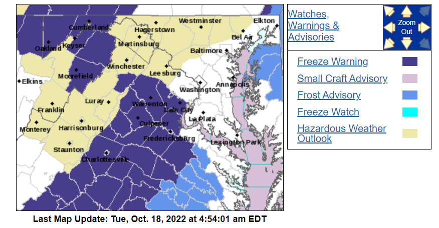
Wednesday will be a bit blustery with temperatures not moving too much from morning readings. Clear skies, light wind and fresh Canadian air will allow a hard frost to develop west of Interstate 95 where freeze warnings have been issued.
Bring potted plants and flowers inside or cover them with a blanket before going to bed Tuesday night. Otherwise, the upper 20s expected west of the Beltway will destroy them.
Meanwhile, lake-effect snow will expand downwind of Lake Erie and the first accumulation of the season will occur as far southeast as western Allegany and Garrett County, Maryland, and the West Virginia highlands. Snow could accumulate on roads overnight impacting midweek travel during the first half of Wednesday, so keep that in mind if traveling through Pittsburgh and Morgantown, West Virginia.
As a matter of fact, snow accumulation in Pittsburgh appears likely later Tuesday and will likely tie Oct. 18, 1972, as the earliest observed snow accumulation on record in the Steel City. It’ll be a close call with the accumulation occurring later Tuesday evening, perhaps as late as early Wednesday.
After scraping frost off the car Wednesday morning before work and school, temperatures will only warm 15 degrees into the 50s. Another frost will develop early Thursday before transitioning to a warmer pattern for the weekend as the jet stream, or zone of upper winds, lifts north and allows an expansive area of warmth in the nation’s midsection to sweep into the Mid-Atlantic.
The mid-October cold spell is right on track with the median date for the average first freeze or hard frost of the season in the D.C. suburbs. In Washington, the first freeze occurs in mid-November.
Fall foliage report
The fall colors are just about ready to peak along the Blue Ridge through Interstate 81 and this midweek cold snap will do the trick. If you are looking for the right window to see the most vibrant colors of the season within a short drive of Washington, this weekend will be your best bet before the leaves begin to fall.
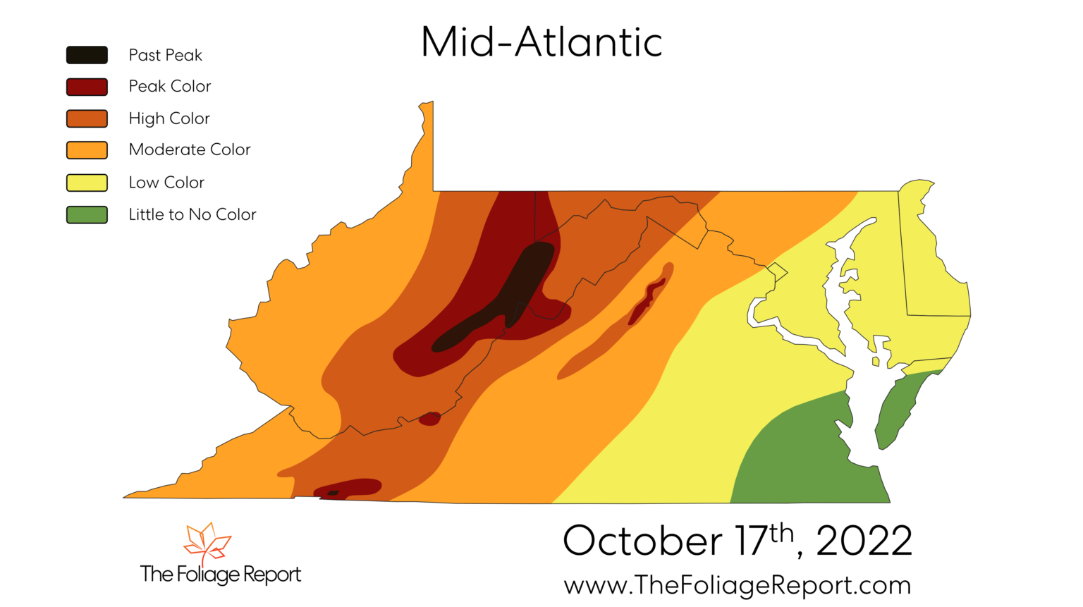
In the immediate D.C. suburbs, the cold pattern will set fall colors in motion. The weekend of Oct. 29-30 will likely be the peak season for places such as Sterling, Virginia, and Maryland’s Germantown and Westminster. Along and east of I-95 will have to wait until early November for the best color.
The foliage season will come to a quick end along and west of the Eastern Continental Divide, at the edge if the Allegheny Plateau running through Western Maryland, late this week. The most vibrant colors along the Route 219 corridor occurred last weekend along the Allegheny Plateau.