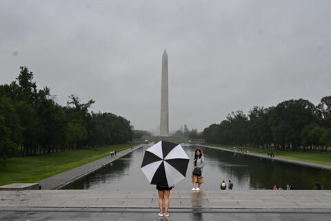
Remnants from Hurricane Ian are expected to bring boatloads of rain and potentially other nasty weather to the D.C. area this weekend.
The expected severe weather has led Virginia to declare a state of emergency, and along with D.C. and Maryland, cancel or postpone events scheduled to take place through the weekend.
Here’s what you need to know.
The first chance of rain in the immediate D.C. area doesn’t come until late in the day Friday, Storm Team4 meteorologist Mike Stinneford said.
- Listen to WTOP online and on the radio at 103.5 FM or 107.7 FM.
- Current traffic conditions
- Weather forecast
- Closings and Delays
- Sign up for WTOP alerts
But the rest of the weekend could be a washout.
All told, the region could see 2 to 4 inches of rain by Sunday night.
While the D.C. area won’t be hit with anything like Florida and the Carolinas, it won’t be a pretty weekend.
“We’re still expecting nasty conditions Saturday, Sunday into Monday. Rain, 30 to 35 mph winds, maybe a little bit higher towards the beaches and towards the Chesapeake Bay,” Chief meteorologist Doug Kammerer, of NBC Washington, told the DMV Download podcast.
“It has been abnormally dry the last month, and the ground will be able to absorb the first round of heavy rain on Saturday. Flooding could become an issue Saturday night into Sunday,” Stinneford said. “The rain from the remnants of Ian may persist into Monday night or Tuesday.”
The National Weather Service calls it a “chaotic weather pattern” across the Mid-Atlantic region. The hurricane downgraded to a tropical storm earlier Thursday morning but has since gained traction over the water and re-strengthened into a Category 1 hurricane around 5 p.m. Thursday.
Hurricane Ian is expected to head north and make a secondary landfall on Friday near the Georgia-South Carolina border.
Kammerer is calling it one of the top five storms to ever hit the U.S. In the I-4 corridor, from Tampa and Orlando towards Daytona Beach, “you’re seeing rainfall totals over 20 inches of rain,” he said. “Water levels that have never been seen before.”
That will bring moderate to heavy rain for most of the D.C. area — but especially central Virginia, the National Weather Service said.
The NWS added that there is the risk of scattered flooding especially late Saturday into Sunday and west of the Blue Ridge Mountains and south of U.S. Route 50.
The rain is expected to stick around into Tuesday before the dry-out begins.
In Maryland
Ocean City officials said the resort town is expected to be hit with high winds and tropical storm conditions, including heavy rain and tidal flooding, leading to the cancellation of the popular Oceans Calling festival.
Overall, the Maryland Department of Emergency Management said it is continuing to monitor the storm closely. Hurricane Ian is expected to deliver light to moderate rainfall and some minor, isolated instances of coastal/tidal flooding this weekend, MDEM said in a tweet.
Hurricane Ian is expected to deliver light to moderate rainfall to Maryland this weekend and with it, the chance of isolated instances of flooding, mainly in southern MD and the lower Eastern Shore. (1/2) pic.twitter.com/EFgaUsF0MO
— Maryland Department of Emergency Management (MDEM) (@MDMEMA) September 29, 2022
Along with the possibility of flooding, the department said periods of gale-force winds are possible at times through Monday, mainly for ocean beaches and south of Drum Point and Cobb Point, Maryland.
Meanwhile, officials in Calvert County in Southern Maryland are handing out sand and sandbags to county residents who need them to prepare for possible flooding. The sandbags are being handed out at three locations. You can find more information on locations and hours on the Calvert County Government website.
In Virginia
Virginia Gov. Glenn Youngkin has already declared a state of emergency in anticipation of possible effects from the storm, which allows the state to mobilize resources and equipment.
“We want to ensure that our communities have the resources needed to respond to and recover from any potential effects from the storm,” said Youngkin.
“We’re planning for rainfall projections anywhere from about two to more than six inches,” said Lauren Opett, spokeswoman with the Virginia Department of Emergency Management.
The southern, central and eastern portions of the state are expected to get hit the hardest.
Officials with the Virginia State Police said all available state police personnel are on stand-by for routine and emergency duty across Virginia for the duration of the storm. Search-and-recovery teams are preparing to deploy to areas based on projected rainfall patterns, vulnerable flood zones and areas prone to storm surge.
“It’s important to note that even when the storm exits, higher-than-normal tides could continue until Tuesday,” Opett said.
If you’re putting together an emergency kit, here are some tips on what to include and how to prepare.
WTOP’s Nick Iannelli contributed to this report.


