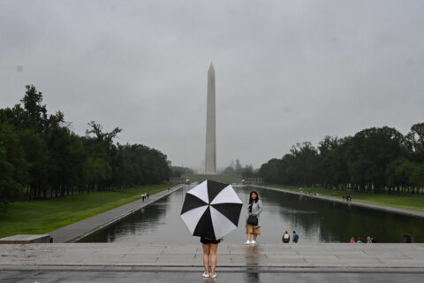
Remain weather-ready through the evening hours, as heat and humidity fuel strong to severe storms across the D.C. area. Here’s what you need to know.
The first round of severe weather is now pushing off to the east, but the atmosphere remains unstable; and as a cold front approaches, there will be a continued risk of severe weather, with the bulk of the activity ending by midnight, Storm Team4 meteorologist Mike Stinneford said.
The biggest concerns are heavy rainfall and strong, damaging winds, Storm Team4 meteorologist Amelia Draper said, adding that up to quarter-size hail and an isolated brief tornado are not out of the question.
The National Weather Service issued severe thunderstorm warnings in the D.C. area, including D.C.; Arlington, Alexandria, Burke, Manassas and Centreville in Virginia; and Waldorf and Clinton in Maryland.
Severe weather led to the closing of fire house testing and TestYourselfDC pickups at 4 p.m. Wednesday. Drop-offs at TestYourselfDC locations will be open until 8 p.m.
Meteorologists warn of potential damaging wind gusts up to 80 mph and hail the size of golf balls into late evening.
“The latest high-resolution guidance favors a linear storm mode with damaging winds being the main hazard,” the National Weather Service’s D.C. office said in its Wednesday weather briefing. “The main period of concern ranges from around 2 to 10 p.m. with the Storm Prediction Center placing most of the area in a slight risk for severe thunderstorms.”
- Listen to WTOP online and on the radio at 103.5 FM or 107.7 FM.
- Current traffic conditions
- Weather forecast
- Closings and Delays
- Sign up for WTOP alerts
Northern Virginia and eastern Maryland, along the Interstate 95 corridor into Delaware, have the greatest potential to see severe weather.
Thunderstorms move out after dusk tonight, but the inclement weather won’t end there: The same cold front to blame for Wednesday’s storms will stall to the region’s south, bringing a chance of heavy rain on Friday with showers possibly lingering well into Memorial Day weekend.
“There’s some evidence that the front will continue to linger south through at least Sunday morning, perpetuating rain chances across the region,” Storm Team4 meteorologist Lauryn Ricketts said. “Some guidance also has that front clearing through the region as high pressure kicks it out to sea bringing sunshine to the region by Sunday and Monday.”
Bearing in mind the forecast is still in flux five days out, Monday — Memorial Day — looks to be on the sunnier side, with cooler air bringing daytime highs back into a more agreeable low to mid-70s.
There’s your silver lining to an otherwise murky holiday weekend outlook — keep those fingers crossed.
Prince George’s County Fire and EMS warned that the storms had already pulled trees down in the southern part of the county. At least one falling tree fell on a house, injuring one person.
STORM DAMAGE ADVISORY: Reports of trees down in southern end of County. Approx 6pm in the 13300 blk of Pendleton St. in Ft. Washington. Tree into house. Collapse investigation. #PGFD Special Ops units on scene. 1 patient removed from home; minor injuries. pic.twitter.com/n2itvHCeG7
— Prince George’s County Fire/EMS Department (@PGFDNews) May 26, 2021
Outages
The storms have knocked out power in some areas around the D.C. region.
In Virginia, Dominion Energy reports more than 7,000 customers are without power in Fairfax County and nearly 2,000 homes and businesses are without power in Prince William County. 3,000 more are out in Alexandria.
In Maryland, SMECO says about 3,400 homes and businesses have no power in Prince George’s County.
Baltimore Gas and Electric says over 3,500 of its customers are also out, mostly in Howard and Prince George’s counties.
Pepco also has reported about 1,600 more power outages in Prince George’s County.
Forecast
Wednesday evening: Showers and thunderstorms, ending around midnight. Storms may be severe. Highs in the 60s to lower 70s.
Thursday: Sunny with falling humidity. Highs in the mid 80s.
Friday: An increasing chance of showers in the morning, with an afternoon of heavy rain. Highs in the mid to upper 70s.
Saturday: Cool. Cloudy, with scattered showers before noon. Highs in the low to mid 60s.
Sunday: Morning showers possible, becoming partly sunny. Cool. Highs in the upper 60s to near 70s.
Memorial Day: Mostly sunny, mild and comfortable. Highs in the low to mid 70s.


