
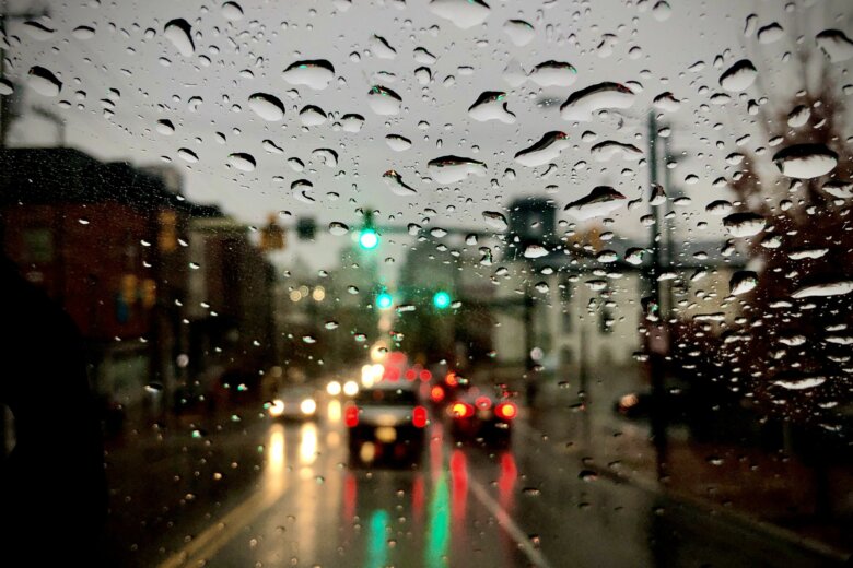
As if the nation didn’t have enough on its plate already, it’s hurricane season, and the D.C. region will find itself dealing with the remains of another storm to end the workweek.
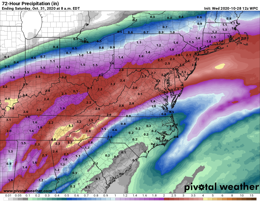
Moisture from Hurricane Zeta will merge with a cold front after landfall in Louisiana on Wednesday, with 2 to 3 inches of rain forecast for much of the D.C. region from early Thursday into Friday morning. That means a substantial flood risk, especially for vulnerable roadways and low-lying areas along streams, so plan accordingly.
The National Weather Service has issued a flood watch for the region on Thursday from 5 a.m. until 11 p.m.
Winds will likely turn gusty later Thursday and a breezy wind will remain heading into Friday, according to Storm Team 4 meteorologist Amelia Draper.
Here’s what to expect:
- Flood watch for the region: It’s in effect from 5 a.m. to 11 p.m. Thursday.
- A soaking rain starting late Wednesday night: “You won’t really want to leave the house on Thursday or Friday,” said Storm Team 4’s Chuck Bell, with the heaviest rain likely to arrive after sunrise Thursday.
- Two to 3 inches with a risk for higher totals: In its forecast discussion, the National Weather Service said locally higher amounts from 4 to 5 inches could not be ruled out. Clean out those gutters and storm drains.
- Listen to WTOP online and on the radio at 103.5 FM or 107.7 FM.
- Current traffic conditions
- Weather forecast
- Closings and Delays
- Sign up for WTOP alerts
The latest thinking has Zeta’s rain stretching over the region from midnight to 2 a.m. Thursday, with central Virginia and the Blue Ridge getting soaked the earliest.
By dawn Thursday, the entire WTOP listening area should be firmly under a hard and steady rainfall lasting all the way through the evening.
“Make sure your gutters and storm drains are cleaned out, and secure any loose items that may be out in the yard or driveway,” Bell said.
Holy cow! That is A LOT of rain. The rain starts late tonight and will not finally come to a stop until Friday afternoon. When all is said & done, a solid 2 to 3 inches of rain will have soaked the entire area. Clean those gutters & storm drains TODAY. Stay with StormTeam4. pic.twitter.com/DyljGEzME0
— Chuck Bell (@ChuckBell4) October 28, 2020
Winds will pick up late Thursday into Friday, especially in Zeta’s wake. Even though the storm itself will rapidly lose steam after coming ashore, gusts of up to 30 mph could down trees on a waterlogged ground.
Halloween looks sunnier, albeit much cooler. The departing storm will pull in a cold air mass behind it: Expect a cold start to Saturday, with a frost and freeze threat to the north and west of the nation’s capital.
Daytime highs on Halloween likely won’t breach the low 50s in addition to a light breeze.
Forecast
Thursday: Rain likely all day, steady and heavy at times. Highs in the 60s. Flood watch in effect from 5 a.m. until 11 p.m.
Friday: Rain the morning tapers off to scattered showers, ending through the afternoon and evening. Breezy. Temperatures falling into the low 50s.
Saturday: Chilly and frosty but sunny. Highs in the upper 40s to low 50s.
Sunday: Increasing clouds with a few late afternoon showers possible. Highs in the low 60s.


