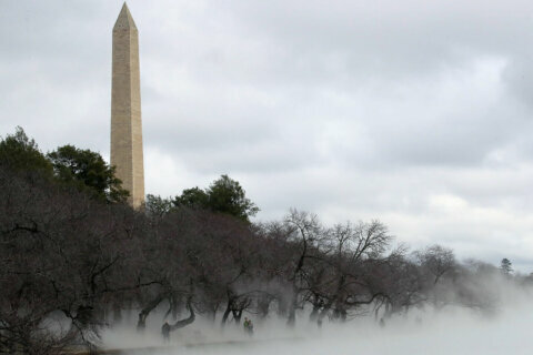
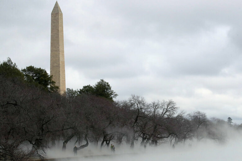
Dense fog will linger in the D.C. region through midday, but after that, it’s smooth sailing: Afternoon temperatures will warm to between 10 and 15 degrees above normal, and stay there for the middle part of this week.
A strong area of high pressure will dominate the region’s weather for the rest of the workweek, forming a setup that NBC Washington meteorologist Chuck Bell sees as more typical of summer than fall.
“For those who have already had a heavy frost or two, you could consider this Indian Summer,” he said. “The upside to this weather pattern is a long stretch of sunny and warm afternoons.”
- Listen to WTOP online and on the radio at 103.5 FM or 107.7 FM.
- Current traffic conditions
- Weather forecast
- Closings and Delays
- Sign up for WTOP alerts
Much of the WTOP listening area is under a dense fog advisory through noon, with forecasters noting visibility of a quarter mile or less will make driving difficult along the Interstate 95 corridor and near water crossings like the American Legion Bridge. Remember to reduce speeds and increase stopping distance.
For the latest road and traffic conditions, see WTOP’s traffic page or listen to updates every 10 minutes online or on the air at 103.5 FM. Submit traffic tips by calling 866-304-WTOP or tagging @WTOPtraffic on Twitter.
The last of the fog should burn away after midday with mostly sunny skies to follow, boosting afternoon temperatures into the mid- to high 70s — unseasonable, considering the average high for Oct. 21 is 67 degrees.
Some localities could even top 80 degrees on Thursday, which would put the area within a few degrees of the record daily high of 84 degrees for Oct. 22 set in 1979.
But even given the warm weather, Storm Team4 meteorologist Matt Ritter doesn’t quite expect this week will be one for the record books.
“We haven’t set any records so far this month and we’re probably not on the pace to do so except for Thursday,” Ritter told WTOP. “The driest October ever was 1963 when Washington only received a trace of precipitation, so we’re well above that.”
A cold front will move in from the Great Lakes and stall over the Maryland-Pennsylvania state line late Thursday into Friday, bringing with it the next chance for wet weather. For most, that will mean drizzle or a chance of light showers early Friday morning.
Daytime highs will cool after Thursday, but not by much: The forecast currently calls for highs in the upper 60s to low 70s going into the weekend.
Forecast:
Wednesday: Thick fog early, then becoming mostly sunny. Warm, with highs in the upper 70s to low 80s.
Wednesday night: A nice evening with renewed fog by dawn. Breezy, with lows in the mid 50s to near 60.
Thursday: Fog clearing before 9 a.m. with a sunny afternoon. Warm, with highs in the upper 70s to low 80s.
Friday: Fog and drizzle in the morning. Partly cloudy in the afternoon. Cooler, with highs in the upper 60s to low 70s.
Saturday: Mostly cloudy and mild, with passing showers possible late. Highs in the upper 60s to low 70.


