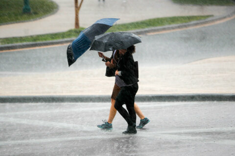
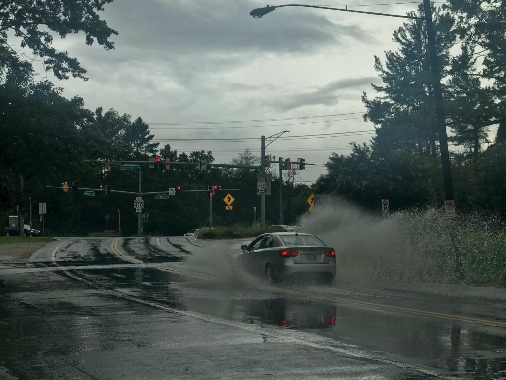
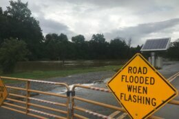
Drenching downpours Thursday in the D.C. area led to dramatic rescues of several dozen stranded drivers from submerged roadways. And in Montgomery County, a stretch of Colesville Road remains closed overnight. Here’s what you need to know.
Both directions of U.S. 29 between Md. 193 (University Boulevard) and Md. 650 (New Hampshire Avenue) is still closed due to flooding, the Maryland Department of Transportation State Highway Administration announced Thursday night.
“The road will remain closed until waters of the Northwest Branch Creek recede to allow for cleanup and further inspection. Motorists are urged to avoid the area and plan alternate routes,” the release said.
Southbound traffic may use Md. 650 south to Interstate 495 West to Md. 193 West before returning to U.S. 29 south.
Northbound traffic may use Md. 193 East to I-495 East to Md. 650 North before returning to U.S. 29 North.
Flooding traps cars, drivers; delays rails
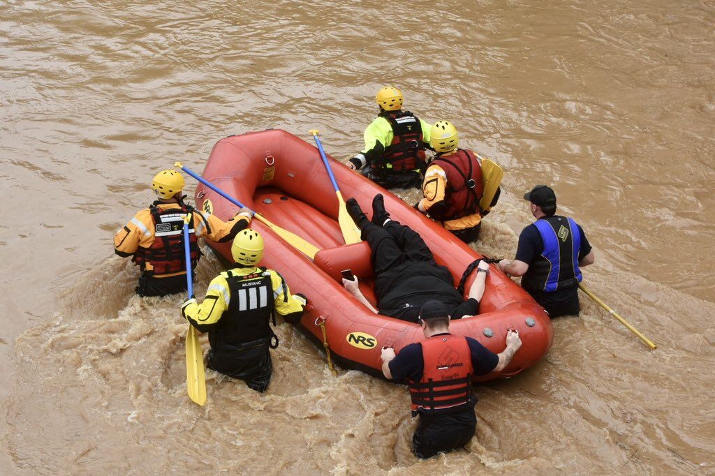
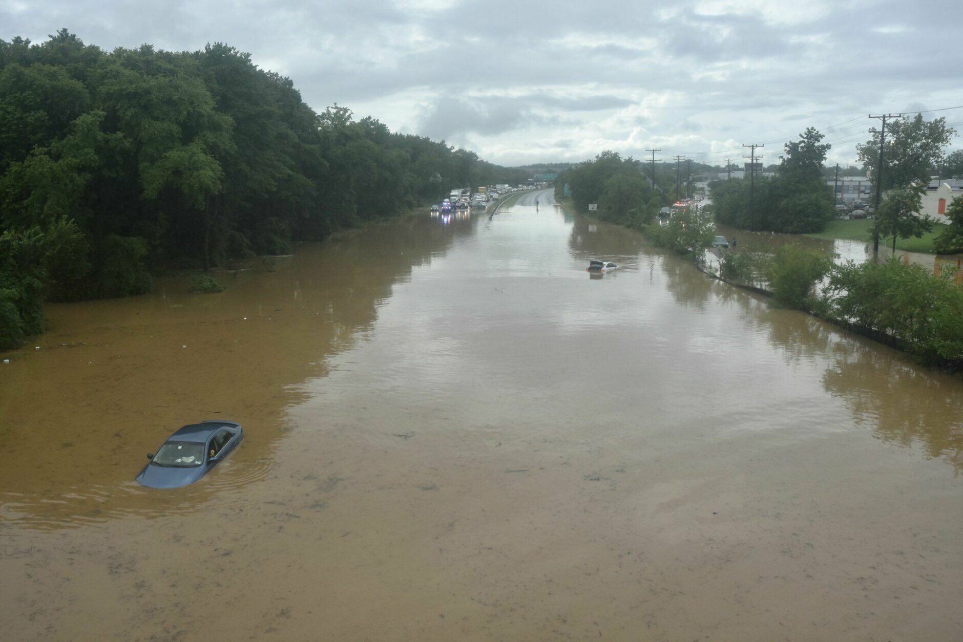
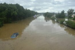
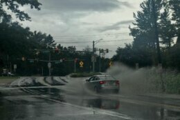
In Prince George’s County, crews rescued at least one stranded driver on Route 50 in Cheverly near the D.C.-Maryland line shortly after 4 p.m. One of the busiest roads in the D.C. area remained completely submerged under feet of water and impassable.
A number of cars appeared to be caught in the water, according to WTOP’s Dave Dildine, who was at the scene.
U.S. Route 50—one of the busiest roads in the D.C. metro area—remains flooded and completely impassable east of Kenilworth Avenue hours after the heaviest rains with water rescues ongoing #dcwx #dctraff pic.twitter.com/ssEAnvKOEL
— Dave Dildine (@DildineWTOP) September 10, 2020
“This is near the main stem of the Anacostia River, an area known for flooding, but I’ve never seen Route 50 this much submerged and with this many vehicles stalled out,” Dildine said.
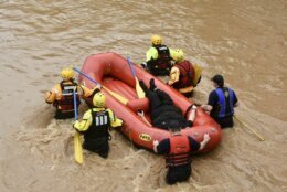
Crews launched an inflatable boat to rescue the driver, who had been using a cup to scoop water from her lap as she waited for rescuers.
Prince George’s County fire rescue boat teams also checked vehicle-to-vehicle by boat looking for anyone who might still be in their vehicles, Dildine reported.
The Prince George’s County Fire and EMS Department said crews were also responding to several cars in the water at Pennsy Drive and Old Landover Road.
Fire and EMS spokeswoman Jennifer Donelan said that in over 4.5 hours, the department got over 250 calls for service, and 134 of those where water-related. The exact number of how many people were rescued from their vehicles is not yet known at this time, but there was only one person that needed to be transported, Donelan said.
She said the department received water rescue resources from a number of neighboring areas, including Alexandria and Fairfax County in Virginia and Anne Arundel County in Maryland.
Severe flooding also caused MARC trains between New Carrollton in Prince George’s County and Union Station in D.C. to hold.
Jack Michaels was a passenger on one of trains from D.C. to New Carrollton, and he said the train was stuck for about two hours before it headed backward to D.C. a little after 5 p.m.
Flooding on the tracks led to delays on several other lines on the MARC. And trains 890 and 874 on the Brunswick Line are canceled Friday morning. Find other service disruptions at the Maryland Transit Administration.
MARC Brunswick Line – Trains 890 and 874 cancelled Friday morning — Due to tonight’s service disruption on the Penn Line, there is no equipment available to operate Trains 890 (5:00am departure from Frederick) and 874 (5:25am dep… https://t.co/vfDNlXGeu7
— MTA Maryland (@mtamaryland) September 11, 2020
Amtrak service to and from D.C. was stopped due to flood water on the tracks, leading to hourslong delays.
Montgomery County: 150 calls in 3 hours
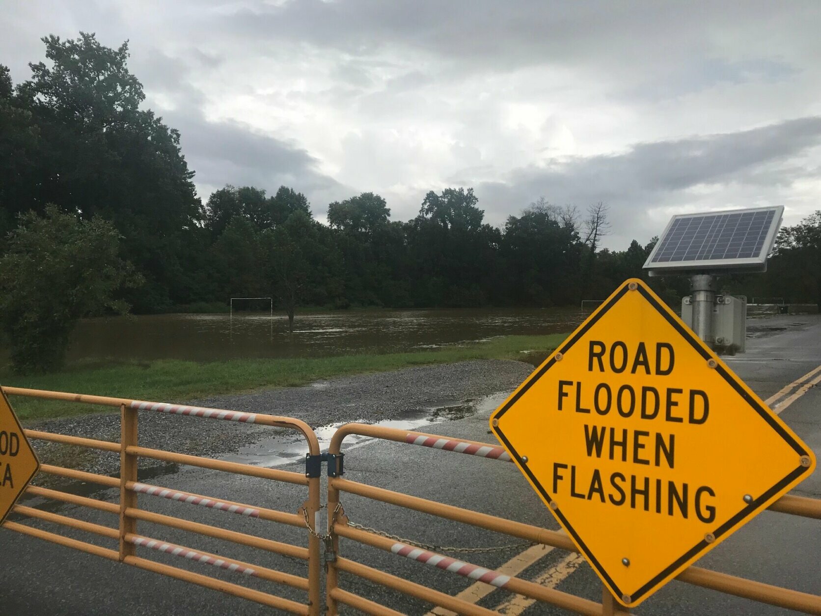
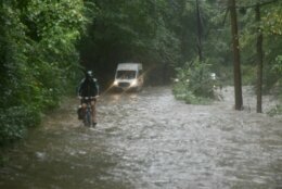
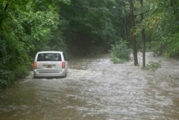
In Montgomery County, in a 3-hour period Thursday afternoon, emergency responders received about 150 calls for cars stuck in high water or water rescues, Fire and Rescue spokesman Pete Piringer said in a video update on Twitter. In a typical 24-hour period, the department normally receives about 300 calls. Crews performed more than two dozen water rescues, Piringer said.
Shortly before 4 p.m., swift water rescue boats checked several underwater vehicles on Beach Drive near Garrett Park Road in Montgomery County. The vehicles were later found to be unoccupied.
In Bethesda, Cedar Lane is blocked and Rock Creek had overflowed its banks.
Since the flash flood warning, which has expired, was issued for Montgomery County earlier Thursday afternoon, “it’s been nonstop since then,” Piringer said.
In the initial round of heavy rain, crews were called to Bethesda, along Bradley Boulevard and Little Falls Parkways and in Aspen Hill. Then the focus shifted to Kensington, Long Beach Drive and Rock Creek.
A video on Twitter showed serious flooding in Aspen Hill, Maryland, at Oriental and Bartlett.
One rescue happened at Dorset Avenue and Little Falls Parkway in Kenwood. Another video showed high water on Wisconsin Avenue in Chevy Chase.
In the District, D.C. Fire and EMS responded to a number of water rescues in Northwest and Northeast. The department tweeted a water rescue just before 2:30 p.m. at Mount Olivet Road Northeast. A video posted shows the area submerged in water.
Update Water Rescue Mount Olivet Rd. NE. #DCsBravest confirm all occupants safely removed. Area remains flooded. pic.twitter.com/QA6VSLjcTJ
— DC Fire and EMS (@dcfireems) September 10, 2020
D.C. rescue crews were also using boats to check submerged vehicles in the 600 block of Rhode Island Avenue NE.
#DCsBravest continue utilizing banana boat to check submerged vehicles in 600 block of Rhode Island Ave NE. Searches negative so far. pic.twitter.com/ecareQfDjR
— DC Fire and EMS (@dcfireems) September 10, 2020
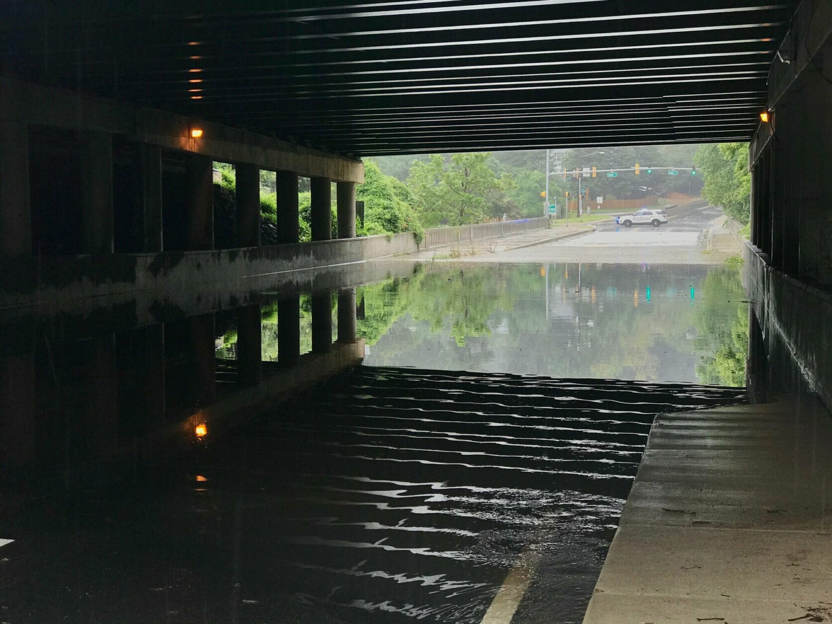
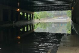
D.C. Fire and EMS spokesman Vito Maggiolo said the department had responded to dozens of flooding-related calls and performed a number of water rescues in the past few hours, including near the Rhode Island Avenue-Brentwood Metro station where an underpass was flooded and a number of cars were submerged.
Emergency crews were checking each of the submerged vehicles to make sure they weren’t occupied, he said.
One person who was inside one of the vehicles escaped and requested medical assistance Maggiolo said
“I want to take this time to urge everybody, please turn around, don’t drown,” Maggiolo told WTOP. “At this point, it’s probably best just to remain at home because of the number of areas that are flooding and northwest and Northeast, and we don’t want anybody to place themselves in any danger.”
He said that the area around Rhode Island Avenue, the area around Kenilworth Avenue, Burroughs Avenue and Eastern Avenue in Northeast were particularly hard hit, but that roads were flooded out around the city.


@wtop AVOID 15th and Constitution! High water pic.twitter.com/z0Stk1gUBr
— Magin Urdanick (@MaginUrdanick) September 10, 2020
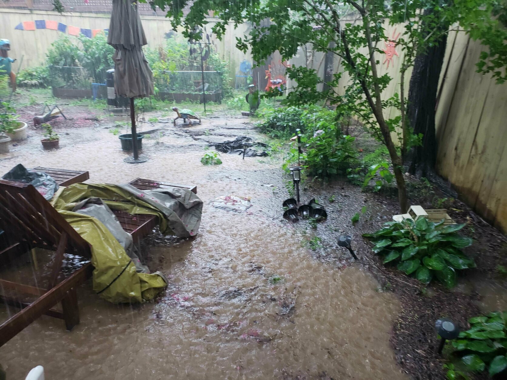
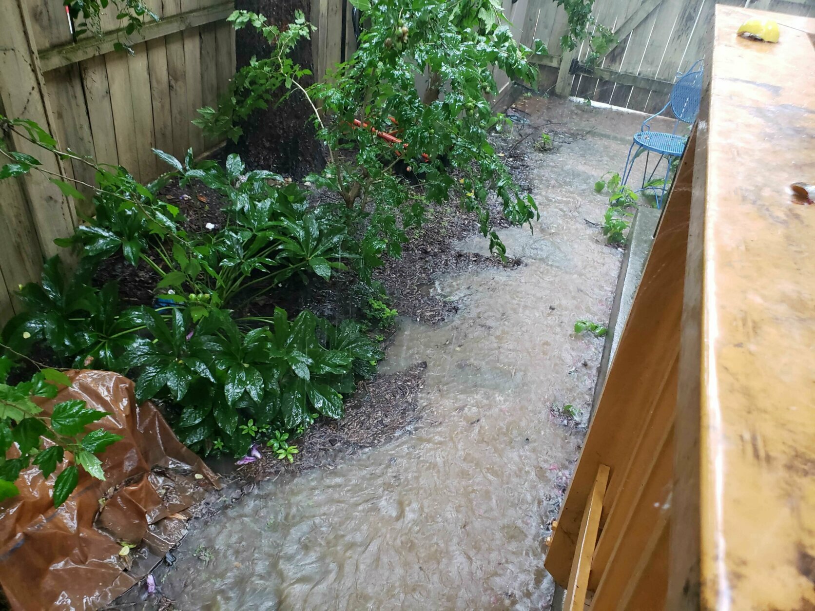
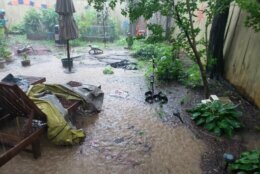
Flooding in the garden with torrential two inches of rain and some thunder in the last hour in Bethesda @capitalweather @WeatherNation @weatherchannel @WTOP pic.twitter.com/VwGf92ZUFF
— wwworks (@wwworks) September 10, 2020

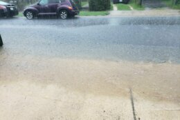
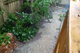
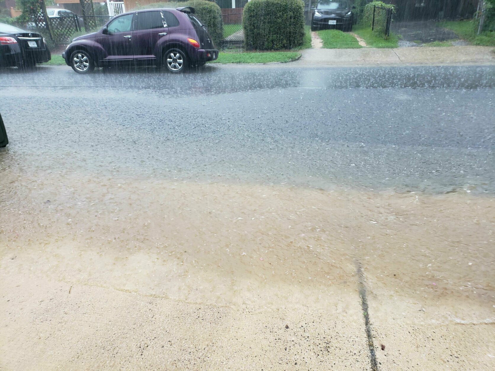
High water reported in the area
Storm Team 4 meteorologist Mike Stinneford said up to 5 inches of rain had already fallen across portions of the D.C. area by early afternoon.
Rock Creek was out of its banks through most of Rock Creek Park. D.C.-area creeks and streams rose rapidly as heavy downpours pelted the area.
There were reports that the Shaw-Howard Metro station in D.C. was experiencing flooding. D.C. Fire confirmed the flooding caused the third rail there to be submerged.
Storm team 4 meteorologist Chuck Bell said the big storm that dropped Denver’s temperature by over 60 degrees between Monday and Tuesday is responsible for the D.C. region’s weather turning so humid.
He cautioned that since the storm moves slowly, the cloudy and rainy pattern will stick around for a while. Cool, dry air from Canada will eventually push a cold front through Monday afternoon, which will bring sunshine and cooler than average weather for most of next week.
Outages
Forecast
- Friday: Less humid than Thursday, but still cloudy. A few lingering showers, especially south of the District. Highs in the upper 70s to low 80s.
- Saturday: Mostly cloudy with a chance of a showers. Highs in the mid-70s to low 80s.
- Sunday: Partly sunny, warmer and more humid than Saturday. A few showers or thunderstorms possible later in the day. Highs in the low 80s.
Radar
WTOP’s Abigail Constantino, Will Vitka, Colleen Kelleher and Zeke Hartner contributed to this report.