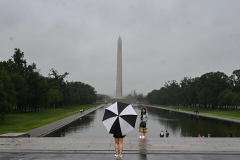
The D.C. region is expected to experience thunderstorms and possible flooding, especially in areas east of Interstate 95, on Saturday afternoon.
The remnants of Hurricane Laura will join with a cold front bringing showers and likely thunderstorms through at least early evening, according to NBC Washington meteorologist Lauryn Ricketts.
“The best chance for stronger thunderstorms will be along I-95 and points east as the moisture moves from the west to the east,” said Ricketts.
It will be mostly cloudy Saturday, “but if we get a few pumps of sun that will only destabilize the atmosphere even more; creating a better chance for some stronger storms,” she added.
- Listen to WTOP online and on the radio at 103.5 FM or 107.7 FM.
- Current traffic conditions
- Weather forecast
- Closings and Delays
- Sign up for WTOP alerts
Any storms that develop may produce heavy rain that could cause isolated flooding, as well as strong winds, said Ricketts.
She cautioned areas closer to Central Virginia, and possibly Southern Maryland, may even see a small tornado.
The National Weather Service said steadier rain and embedded thunderstorms are expected through the D.C. region from the west to southwest “later this morning into this afternoon.”
While we are currently in a lull, steadier rain and embedded thunderstorms are expected to move back into the region from the west-southwest later this morning into this afternoon. Localized strong to severe storms are possible midday and this afternoon, esp. near/east of I-95. pic.twitter.com/gxwCbqgJAH
— NWS Baltimore-Washington (@NWS_BaltWash) August 29, 2020
A round of Friday evening thunderstorms placed much of the D.C. region in danger of flooding until the early morning hours of Saturday.
Forecast:
- Saturday: Morning rain showers. Midday rain with some storms, some strong to severe. Drying out through the evening, humidity falls overnight. Temperatures in the lower to mid 80s.
- Overnight: Mostly clear. Temperatures near 60.
- Sunday: Beautiful, sunny with lower humidity. Temperatures in the low to mid 80s.
- Monday: Humidity returns, cloudy with rain and a few storms. Temperatures in the upper Tuesday: Cloudy with chances of rain, muggy. Temperatures in the lower 80s.


