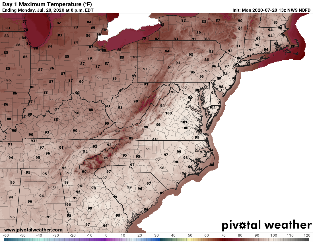
Dangerously high temperatures will remain in the area through at least the middle of the workweek.
The heat is expected to stick around Tuesday, with heat index values projected around 101 degrees. Daytime highs are expected to remain in the 90s for the rest of the week, causing some area health officials to reschedule or cancel COVID-19 testing.
There is a chance for isolated thunderstorms Tuesday, according to Storm Team4 meteorologist Somara Theodore, but there will be greater rain chances Wednesday and Thursday.
- Listen to WTOP online and on the radio at 103.5 FM or 107.7 FM.
- Current traffic conditions
- Weather forecast
- Closings and Delays
- Sign up for WTOP alerts
With humidity factored in, Monday felt as warm as 110 degrees, Storm Team4 meteorologist Lauryn Ricketts said.
D.C. hasn’t recorded a 100-degree day since August 2016, though NBC Washington meteorologist Chuck Bell said Monday’s temperatures — as hot as they’ll feel — should stop rising just short of an all-time record.
Monday’s record high at Reagan National is 106, set back in 1930.
Forecast
Tuesday: Mostly sunny and very hot with the chance for an afternoon isolated storm. Highs in the mid-90s.
Wednesday: More clouds than sun, with the chance of rain and storms later in the day. Highs in the low 90s.
Thursday: Chance of showers and storms with partly-sunny skies. Highs in the low-to-mid 90s.
Current conditions
WTOP’s Matt Small and Jose Umana contributed to this report.