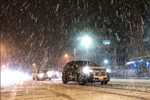

WASHINGTON — With much of the D.C. area coated in snow Tuesday evening, the National Weather Service is also warning of falling overnight temperatures and windy conditions that will likely lead to icy surfaces and make for slippery roadways.
The frosty forecast has also led the Office of Personnel Management to announce a three-hour delayed arrival Wednesday for federal workers, with an option for unscheduled leave or telework.
A number of area school systems will be closed or opened late Wednesday.
Snow has moved east of the area, and Storm Team 4 meteorologist Mike Stinneford said overnight temperatures are expected to fall as the wind picks up. Any standing water or slush will freeze overnight, making for a slippery Wednesday morning commute.
- Listen to WTOP online and on the radio at 103.5 FM or 107.7 FM.
- Current traffic conditions
- Weather forecast
- Closings and delays
- Sign up for WTOP alerts
Snow will exit the region over the next couple of hours. Remain alert for any snow covered roads or icy patches as temperatures fall. pic.twitter.com/oudYZSpDmD
— NWS DC/Baltimore (@NWS_BaltWash) January 29, 2019
As of 6:15 p.m., Stinneford reported a number of snow totals around the area: 3 inches at Dulles International Airport; 3 inches at Leesburg, Virginia; 2.6 inches at Damascus, Maryland; 1.4 inches at Vienna, Virginia; and an inch at Columbia, Maryland.
Related Gallery

A winter weather advisory that was in effect for the WTOP listening area was canceled early Tuesday night.
Cold air will push through midday Wednesday with a chance of some snow showers or flurries, Stinneford said. Thursday is expected to be even colder, with wind chills close to zero. Stinneford said eyes are on the forecast Friday for another chance of light snow.
A powerful, eastward-moving frontal boundary pushed in cold air from the Midwest, parts of which are feeling incomprehensibly frigid temperatures with wind chills down to 60 degrees below zero.
Forecast
Wednesday: Partly sunny, windy and cold. A snow shower/flurry midday.
Highs in the low to mid-30s.Thursday: Sunny, windy and bitterly cold.
Highs in the low to mid 20s; wind chills around zero.Friday: A chance of light snow.
Highs in the mid to upper 20s.Saturday: Partly sunny and warmer.
Highs near 40.
The rest of the week will prove to be quite cold, as the area gets a taste of the severe weather affecting the rest of the U.S.
“The real issue tomorrow is going to be the wind,” Storm Team 4 meteorologist Chuck Bell said.
Though it won’t get quite as bad as the record-breaking cold air pushing through the interior, overnight lows from Tuesday into Wednesday will still fall into the teens, with single digits possible in higher elevations west of D.C.
Freezing daytime highs, strong winds and sporadic snow squalls are all in the forecast through Friday, with the weather service distinctly noting dangerous subzero wind chills and a possibility for isolated power outages from stronger gusts.
Relief from this latest intrusion of cold air won’t come until Monday, when highs will climb back into the low 50s.
Road crews mobilized
The storm’s timing during peak traffic volume prompted several area school districts to close a few hours early. The Office of Personnel Management said federal workers in the D.C. area could leave two hours early Tuesday and request unscheduled leave.
To accommodate the government’s early closing time Tuesday, the Maryland Department of Transportation announced that MARC trains will have additional capacity on the Brunswick, Camden and Penn lines.
Capacity was also added on the Virginia Railway Express’s Fredericksburg Line.
Across D.C., Maryland and Virginia, road crews treated roads in anticipation of the wintry mess. One concern is the storm’s timing. As the area learned back on Jan. 20, 2016, it doesn’t take major accumulation to disrupt regional traffic.
“We’re not going to get 18 inches of snow, but the timing with it coming during rush hour and then the rapid drop into freezing temperatures is definitely a recipe for problems,” said Ellen Kamilakis of the Virginia Department of Transportation.
Even though rain can wash away salt and other treatments, VDOT wasn’t taking any chances. The early closings for both students and government employees, she said, can be great because with fewer cars on the road, “salt can spread a lot wider.”
If you have to be out, she said, assume that anything wet is going to be icy, especially once the sun goes down.
And, if you can, opt to drive behind the snow plow instead of in front of it, said Charlie Gischlar, a spokesman for the Maryland Department of Transportation’s State Highway Administration.
Also, go slow: “Ice is nothing to play around with,” he said.
WTOP’s Dan Friedell contributed to this report.


