FAIRFAX, Va. — The ride home on Wednesday, Jan. 20, 2016 was one some people will never forget.
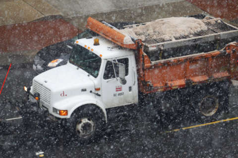
Light snow, combined with cold temperatures turned into icy conditions for the thousands of drivers trapped in the gridlock, known as “Commutergeddon.” Some drivers didn’t get home until early Thursday.
And local weather and traffic officials want to make sure it never happens again.
“You’re talking about a very small amount of snow, but it’s coming at rush hour and road temperatures are very cold,” said Chris Strong, warning coordination meteorologist, for the National Weather Service.
While the weather conditions alone might be a bit tricky, what compounded the situation was the human behavior.
“You end up having people in a full rush hour, expecting to do what they want, because we’re only talking about a half-inch of snow,” said Strong.
So, drivers assumed they could stay at work, and head for home at a normal time.
“What happens is the car tires melt the small amount of snow, the road temperatures are so cold it immediately refreezes, and it turns everything into an ice rink,” he said. “There’s accidents, trucks go off the roads and it turns into gridlock rather quickly.”
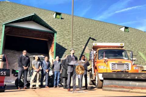
After Commutergeddon, the weather service worked with the Virginia Department of Transportation and other traffic agencies to develop warnings that can be shared up to full day ahead that signal conditions could be ripe for a commuter nightmare.
“Most of the time when we give information out to the public it’s for something we expect,” said Strong. “This is a little different because it’s not something we necessarily expect is going to happen, but it’s possible.”
Having the information early can help VDOT make sure its trucks are staged to be ready to treat roads, said Lauren Mollerup, the agency’s maintenance engineer for northern Virginia.
“That communication is really helpful,” she said. “We do a lot of ‘skeleton mobilizations,’ where if we think rush hour is going to be affected, we’ll have staff stay over night and work that.”
In addition, the National Weather Service is taking a more proactive notification stance with snow squalls.
“It affects a targeted area, it’s a small band in an otherwise cloudy day, where temperatures are cold,” said Strong, who said the conditions often happen mountain areas, including Loudoun County.
“Since you can’t forecast exactly where that squall’s going to be, and have the trucks pre-deployed at mile marker 143, we’re watching for these 24/7,” Strong said. “When we see one starting to come together on radar, we can call the Departments of Transportation and this could turn into a multicar pileup very quickly.”