Meteorologist’s view: Flood warnings for bigger rivers in DC area

As of Sunday afternoon, most of the WTOP listening area received over an inch of rainfall, but almost half of us have received 2”-4”, especially in the mountains, which drain into the Shenandoah and the Potomac rivers. Parts of Stafford County picked up almost twice that, based on Doppler radar estimates. (Data: National Weather Service, Graphics: WTOP)
Even though every flood is different, history of past flood provides a reasonable expectation of impact when rivers are forecast to crest at certain levels. The projection is called a hydrograph. Here is the latest for the Potomac River near Edwards Ferry. (Courtesy Matt Ritter)
The forecast hydrograph for Georgetown has a forecast crest just under 8 feet occurring Tuesday late morning. According to past flooding, at 8 feet, backwater flooding of Rock Creek in Georgetown begins at this level. (Courtesy Matt Ritter)
(1/3)
Even though every flood is different, history of past flood provides a reasonable expectation of impact when rivers are forecast to crest at certain levels. The projection is called a hydrograph. Here is the latest for the Potomac River near Edwards Ferry. (Courtesy Matt Ritter)
The forecast hydrograph for Georgetown has a forecast crest just under 8 feet occurring Tuesday late morning. According to past flooding, at 8 feet, backwater flooding of Rock Creek in Georgetown begins at this level. (Courtesy Matt Ritter)
As of Sunday afternoon, most of the WTOP listening area has received over an inch of rainfall, but almost half of us have received 2 to 4 inches, especially in the mountains, which drain into the Shenandoah and the Potomac rivers. Parts of Stafford County picked up almost twice that, based on Doppler radar estimates. (Courtesy Matt Ritter)

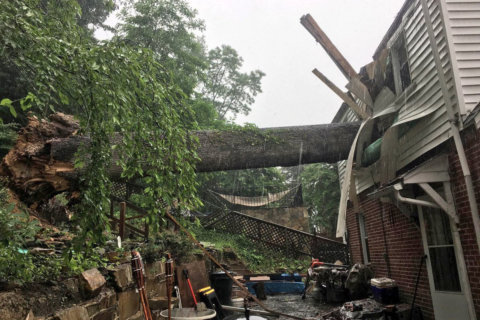
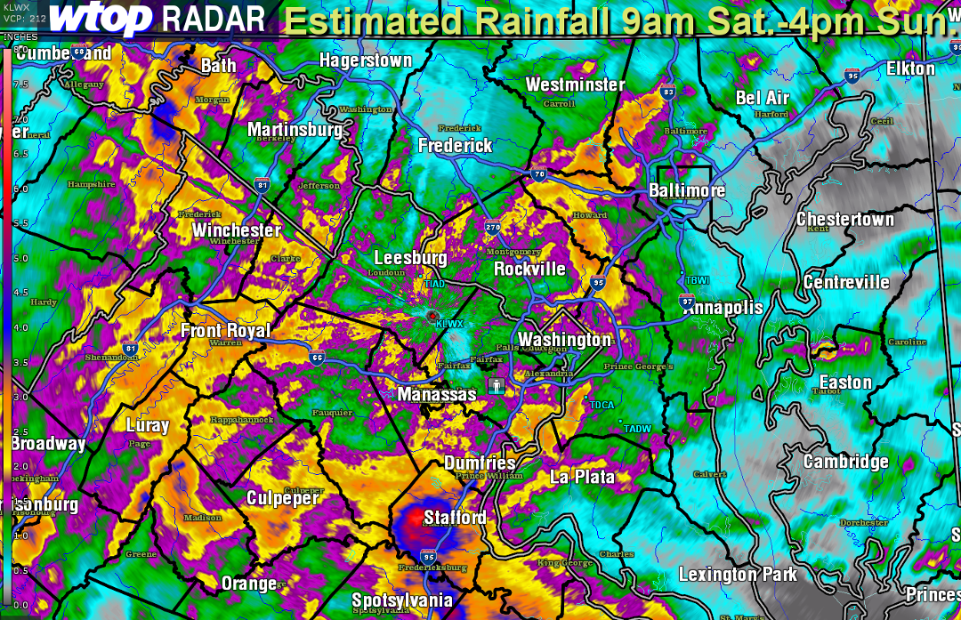
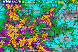
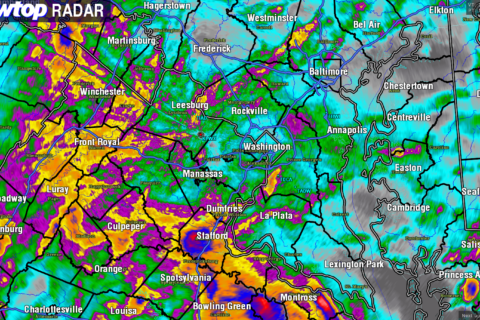
WASHINGTON — After almost constant rain over the weekend, flooding of the bigger rivers in the D.C. area has become more likely Sunday afternoon, as the waters from streams, creeks, and runoff from roadway fills the rivers.

River flood warnings had already been posted for the Rappahannock River in Remington as of Sunday afternoon, in effect until Monday.

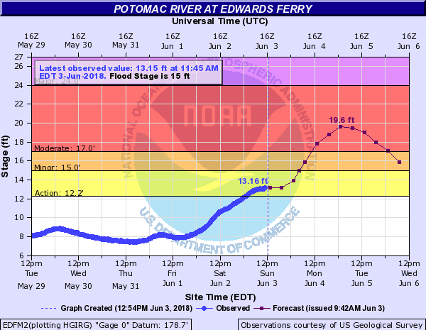
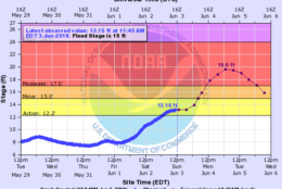
The Potomac River at Harpers Ferry, Shepherdstown, Point of Rocks and Edwards Ferry has river flood warnings in effect until Tuesday or until further notice.

The Shenandoah River also has locations under effect until Tuesday evening.

A river flood watch was in effect for the rest of the length of the freshwater Potomac until further notice.

Most computer models from the Middle Atlantic River Forecast Center in State College, Pennsylvania, have the rivers going above flood stages Sunday evening or overnight, cresting at minor to moderate flood stages late Monday or early Tuesday.

Some of the freshwater Potomac locations may not drop below flood stage until Wednesday.

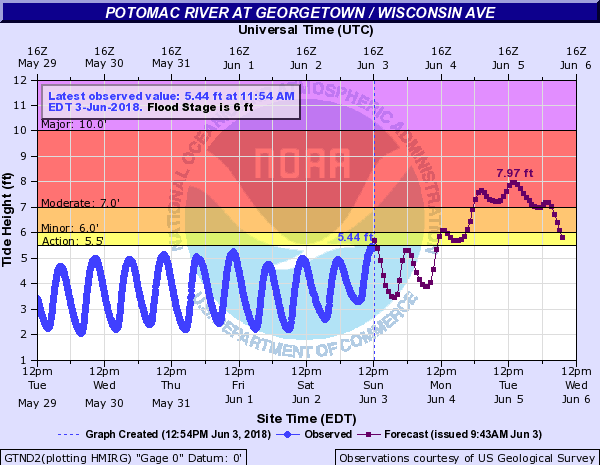
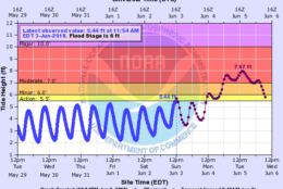
As is often the case, at Georgetown and points south, flooding levels will be affected by tides.

Federal News Network Logo
Log in to your WTOP account for notifications and alerts customized for you.

Sign up