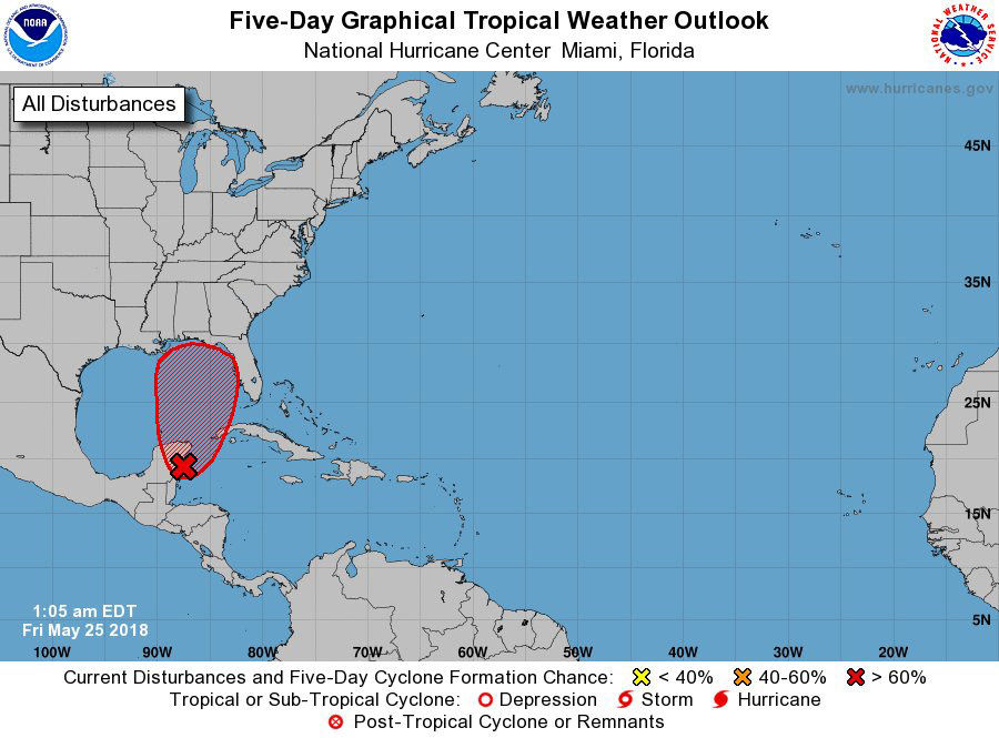
I think I can see summer from here. Way above average temperatures for the #MemorialDay weekend. Meteorological summer, and Hurricane season, start June 1st - which is next Friday - and there may well be Tropical Storm Alberto in the Gulf by Sat. PM. pic.twitter.com/A9EKdcLuNz
— Chuck Bell (@ChuckBell4) May 25, 2018
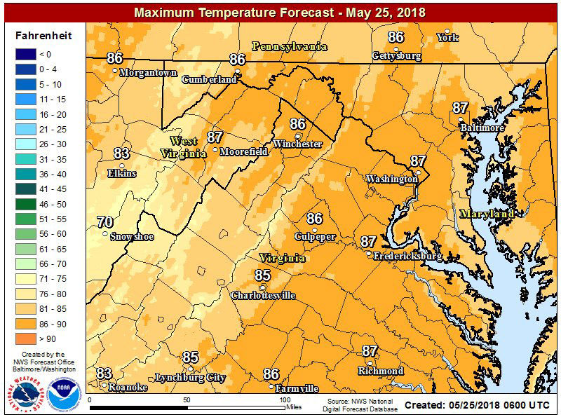
#TGIF @DMVFollowers as the #Memorial Day weekend gets started. Clear skies and low humidity today but the heat and humidity of summer are on the way for the weekend. I'll update those weekend rain chances on @nbcwashington. Today's high: 88. pic.twitter.com/z17aYIcfGM
— Chuck Bell (@ChuckBell4) May 25, 2018
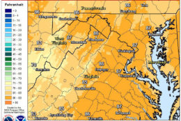


WASHINGTON — Memorial Day weekend, aka the unofficial start of summer, heralds heat, humidity and a chance of some rain. But don’t expect anything too disruptive.
Quick Links:
“Southwest winds will bring much higher humidity into the region tonight, and rain chances return Saturday,” said Storm Team4 Meteorologist Chuck Bell.
While rain is in the forecast for the rest of the weekend, the good news is the weather won’t be anywhere near as wet as last weekend.
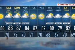
“Sunday has the highest rain chance of the holiday weekend,” Bell said. “Rain chances peak from 2 to 7 p.m. Sunday at 70 percent with high temperatures in the mid-80s.”
Bell said a weak weather front will stall out close to the D.C. area by Monday, which will help keep temperatures and rain chances down a bit.
Highs on Monday are expected to be in the low 80s, and there will be a small chance of a shower or two.
The weather might be a bit riskier for people with plans to travel to the Gulf Coast for the weekend.
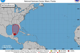
Even though hurricane season doesn’t officially start until June 1, the National Hurricane Center is watching a tropical wave near Cancun, Mexico, that could wind up becoming Tropical Storm “Alberto” over the weekend.
The storm was expected to enter the Gulf of Mexico on Saturday, and by Sunday it could be upgraded to a tropical storm. On Monday, the storm could make landfall somewhere between New Orleans and Pensacola, Florida.
You can track the storm on the National Hurricane Center’s website.
Depending on what track the storm takes, it could have an impact on the weather in the D.C. area by the second half of next week in the form of soaking rains and potential flooding, Bell said.
Beach Forecast
Rain is in the forecast for most of the beaches close to the D.C. area as well.
You can check the current beach weather and traffic conditions on WTOP’s weather page.
Western Shore
On Sunday, highs will be in the low 80s with a higher chance of rain. On Monday, morning storms are possible, with highs near 80 degrees.
Ocean City
Thunderstorms are in the forecast for Sunday and Monday, with expected highs near 80 degrees.
Virginia Beach
Sunday will be partly cloudy, with a stray thunderstorm and a high of 87 degrees. Monday will be cloudy and rainy with a high of 83 degrees.
Rehoboth Beach, Delaware
Thunderstorms are expected to continue on Sunday and Monday with highs near 80 degrees.
Bethany Beach, Delaware
Thunderstorms are expected on Sunday and Monday. The expected high on Sunday will be 85 and 79 degrees, and 75 degrees on Monday.
Duck, North Carolina
On Sunday, the high is also expected to reach 84 degrees with more clouds than sun. Monday will see temperatures dip a bit below 80 with periods of rain.
Weekend Forecast
Sunday: Mostly cloudy with thunderstorms possible, but not a complete washout. High is expected to be around 87 degrees.
Monday: Mostly cloudy, a bit cooler with scattered showers possible. The rain is most likely to fall south of D.C. Highs are expected to be in the low to mid-80s.
Traffic
Regardless of weather, there will be several parades and road closures that will impact travel on the holiday weekend.
For the most updated traffic report, visit WTOP’s traffic center. You can see a map of the latest traffic conditions below.
Radar
WTOP’s Jack Pointer contributed to this report.