Workweek weather: Week starts with storms; summer officially arrives

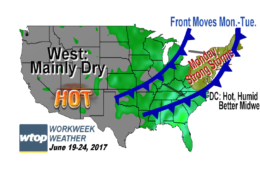
WASHINGTON — Although it has certainly felt like it’s already here, summer officially arrives this week. The solstice will be at 12:24 a.m. EDT Wednesday. It will be a rather pleasant day, but we have to get rid of the current weather situation first. We will do so, but we’ll have to pay the price in the form of some strong thunderstorms Monday afternoon and evening. It will be a Storm Team 4 Weather Alert Day for the severe weather potential.

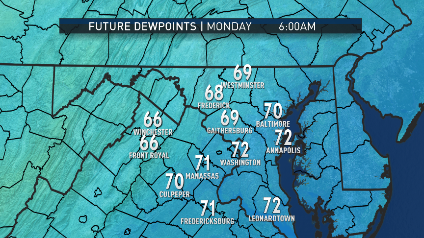
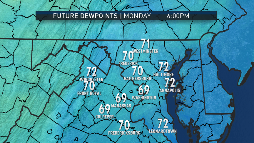
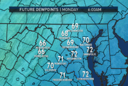
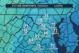
Monday starts off already very warm, very humid and muggy. Dew point temperatures will generally be in the low 70s, which is pretty high for our part of the country, so it will feel pretty uncomfortable. Air temperatures will also have already been in the upper 70s, so a little bit of sunshine in the morning will make temperatures rise very quickly. The atmosphere will be quite unstable and “energized” as a strong cold front heads through during the afternoon. It looks like a line of storms will accompany the front, as opposed to scattered activity. A flash flood watch is in effect for parts of D.C., Maryland and Virginia from 3 p.m. through the evening. See which areas are under watch on WTOP’s Weather page.
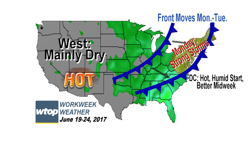
Although it has certainly felt like it’s already here, summer officially arrives this week. The solstice will be at 12:24 a.m. EDT Wednesday. It will be a rather pleasant day, but we have to get rid of the current weather situation first. (WTOP/Storm Team 4)
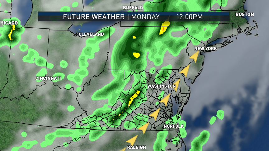
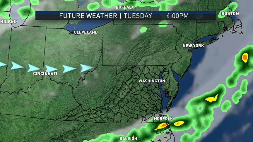
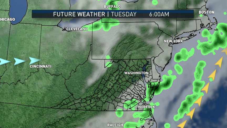
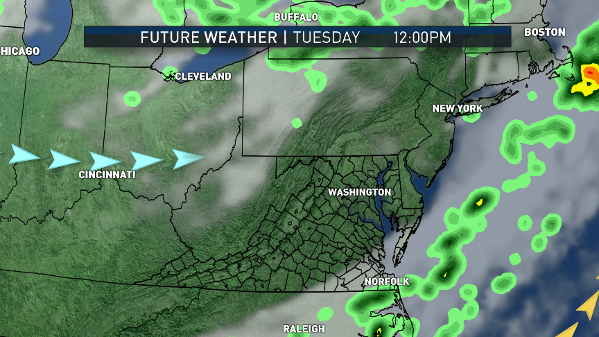
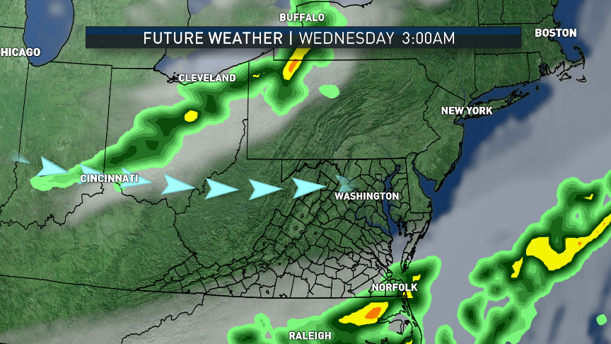
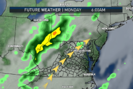
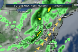
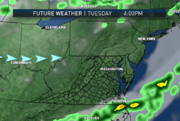
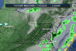
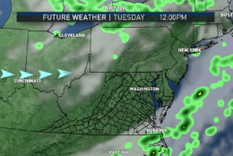
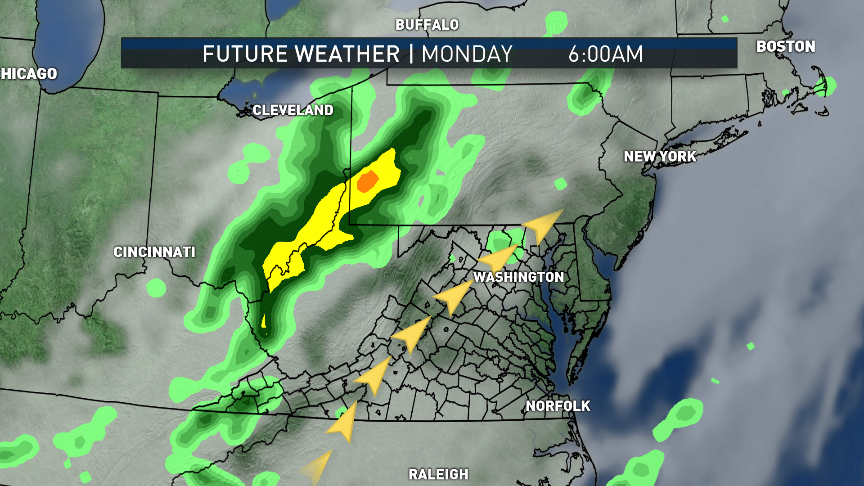
This series shows the simulation of the future radar and satellite as the cold front touches off the thunderstorms Monday afternoon in the RPM computer model. Most of what we’ll have to worry about will occur in the early afternoon to early evening hours. The primary threat will be heavy rainfall, indicated by all the yellow and orange colors. Behind the storms, westerly winds will eventually start lowering the humidity Monday night through Tuesday night.  (Data: The Weather Company. Graphics: Storm Team 4)
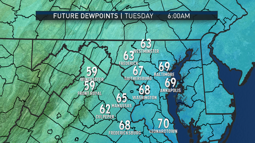
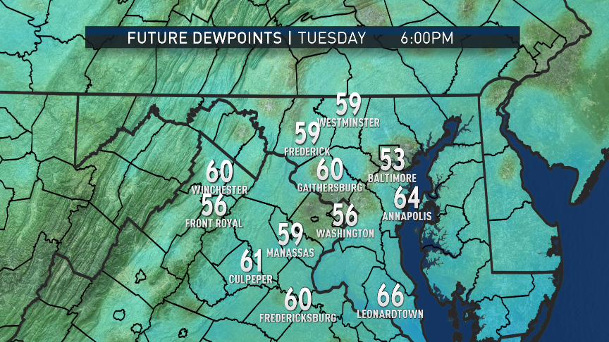
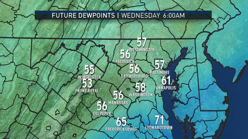
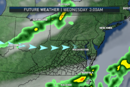
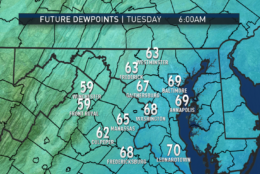
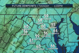
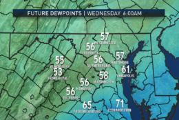
As mentioned, we will be losing the tropical-like humidity that we had over the weekend and will still have first thing Monday morning. By Tuesday afternoon into Wednesday morning, it will especially be noticeable. (Data: The Weather Company. Graphics: Storm Team 4)
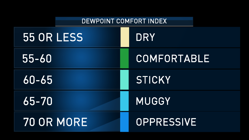
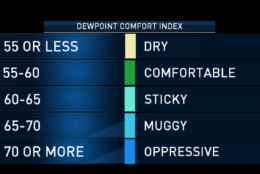
This is the Dew Point Comfort Index as a reminder to the relevance of the dew points in the warmer months.  (Data: The Weather Company. Graphics: Storm Team 4)
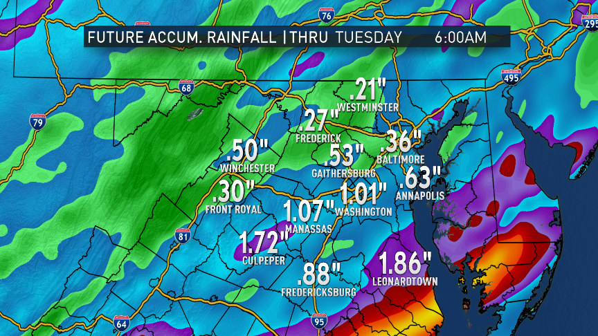
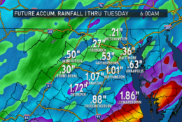
And lastly, the RPM computer is producing some big rainfall amounts for this frontal passage. Keep in mind a lot of these amounts will accumulate in a short period of time, so some of the rain will be heavy at times. The front will likely linger in central Virginia and southern Maryland Monday night, so amounts are heavier there.  (Data: The Weather Company. Graphics: Storm Team 4)
(1/15)

Confidence is high that we’ll all see thunderstorms; it’s just a matter of how strong they get. The primary threat will be very heavy rainfall, but damaging winds and large hail can’t be ruled out. The most likely areas to see the strongest storms will be where the front coincides with maximum daytime heating: mainly east of US-15 and north of Interstate 66, up through northern and eastern Maryland and farther north into New England. The timeline, or “window of opportunity” for the storms, will generally be 2-8 p.m., as of the publication time of this blog.

By midnight, most — if not all the storms — will have passed east toward the coast. Winds will start shifting to more of a westerly direction, cutting off the very humid wind flow that started this past weekend. The improvement will be modest at first with dew points dropping into the upper 60s by Tuesday morning. But by Wednesday morning, that drop off will continue to upper 50s and low 60s, making it much more comfortable. Daytime highs on Tuesday and Wednesday will both be much closer to average, also. The weather looks fantastic for the U2 concert at FedEx Field Tuesday evening. (One might say it will be a beautiful day.)

On Wednesday, a weak ridge of high pressure will pass through, keeping it dry and mostly clear. But southwesterly winds will send a warm front our way Wednesday night and Thursday when the high moves away, and that will start sending the heat and humidity back for the rest of the week, along with chances for scattered thunderstorms.

Even though the drought is officially over, June has not seen a lot of rainfall. At Reagan National Airport, we are almost at 2 inches of rainfall below average for the month of June and a little over 3 inches below for the year. So while flash flooding on Monday would not be welcome nor is any other storm damage, the topsoil, gardens and lawns could use the watering.

Daily weather highlights

MONDAY

  • Hazy and partly sunny in the morning
  • Hot and humid
  • Clouds building by lunchtime, thunderstorms near I-81 corridor
  • Strong storms moving across the area west to east during the afternoon through early evening
  • Gusty winds and heavy downpours
  • Evening commute impacted, much slower than usual

TUESDAY

  • Mix of sun and clouds
  • Not as hot, less humid and more comfortable
  • A bit breezy

WEDNESDAY

  • Mostly to partly sunny
  • Seasonable and pleasant

THURSDAY

  • Mostly sunny
  • Hotter and more humid again
  • Only a risk of an isolated late-day thunderstorm
  • Likely over the 90-degree mark

FRIDAY

  • Increasing clouds
  • Very warm and very humid
  • Scattered thunderstorms in the afternoon and evening

Editor’s Note: The WTOP Workweek Weather Blog is intended as an in-depth yet plain language summary of the business week’s weather potential in the D.C. area along with an explanation of the contingencies and uncertainties that exist at the time of publication. For the latest actual Storm Team 4 forecast, check out the main WTOP Weather Page.

Federal News Network Logo
Log in to your WTOP account for notifications and alerts customized for you.

Sign up