WASHINGTON — A nor’easter is expected to sock the Northeast Monday and Tuesday, bringing with it snow and high winds.
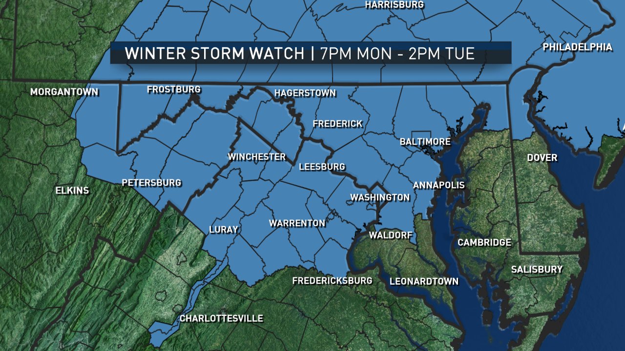
A Winter Storm Warning is in effect from 7 p.m. Monday to 2 p.m. Tuesday for:
- Alexandria, Virginia
- Arlington County, Virginia
- Baltimore County, Maryland
- D.C.
- Fairfax County, Virginia
- Howard County, Maryland
- Montgomery County, Maryland
- Prince William County, Virginia
According to the National Weather Service, the storm could dump as much as 12 inches of snow, making roads impassable and spurring power outages and downed trees.
The rest of the region is under a Winter Storm Watch Monday night into Tuesday afternoon.
According to the NWS, colder than normal weather is expected across much of the nation. Michael Schichtel of the National Weather Service’s Weather Prediction Center says the storm could pack a wallop, with some parts of the region getting a foot or more of snow.
“It’s cold enough for, well certainly, some very significant snows — upwards of half a foot or more through the metropolitan Washington, D.C.-Baltimore area,” Schichtel said. “As you get up towards the northeast, for New York City and Boston, certainly the interior sections could get quite a wallop out of this.”
NBC Storm Team 4 Steve Prinzivalli said a developing late-winter storm is poised to slam the area with heavy snow and a wintry mix Monday night.
School closures are likely Tuesday and possibly into Wednesday. Many roads will be impacted Tuesday and flight delays and cancellations are possible.
Forecasters say 8 to 12 inches are expected in portions of Maryland’s Frederick and Montgomery counties, and portions of Northern Virginia, including Loudoun, Rappahannock, and Fauquier counties.
Six to 10 inches of snow is expected in D.C., parts of Northern Virginia, Baltimore and Montgomery County, Maryland. A wintry mix is possible at times, which could cut down on the snow totals.
Prinzivalli said that two disturbances — one diving down from the Midwest and a second one carrying moisture from the Gulf of Mexico — are expected to merge near the mid-Atlantic coast Monday night, creating a powerful nor’easter.
The snow is expected to hold off for the Monday evening commute, but motorists should plan on staying off the roads overnight into Tuesday, according to Storm Team 4’s Amelia Draper.
The most snow is expected to fall overnight through at least 8 a.m. Tuesday. The bulk of the accumulation is expected west of Interstate 95.
Due to blowing and drifting snow, the snow is expected to be heavy and visibility is expected to be poor on Tuesday morning. Driving will be difficult in the blustery conditions, Prinzivalli said.
The snow and wintry mix is expected to diminish Tuesday afternoon — replaced by gusty winds and frigid wind chills, Prinzivalli said.
Temperatures in the D.C. region had already taken a dramatic plunge over the weekend, going from the spring-like 70 degree warmth to unseasonably cold 30s and 40s.
Temperatures on Sunday were expected to reach 40 — about 15 degrees below average.
One of the worst March storms in modern memory occurred in 1993, when a super storm dumped more than a foot of snow in parts of the region and winds gusted over 40 mph.