WASHINGTON — How cold did it get Tuesday night and Wednesday morning?
Storm Team 4 Meteorologist Matt Ritter said the coldest point in the area was Harpers Ferry, West Virginia, which got down to 27 degrees.
You didn’t have to go out that far to get below freezing. Temperatures reached 30 in Gaithersburg and Frederick, Maryland, and at the Manassas, Virginia, airport, Ritter said. All the lows were recorded between 7 a.m. and 8 a.m. Wednesday, Ritter said.
The “urban heat effect,” Ritter said, kept the District and the immediate area a bit warmer. The low at Reagan National Airport was 41, and Ritter says the Potomac River and the Chesapeake Bay are “still quite warm,” thus keeping temperatures up a bit.
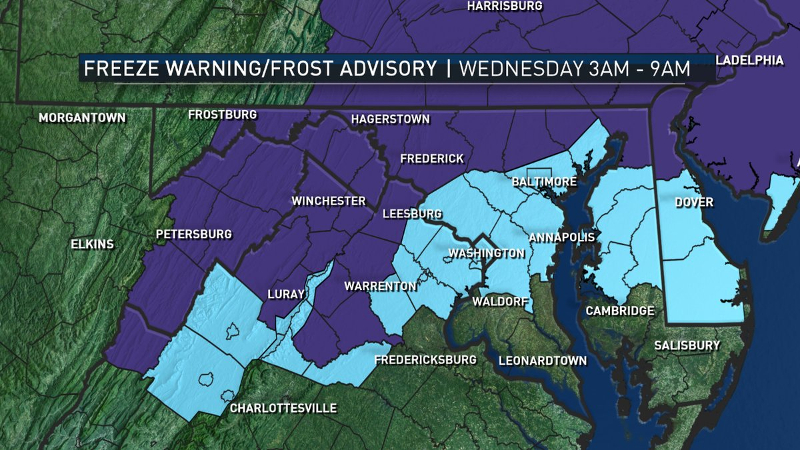
Freeze warnings were in effect in the northernmost and westernmost parts of the WTOP listening area, while less-severe frost advisories were in effect around D.C. Freeze warnings only apply to the first killing frost of every fall, which ends the growing season, Ritter explained. So there won’t be any more freeze warnings for the areas that had them on Tuesday night, while D.C. and its immediate environs are still in line for them.
That killing-frost dividing line also means that the warming phenomenon that has been known as Indian summer could happen in the outlying areas, Ritter said — the weather pattern refers only to a warm spell after the first frost. So last week’s 80-plus degree readings in and around D.C. don’t apply.