WASHINGTON — While Tropical Storm Harvey continues to bring catastrophic, life-threatening flooding to Texas in the days ahead, we may have a named tropical low pressure system moving up the eastern seaboard from now through the middle of the week.
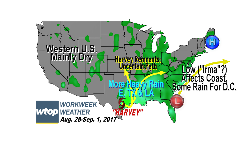
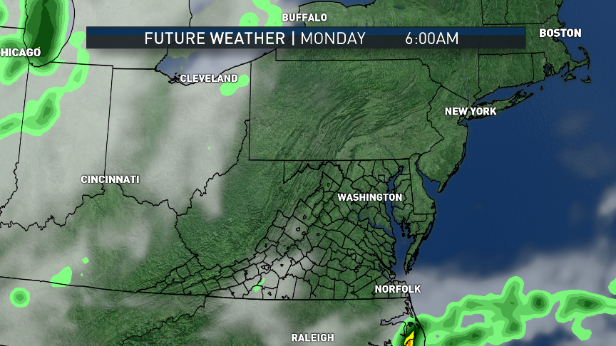
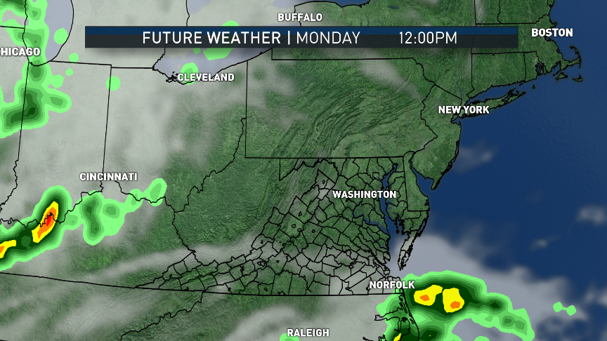
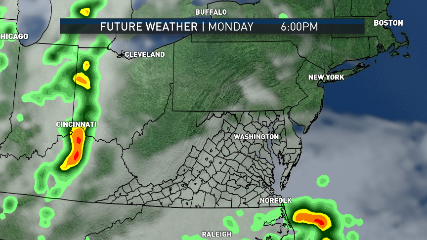

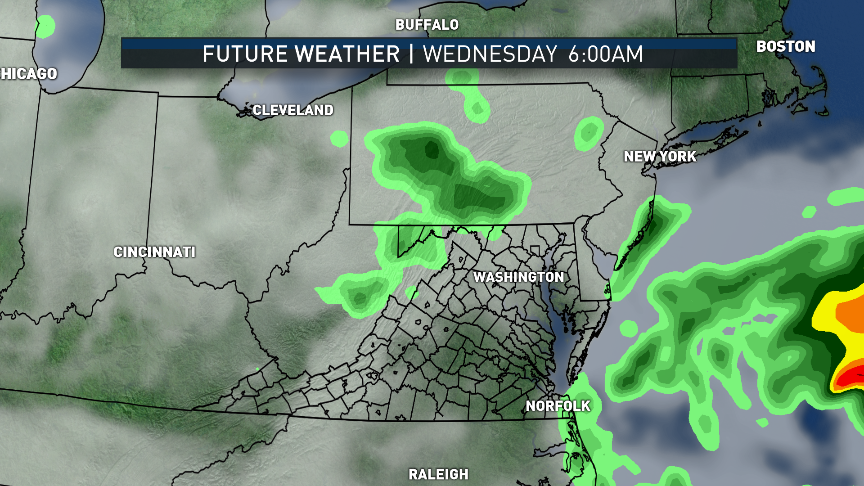
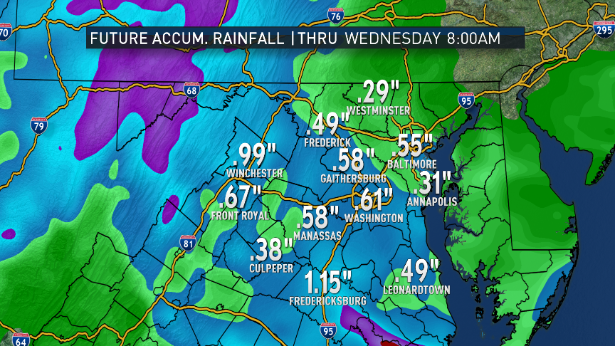
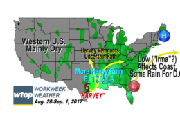

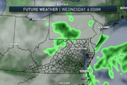
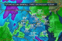
The name would be Irma. The storm is forming off the coasts of northern Florida and the Carolinas along an old stalled-out frontal boundary in a climatologically favored area for this to occur. Most models develop the storm and send it close enough to us that the D.C. area will get some light to moderate rainfall from it, but mostly east of the mountains.
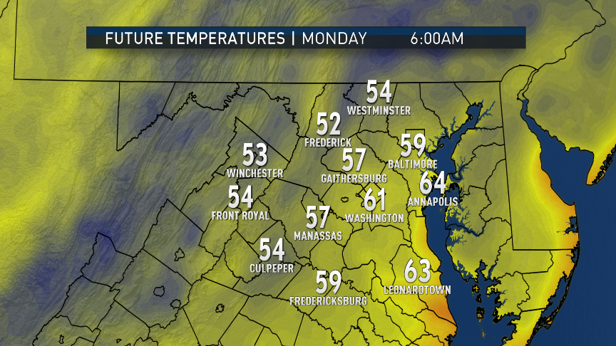
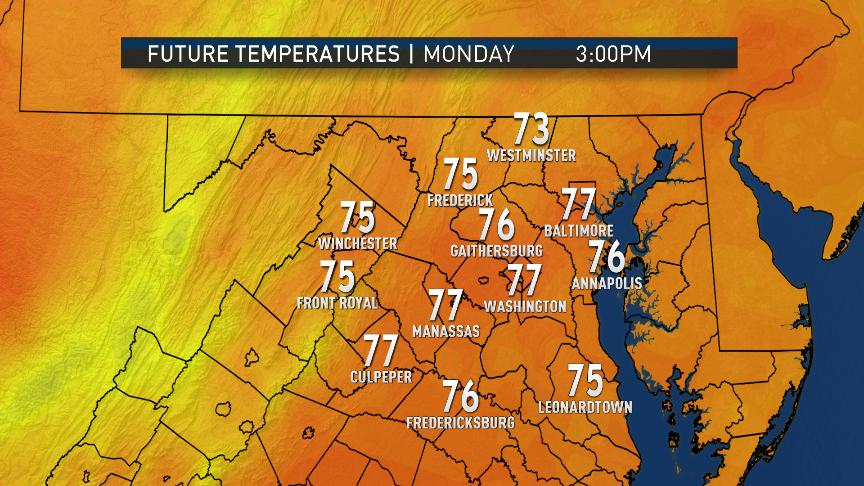
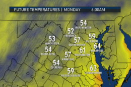
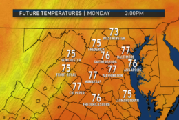
Easterly winds set up between the low and the high pressure system over New England that has been providing us with comfortable weather for days will keep clouds around and temperatures down, remaining well below average until the middle of the week. Along with this increased rain chance will be an increase in the humidity, with dew points climbing out of the 50s into the 60s starting Monday, making it feel a bit more uncomfortable. However, tropical storm conditions would be confined to coastal areas, especially Hampton Roads and the Outer Banks.
The rain will end Wednesday morning at the latest, followed by partial clearing of the skies courtesy of a switch to a more westerly wind direction. That will also result in some higher temperatures, back up to more seasonable levels for the first time in a while, and making those higher dew points much more noticeable. So the middle of the week will be a bit more like August. Then a cold front will slide through on Thursday followed by a return to much less humid air and cooler than average temperatures.
There is a lot of disagreement in the longer range computer models about what to do with the ultimate remnants of Harvey, whether dissipating it over Arkansas or taking it into the Tennessee Valley. Either way, rain from the storm will not affect us this week.
Daily weather highlights
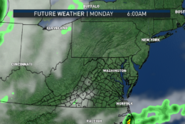
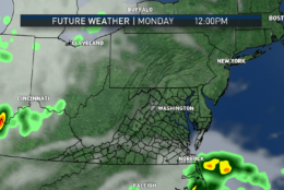
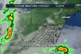
Monday
- Just a few clouds to start, cool and comfortable, also
- Clouding over from south to north during the day
- Temperatures still below average
- Breeze picks up toward evening
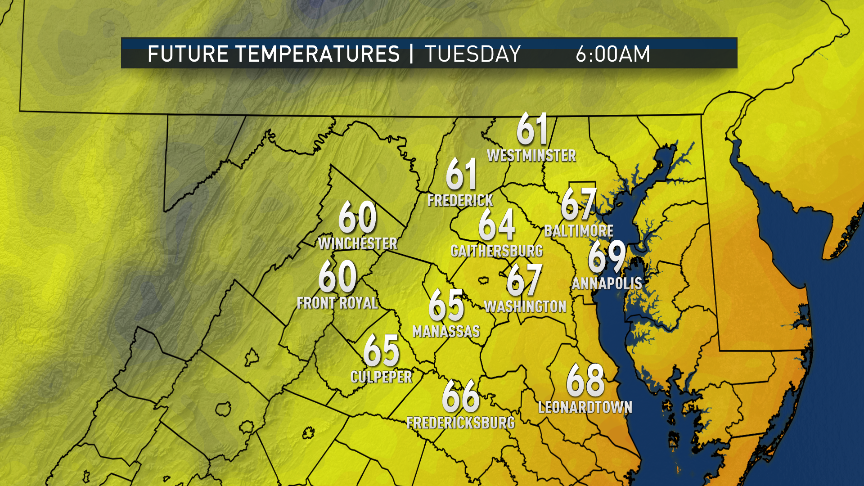
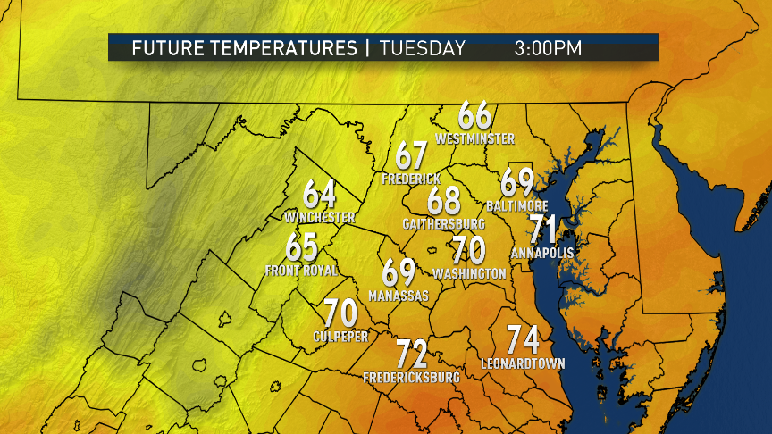
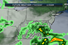
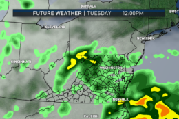
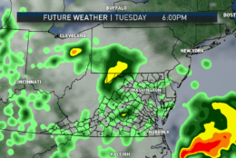
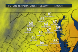
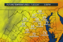
Tuesday
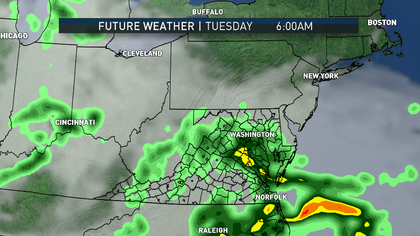
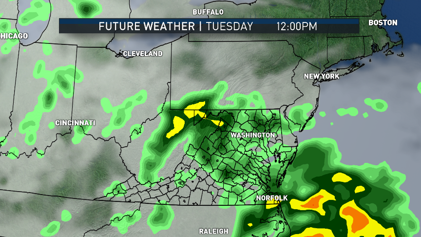
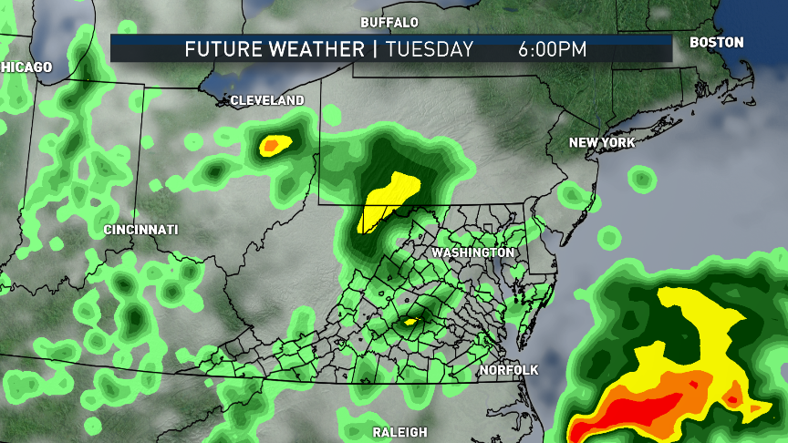
- Cloudy, damp and cool
- Coolest day of the week, not getting much milder than morning lows
- Rain and drizzle, especially east of the mountains
- Rain may be moderate from central Virginia through southern Maryland, and some thunder will be possible
- Breezy and gusty
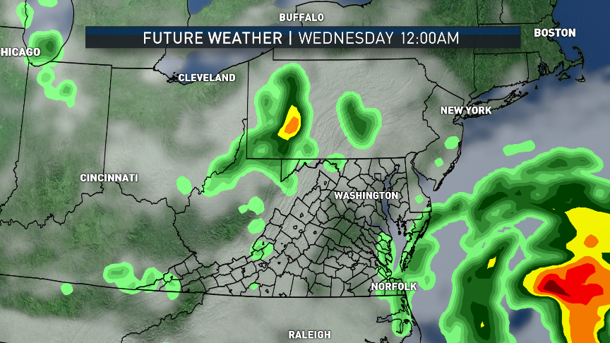
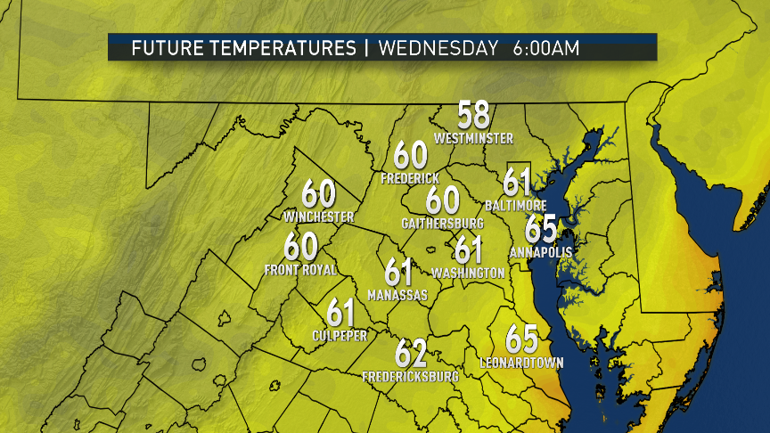
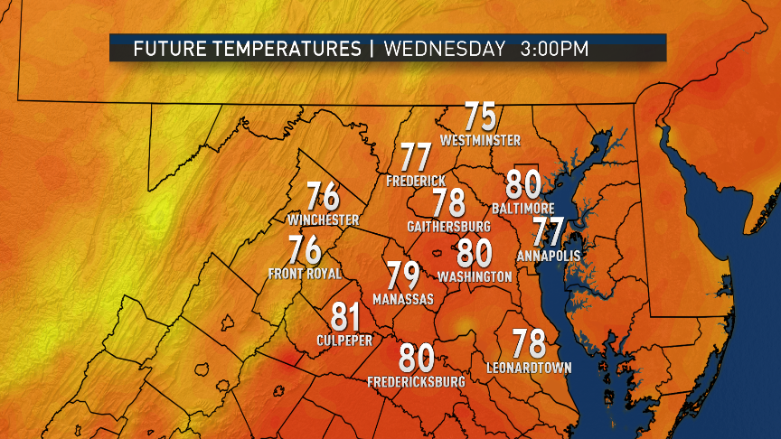
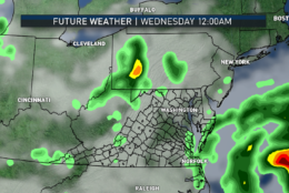
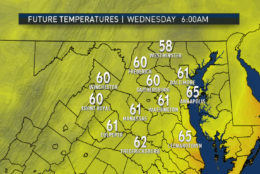
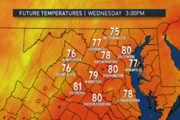
Wednesday
- Any lingering rain ending in the morning
- Breezy and turning warmer with gradually clearing skies
- Warm and sticky during the afternoon
Thursday
- Increasing clouds
- Warm and muggy
- Chance of a few showers or thunderstorms later in the day
Friday
- Back to autumn-like conditions
- Breezy with much lower humidity
- Sun goes in and out of fair weather clouds
Editor’s Note: The WTOP Workweek Weather Blog is intended as an in-depth yet plain language summary of the business week’s weather potential in the D.C. area along with an explanation of the contingencies and uncertainties that exist at the time of publication. For the latest actual Storm Team 4 forecast, check out the main WTOP Weather Page.