WASHINGTON — The new workweek will start with high pressure moving away — the same system that brought the perfect weather on Sunday — and with increasing clouds.
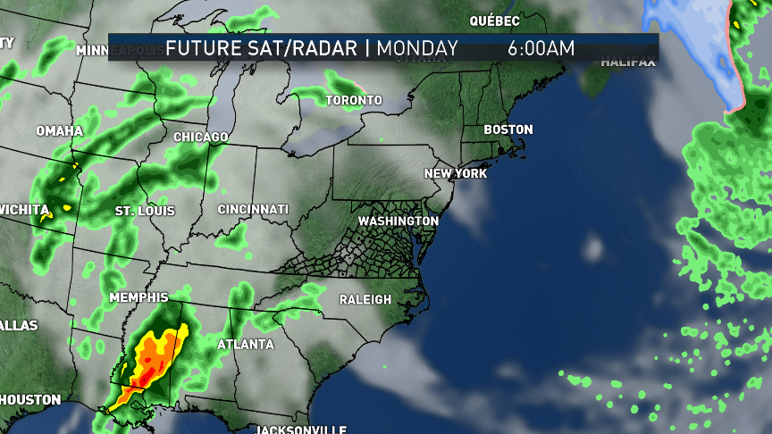
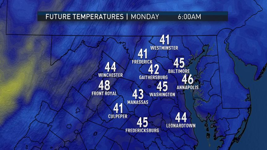
Those clouds will keep it from starting Monday off as chilly as Sunday did. Those clouds will be in advance of a storm system that will bring some beneficial rainfall to the entire listening area, meaning dry Nationals and the Orioles Opening Day games — not counting extra innings — because the games start in the afternoon.
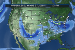
The showers will be moving in during the evening, close to the end of the typical evening commute. They will continue Monday night and end around the time of the Tuesday typical morning commute, followed by unseasonably warm and windy conditions behind a warm front.
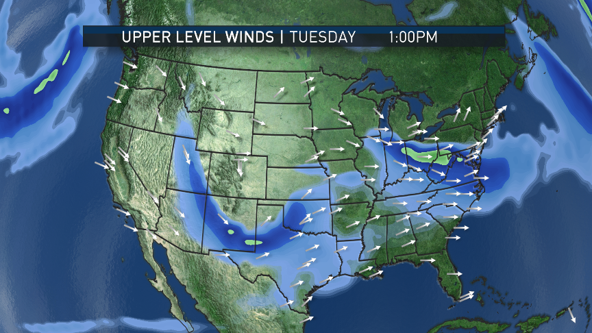
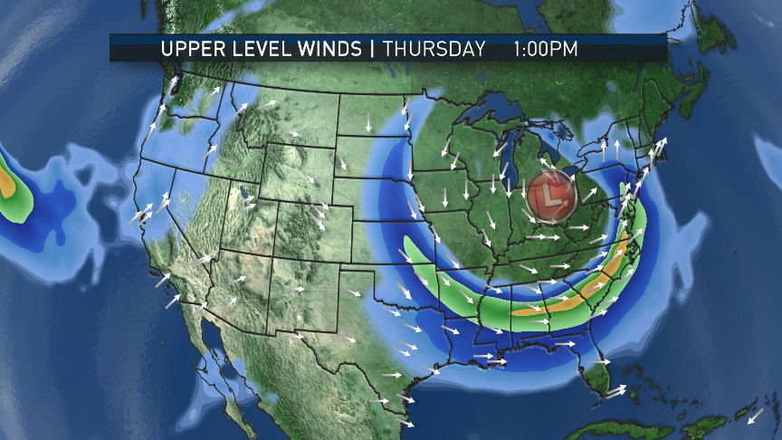
The system is associated with remnants of severe thunderstorms in the Deep South that were ongoing over the weekend in an area of enhanced winds with the southern branch of the Jet Stream, and cold air in the Plains interacting with dry air from western Texas, and very humid air near the Gulf of Mexico.
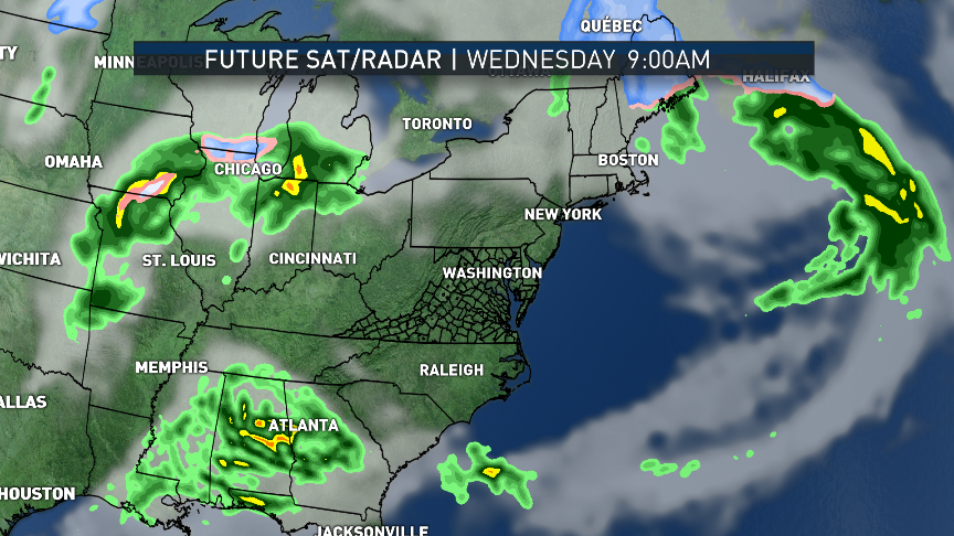
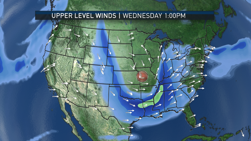
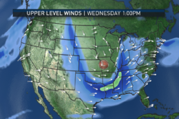
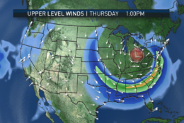
The system will move up the mountains, as it brings showers. It’s a very typical pattern for this time of year. A few days later, another very similar system will bring some storms in the South, and that system will also head up the mountains to bring more showers and thunderstorms in the Wednesday night through Thursday time frame.
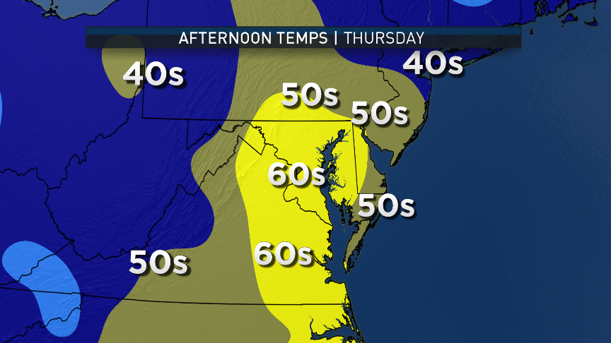
Wednesday’s Nationals and Orioles games should be dry (though it’s cutting it close), but Thursday’s Nationals’ game at home might be affected by this round of wet weather. It should be noted that even though the area may get a thunderstorm or two mixed in with both of these systems, the severe weather most likely will stay in the Carolinas but will have to be watched, especially Thursday.
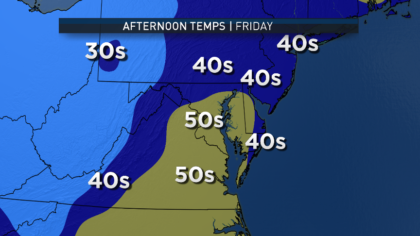
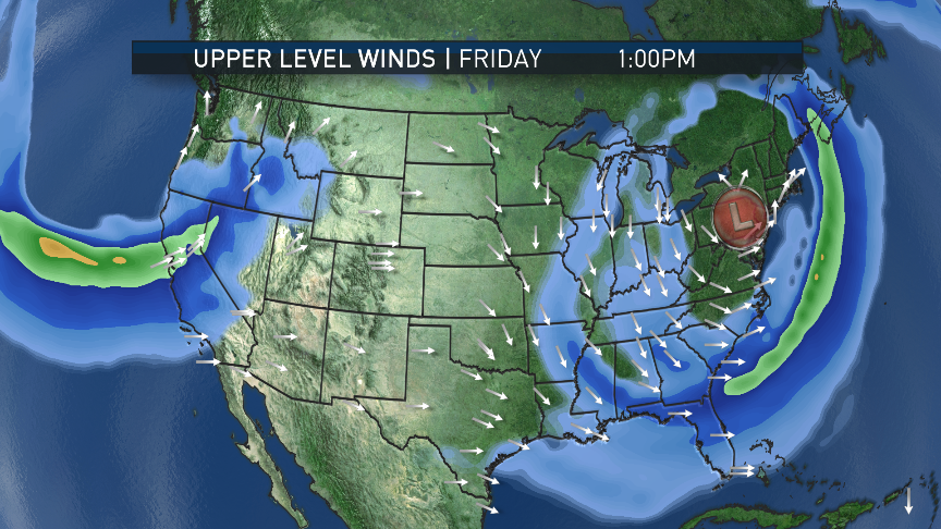
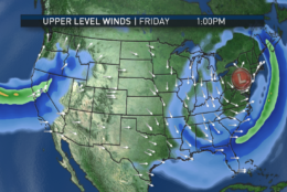
Friday will feature a “cutoff” area of low pressure in the atmosphere overhead, keeping it cooler and unsettled with some spotty showers or drizzle. Then high pressure will dry out over the weekend.
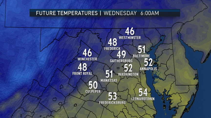
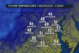
Most of the week will have temperatures above average with Tuesday being the warmest day, thanks to all the sunshine in the wake of the warm front. Friday will be the coolest day of the week in the wake of the stronger storm system.
Total rainfall amounts over the course of the week will be close to an inch, but in the vicinity of any possible thunderstorms, amounts may be locally higher.
Daily weather highlights
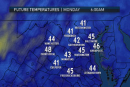
MONDAY
- Clouding over
- Breeze picking up
- Seasonable high temperatures if not slightly above
- Showers moving in toward the end of the Nats and Orioles games and the evening commute
- Showers pick up in intensity overnight
TUESDAY
- Lingering showers, drizzle, and areas of fog for the morning commute
- Gradual clearing and becoming windy
- Temperatures soar in the sunshine, well above average
- Some spots in central Virginia and southern Maryland reaching 80
- Diminishing winds after sunset
WEDNESDAY
- Clear and comfortable start
- Clouding over in the afternoon and evening
- Not as warm but still unseasonably mild
- Showers and possible thunderstorms arriving toward nightfall
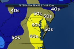
THURSDAY
- Showers likely, thunderstorms possible
- If thunderstorms become more likely, severe potential will have to be monitored through the week
- Severe likelihood is low as of blog publishing time
- Turning sharply cooler toward nightfall
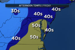
FRIDAY
- Mostly cloudy, breezy, and cooler
- A few spotty showers or some drizzle
- Seasonable high temperatures but feeling much cooler compared to the rest of the week
Editor’s Note: The WTOP Workweek Weather Blog is intended as an in-depth yet plain language summary of the business week’s weather potential in the D.C. area along with an explanation of the contingencies and uncertainties that exist at the time of publication. For the latest actual Storm Team 4 forecast, check out the main WTOP Weather Page.