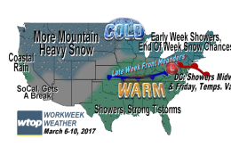
WASHINGTON — This week, we’ll see another warmup with chances of rain scattered throughout the week.
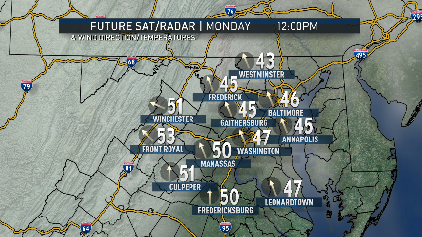
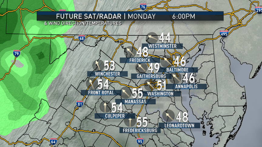
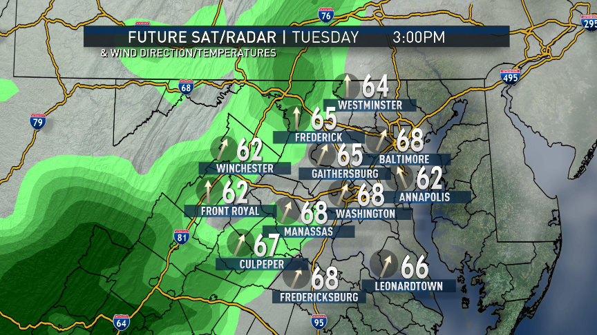
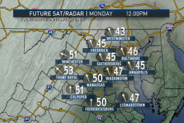
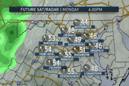
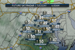
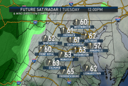
To start out the workweek, subfreezing temperatures over most of the area early Monday morning will be followed by much milder temperatures in the afternoon. This is courtesy of high pressure pulling away from the area to our southeast during the day and southerly winds setting up. It is the same area of high pressure which, while it was heading our way, provided us with the cold, blustery conditions over the weekend. This will be the “return flow,” as it’s called. That return flow will also be tapping a bit of moisture from the Gulf of Mexico and bringing a few rain chances our way, first with a warm front during the day on Monday. The moisture flow will strengthen into Tuesday.
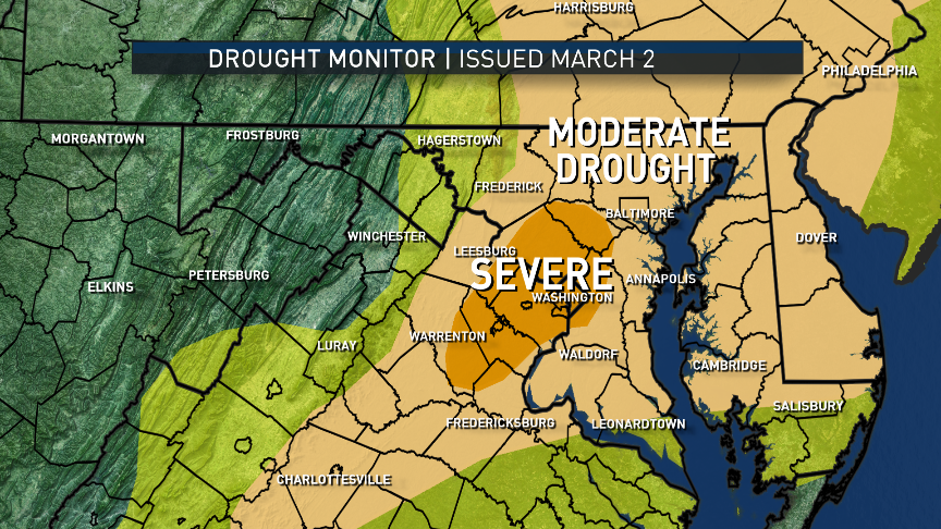
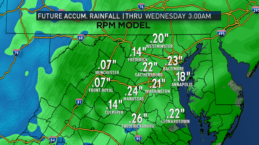
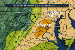
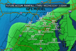
This is certainly good news as late last week, the U.S. Drought Mitigation Center downgraded a lot of our area into the “Severe Drought” category in the Drought Monitor for both long-term and short-term effects. Long-term effects could be considered groundwater, waterways, rivers, etc. and are related to precipitation shortages greater than six months. Short-term effects could be considered topsoil and brush and, very soon, agriculture. They’re related to shortages of the past six months. Rounded off, between this year so far and last year, we’re close to a foot below normal for rainfall and ice and snowmelt equivalent. There’s no other way to put it: We need a few all-day storms with precipitation that gets to soak in (as opposed to runoff that causes flooding).
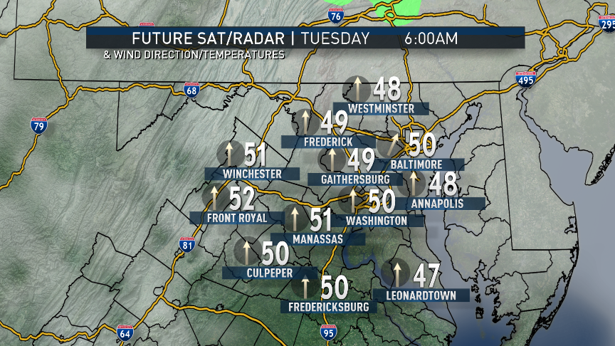
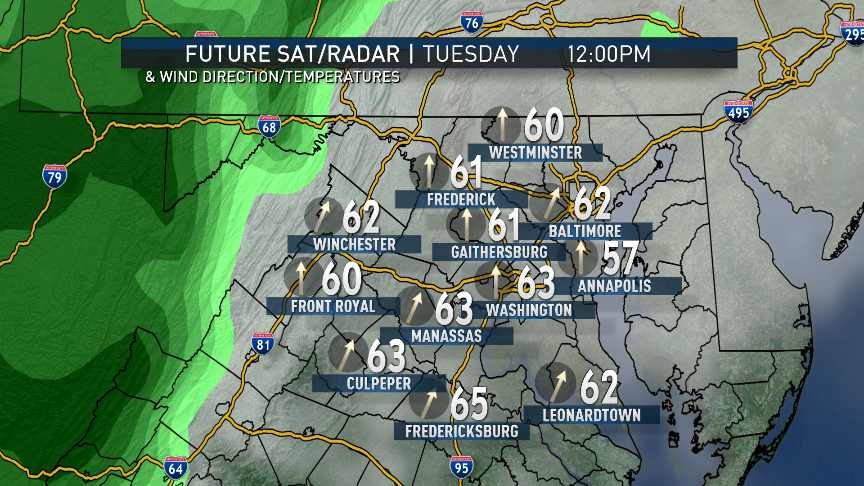
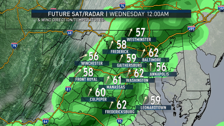
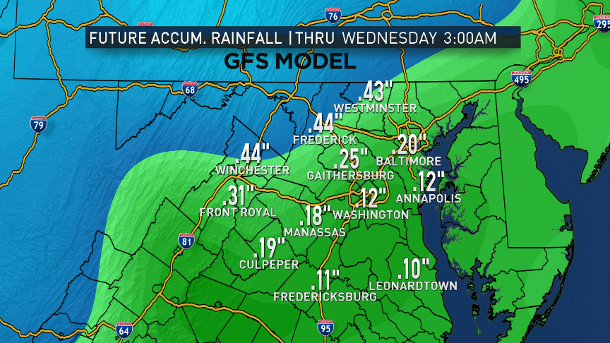
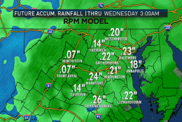
The best chance for rain will be late Tuesday into Wednesday morning as that moisture flow from the Gulf gets lifted by strong winds aloft and an advancing cold front. The heaviest amounts look like they may be just to our west in the mountains, but we should still end up with several tenths of an inch. That will certainly help the topsoil and mitigate some wildfire danger in the short term.
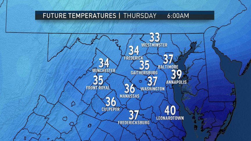
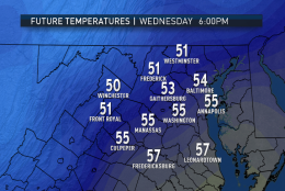
We will start to dry out Wednesday, especially when a secondary cold front passes through overnight into Thursday morning. That boundary will have several waves of low pressure moving along it, playing havoc with its motions — especially in the various computer models that look far into the future.
Basically, it’s a boundary between two dueling high pressure systems: one in Canada trying to make it colder with northerly winds and one across the South trying to make it warmer with southerly winds. This is a pretty common pattern as we get closer to actual spring.
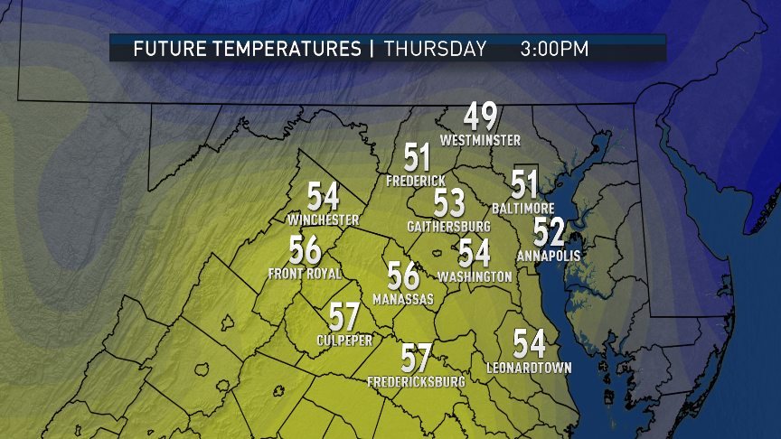
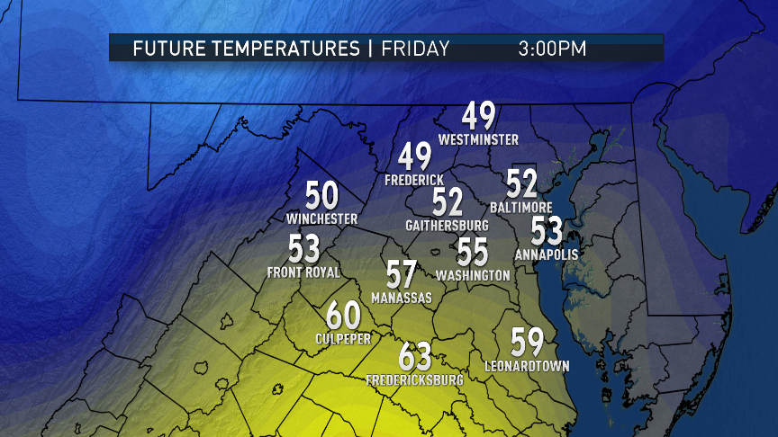
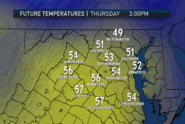
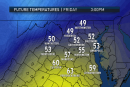
There is some great uncertainty with the high temperatures for the end of the week. From north to south, there could be a 20 degree difference in afternoon temperatures across the WTOP listening area on Thursday and Friday. Regardless, this setup means another chance for some rain in the general vicinity of Washington on Friday, and also possibly into Saturday.
Daily weather highlights
MONDAY
- Cold start but not as frigid as Sunday
- High and midlevel clouds increasing during the day
- More seasonably mild temperatures, if not above average by a few
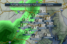
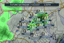
TUESDAY
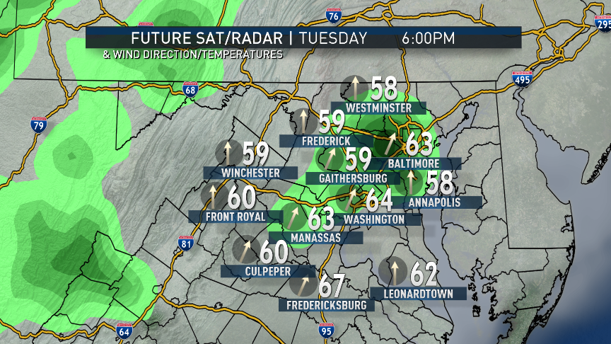
- Cloudy and kind of damp
- Several rounds of showers through the day, especially later in the day
- Showers continue into the night
- Springlike temperatures
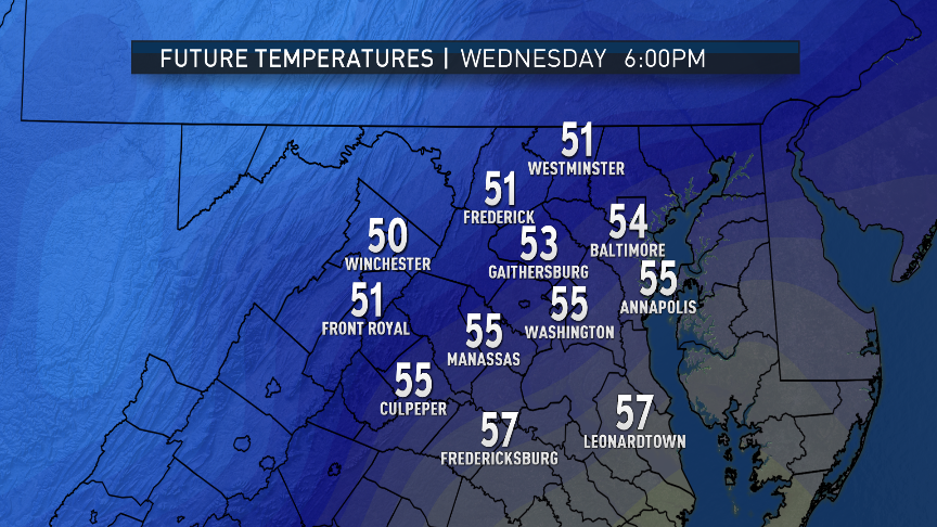
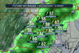
WEDNESDAY
- Showers ending near or just before the morning rush
- Warm to start the day with high temperatures in the early morning
- Breezy and turning a bit cooler through the day, with what would be average highs in the afternoon
- Clearing skies for the evening rush
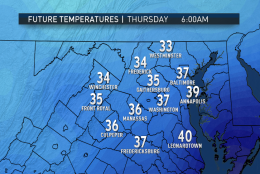
THURSDAY & FRIDAY
- Great deal of uncertainty based on the movement of frontal boundary
- Where there are clouds and northerly winds — cooler than average temperatures and a chance for rain
- Where there is more sunshine and southerly winds — springlike temperatures and drier weather
- Based on pattern recognition and local experience, most likely scenario would be for cooler temperatures, clouds, rain near D.C. and points north, warmer in central Virginia and southern Maryland
Editor’s Note: The WTOP Workweek Weather Blog is intended as an in-depth yet plain language summary of the business week’s weather potential in the D.C. area along with an explanation of the contingencies and uncertainties that exist at the time of publication. For the latest actual Storm Team 4 forecast, check out the main WTOP Weather Page.