WASHINGTON — The day after a late-season winter storm coated sidewalks and some streets in a messy layer of snow and slush, the D.C. area is a bracing for a days-long deep freeze that could set records for mid-March.
Related Gallery

The National Weather Service has issued a wind advisory for D.C. until 6 p.m., and the gusty winds of up to 45-55 mph are already pushing wind chills to the teens and single digits.
In contrast to the record-breaking warmth of the past few weeks, Wednesday could set records at the other end of the thermometer.
The coldest high temperature on record for March 15 — just a week before the official start of spring — is 32 degrees, which was set in 1932. That’s two degrees warmer than Wednesday’s forecast high. Similar records at Dulles Airport are 32 (set in 1993) and 31 at BWI (also set in 1993).
The subfreezing temperatures overnight refroze the snow and slush left behind after Tuesday’s winter storm and led many area schools to delay opening Wednesday morning.
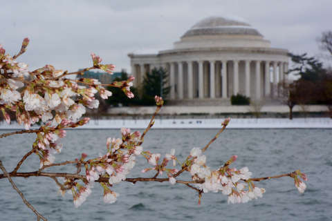
There’s also concern the icy temperatures could destroy as much as 90 percent of the cherry blossoms beginning to form along the Tidal Basin.
The current cold snap will extend through Friday, making the longest stretch of below average temperatures since last May, according to Storm Team4 meteorologists.
But spring is set to make a return this weekend, with temperatures pushing near 60 degrees on Saturday.