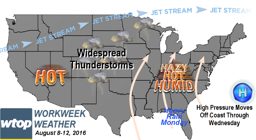
WASHINGTON — The weekend finished on a comfortable note thanks to the Canadian high pressure, and the new workweek will start off comfortable. But the sultry stuff will be quickly moving back when the high pressure center moves to our south and east.
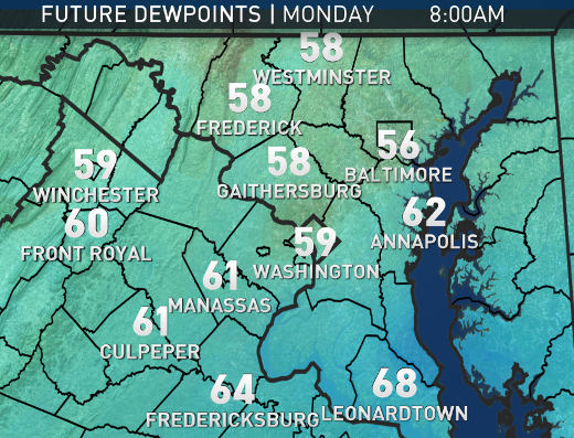
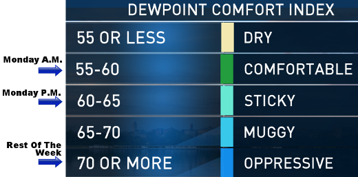
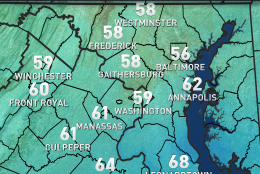
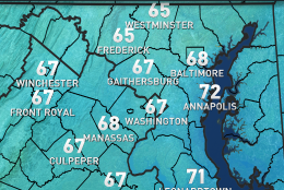
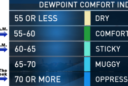
After that, it will become our newest “Bermuda High,” pumping in the heat and humidity. The northwesterly flow at the surface from Sunday will become more northeasterly Monday morning — still fairly dry for us. Dew points will only be in the low 60s through the day, which means it will start getting just a little closer to levels where the humidity starts to feel sticky again. (On Sunday, the dew points were in the upper 50s, making it very pleasant.)
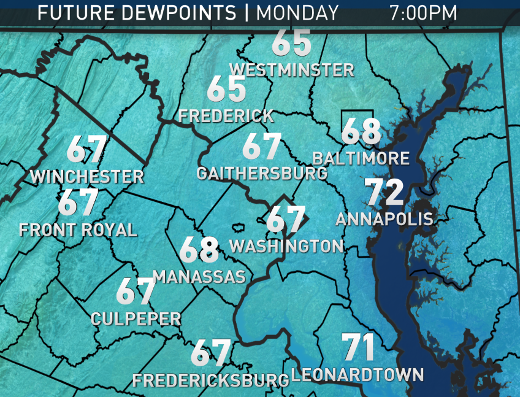
Monday night, the flow will become more southeasterly as the high moves offshore, so that will start transporting in more low level moisture off the ocean and the Chesapeake and that means low clouds and indeed — more humidity.
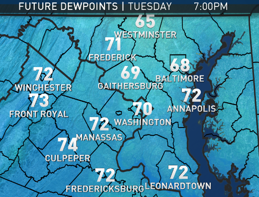
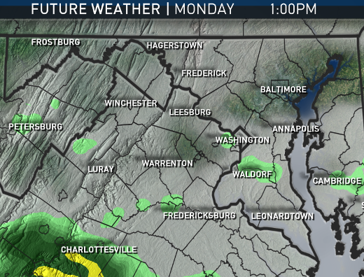
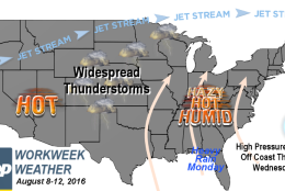
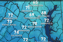
On Tuesday, the dew points will be back in the low 70s and that’s when it starts to feel muggy again. By Wednesday the center of high pressure will be off the southeast coast and the flow at the surface and aloft will be out of the southwest, so we’ll have southern heat and humidity. Each day the rest of the week will have hazy, hot and humid weather with the daily chance for random, isolated afternoon and evening thunderstorms. The best chance for storms will be Friday as a weak cold front approaches from Pennsylvania, but it looks like the front will dissipate and the hot stuff will last all the way into the weekend.
The pattern definitely exemplifies the “summer doldrums.” There will be very little going on in terms of large scale weather features. Rainfall will only come from spotty, random thunderstorms. Temperatures will rise each day, but only by a few degrees compared to previous days. The biggest changes will be the amount of humidity.
DAILY WEATHER HIGHLIGHTS
MONDAY:
– Mostly clear and relatively cool for August in the morning
– A mix of low level and high level clouds with the sunshine
– Temperatures just as warm as Sunday, but by Monday evening it starts to feel sticky again
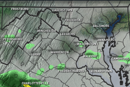
– In far southern and west locations, where it gets more humid first, a slight chance of a late-day thunderstorm
TUESDAY:
– Increasing clouds and increasing humidity
– Dewpoints climb into low 70s by the end of the day, making it feel muggy
– Isolated late-day thunderstorms possible, this time almost anywhere, but the majority of us don’t get storms
WEDNESDAY and THURSDAY:
– Hazy, hot and humid typical August weather for the D.C. area
– Very muggy humidity making it feel even hotter
– Afternoon and evening thunderstorms pop up in the daytime heating, but only scattered storms
FRIDAY:
– Hazy, hot and humid like the previous two days, but with more clouds and a better chance for thunderstorms
– Cloud cover may keep us below 90, but if not, it will be another heat wave
NOTE: The WTOP Workweek Weather Blog is intended as an in-depth yet plain language summary of the business week’s weather potential in the D.C. area along with an explanation of the contingencies and uncertainties that exist at the time of publication. For the latest actual Storm Team 4 forecast, check out the main WTOP Weather Page.