WASHINGTON —Flooding on roadways and hundreds of power outages were reported in several areas Tuesday night as heavy rain moved through the D.C. region.
At least four water rescues were reported in Loudoun County, Virginia. Officials said one person climbed onto the roof of their vehicle after getting stuck at Rockbridge Drive and Sycolin Road, and a family needed help getting out of their home after a basement flooded in Lucketts. No injuries were reported.
NBC Washington Chief Meteorologist Doug Kammerer says Leesburg, Virginia saw 6 inches of rain fall Tuesday.
Many were also without power overnight. As of 3:55 a.m. Wednesday, here are the latest outage numbers:
- Pepco is reporting 576 customers without power, mainly in Montgomery County, Maryland.
- Dominion Power is reporting 2,555 outages, mostly in Loudoun County, Virginia.
- NOVEC reports 73 customers without power
- BGE says 5,973 customers are impacted, mostly in Baltimore County, Maryland.
Click here for the latest forecast.
PREVIOUS INFORMATION:
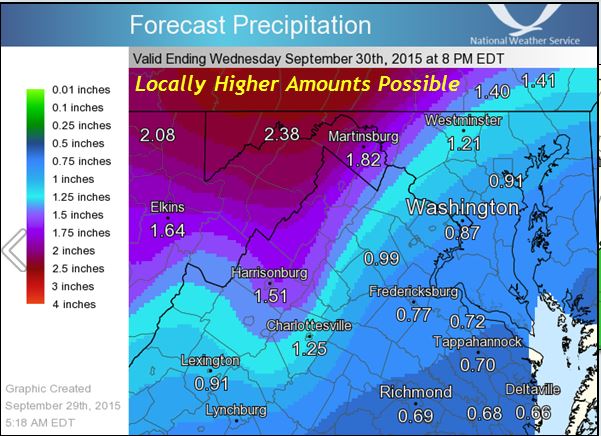
The heaviest rain moved into the region after 4 p.m. Tuesday as an area of low pressure traveled out of the northern Gulf of Mexico and northeast along the Appalachian Mountains.
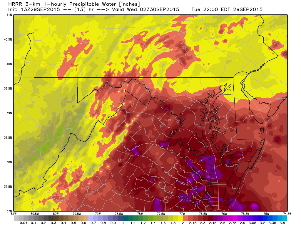
Our precipitable water values are through the roof for this time of year. In fact, the PWAT values are more than 2 inches, which puts us at more than 200 percent of the normal for this time of year! (We actually will near the record, if not break the record for these values in late September). That’s a lot of deep moisture over us.
So what exactly is precipitable water or what we like to call PWATs? Precipitable water is basically the amount of water contained in a vertical column, just above the surface (if it were all precipitated out) or the available moisture in the atmosphere for generating rain.
Rain showers will steadily decrease and weaken in intensity through the day Wednesday, ending up as just a few showers by Wednesday afternoon once the front passes through. Breezy winds will pick up out of the north bringing some cooler air behind the front.
So by Wednesday afternoon, expect some lighter showers, but also some gusty winds gusting up to 20 mph at times. Breezy conditions will continue into the overnight and through Thursday, rolling at about 10 mph consistently as the cold front stalls to the south and a trough (elongated area of low pressure) intensifies over the Ohio and Tennessee valleys.
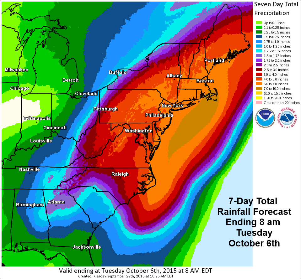
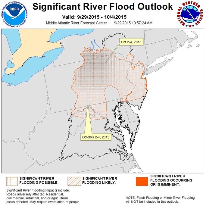
With the trough just to our northwest and the cold front stalled to the south, rain chances will continue through the end of the week with clouds lingering. In fact, as this week moves on and rain chances seem pretty good, there is a possibility for significant river flooding over much of the Mid-Atlantic by the time we get into the weekend!
Not only that, but for this weekend we will turn our attention to Tropical Storm Joaquin (wah-KEEN) for the weekend. This could bring us some heavy rain and winds for the start of the weekend.
The jury is still out on rain amounts for that event, but we will take one weather system at a time and we’ll continue to watch how things develop.