WASHINGTON — A tricky forecast is coming together as we head into the end of this workweek.
Finally, we can say goodbye to 90-degree days Thursday as we will only top out in the upper 70s to lower 80s for daytime highs.
Wednesday was our last day above 90 degrees as we hit a high of 93 degrees at Reagan National Airport. Yesterday was also our 13th day in a row at 90 degrees or above. This is the longest streak of 90-degree days since 2001 and the 3rd longest streak ever!
Friday, daytime highs will top out in the 70s to near 80 degrees. The last time D.C. only hit a daytime high in the 70s was July 2, when we rose to 77 degrees. We can thank cloud cover and rain showers for the much cooler conditions that we can expect during the next 48 hours.
Now, onto that rain. This has been a tricky forecast over the past several days and let me explain why.
The Setup:
A stalled frontal boundary lies across Southern Virginia/North Carolina and stretches back through Kentucky and down through Oklahoma. An area of low pressure is moving out of the Midwest along that front.
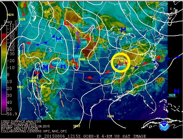
Eventually that low will move into the Mid-Atlantic. The exact track of this low is still yet to be determined. But as of Thursday morning, we are still anticipating a southerly track across Virginia. The reason the track of the low is important is because it will determine what locations see the heaviest rain. Obviously we will have to be concerned about flooding with areas that receive heavy rain. With a forecast southerly track, most of the heaviest rain will set up south of D.C. and into Central Virginia.
Timing:
After a dry morning commute, all focus is now turns to the Thursday evening rush.
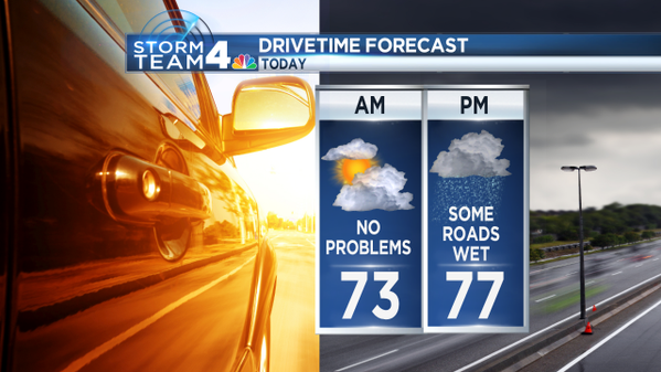
Expect rain showers to move into the Shenandoah Valley after the lunch hour. I would say showers are likely to roll in between 1 p.m. and 3 p.m. along Interstate 81. And they will start to spread east through the early evening. However, the rain will be spotty to start.
Anyone headed to Nats Park for the 4:05 game this afternoon should bring some rain gear. Rain will be likely, especially in the later innings.
The evening commute will be a little wet but it really depends on where you are headed. We are not anticipating heavy rain for the evening commute around the Greater D.C. area, but just be prepared because we all know too well that just a little rain is enough to slow roads around the region.
While we are not foreseeing any widespread thunderstorm activity, there could be a few thunderstorms. But most of those will remain south of Washington and around the Chesapeake Bay.
As that low pressure travels to the east and into the Mid-Atlantic tonight, the rain looks to intensify slightly. This will bring some heavy rain to the region at times during the overnight.
Again, the heaviest rain is forecast to be from Charlottesville to Fredericksburg and out to Southern Maryland with points south and east through Central Virginia and out to the Eastern Seaboard. But any change in the track of this low will change the forecast.
Accumulation:
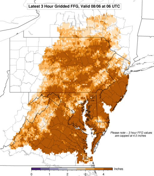
You will absolutely wake up Friday to not just rain showers, but also some ponding on the roadways. If you are south of D.C. and closer to central Virginia, there is a chance there could even be some isolated flooding concerns.
I am not as concerned about flash flooding around the region because it will take a lot of rain in a very short amount of time to reach flash flooding conditions.
While we need some rain around the region just to spruce up some of our lawns and gardens, we are still running well above average for rainfall this summer (and just FYI, we are not in any threat of a drought). Since June 1, we have received 16.99 inches of rain here in D.C. The average rain for that same time period is 8.04 inches of rain — half as much as has fallen this summer.
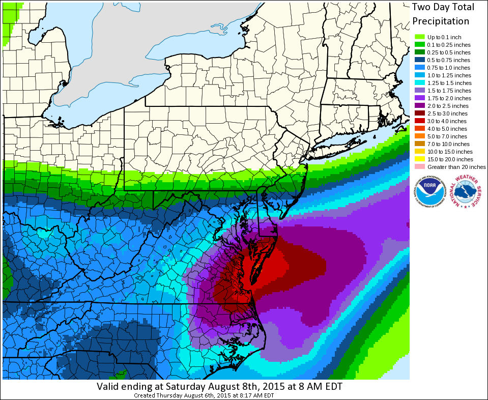
Again, where exactly the heaviest rain will set up is still yet to be determined. Rain accumulation model from NOAA still shows the heaviest rain will fall to the south.
Rain will eventually move out of here from the west to the east through the day on Friday. We could even get some peeks of sunshine as we continue into the afternoon on Friday.
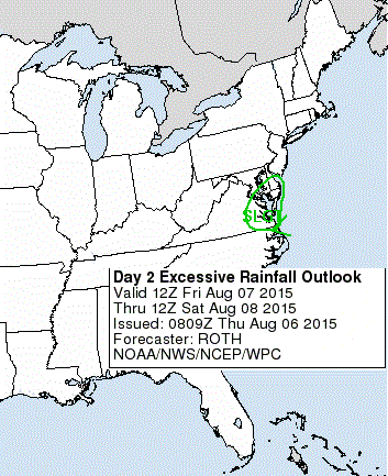
However, not everybody will be in the clear. Areas east of I-95 will be the last to see the rain end, therefore, more rain will be able to accumulate (hence the higher totals through Friday). We will have some flooding concerns also in these regions as highlighted below:
The area of low pressure will move eastward out into the Atlantic by Friday night and will eventually move off and up the coast. I believe it will stay far enough away so area beaches will not be impacted on Saturday. But again, it will be a wet Friday for folks along and traveling to the East Coast from Virginia Beach up through the Delaware beaches.
High pressure will scoot into the region for the weekend bringing sunshine, low humidity and temperatures in the mid to upper 80s. So we are in for a great weekend after a little end-of-the-week rain. Make plans outside now!