UPDATE: 12:35 p.m., Tuesday, June 23
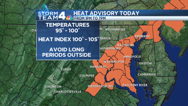
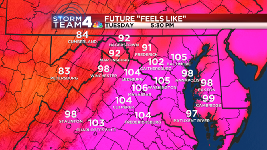
WASHINGTON – The National Weather Service has issued a Heat Advisory for most of the listening area beginning at 1 p.m. and lasting through 7 p.m. Tuesday because the heat index will make it feel like it’s 105 degrees outside.
Anyone who works or spends time outside should take precautions including rescheduling strenuous activities until early morning and late evening. Know the signs and symptoms of heat exhaustion and heat stroke. Wear light weight and loose fitting clothing and drink plenty of water.
Those who work outside should take frequent breaks in the shade or air conditioned buildings, according to the weather service.
EARLIER: 10:30 a.m., Wednesday, June 23
WASHINGTON — Happy second full day of summer!
Following Sunday’s solstice, we jumped right into the season with very warm temperatures throughout the region. We should be in the mid-80s this time of year. On Monday, the first full day of summer, temperatures reached the mid-90s.
Today, we’ll surpass that, thanks to a warm front that lifted from the south to the north. Temperatures will reach the upper-90s. With the heat index, it’ll feel much hotter.
This is dangerous heat, so make sure you limit your time outside. If that is unavoidable, make sure you stay hydrated. The risks of heat-related illnesses are running pretty high today.
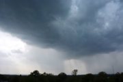
Given the combination of heat and humidity, as well as an approaching cold front from the north and west (that will eventually pass through tonight), we are talking about some afternoon storms. Some of those could be pretty strong.
The Storm Prediction Center put our region in the “Enhanced Risk” for severe weather. Severe storms are possible with damaging winds, hail and perhaps a small threat of isolated tornadoes. Expect lots of lightning and heavy rain; please keep a watchful eye to the sky, especially if you are at Nationals Park for the game tonight. Storms will likely reach the area between 2 p.m. and 8 p.m. They’ll move in from the north and west and push towards the south and east.
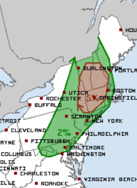
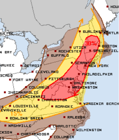
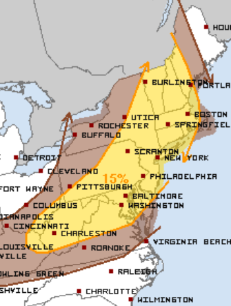
If you are traveling today, keep an eye on that flight before you get to the airport. The severe weather threat extends from Maine, through Boston and Philadelphia, and west into most of Kentucky. There will be plenty of flight delays this afternoon — not only for local airports, but for most of the airports through the northeast.
The cold front will sweep through tonight, bringing some relief to the region as high pressure moves in for Wednesday. Storms will diminish after 8 p.m. and humidity will start to drop.
Wednesday will be fairly pleasant with sunshine and temperatures in the upper-80s. However, humidity will keep dropping to comfortable levels in the afternoon.
Though humidity will resurface on Thursday, temperatures fall into the 70s this weekend. Things look a little unsettled then: It might rain, so that’s something we have to watch as we get closer.
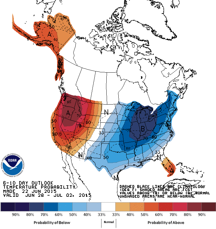
After Sunday, there is a good chance that temperatures will stay at or below normal as we move into the 4th of July holiday weekend.