WASHINGTON — What a frigid Friday!
A record low of 5 degrees at Ronald Reagan Washington National Airport broke the previous record of 8 degrees set back in 1896.
On a side note, this was the first, record low in the month of February in D.C. since 1970 – 45 years!
Baltimore Washington International Airport fell to 1 degree, breaking the record of 4 degrees set in 1979. Here is how cold it got around the area:
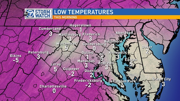
After such a cold morning, highs Friday afternoon will only reach the mid to upper teens. Clouds increase overnight ahead of the next weather system that will bring snow, sleet, freezing rain and rain. Take a look at what the system will look like by 8 p.m. Saturday.
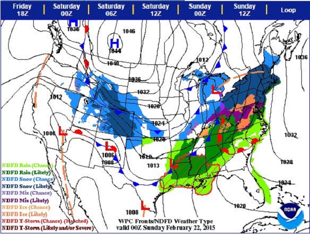
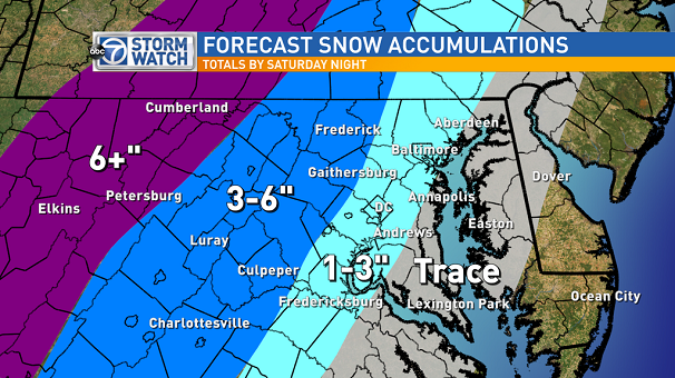
It will be a very messy Saturday with snow, sleet, freezing rain and rain. It now appears the snow will arrive earlier than previously forecast, which means the potential for higher snowfall accumulations before the precipitation transitions to sleet and freezing rain. With record cold Friday morning, road temperatures are well below freezing, so once precipitation begins to fall, it will instantly stick.
Here’s a simulation of the radar by noon Saturday.
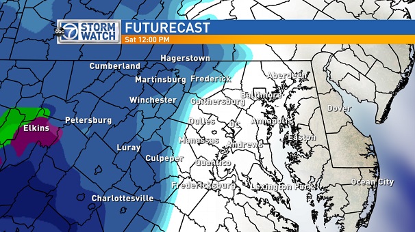
Snow should make it into the D.C. metro around lunch time Saturday. Snow will slowly transition to sleet and freezing rain by mid to late afternoon. Snowfall totals will depending on what time the changeover occurs. Even if there is only a few inches of snow, there will be the possibility for sleet and freezing rain to accumulate on top of the snow through the afternoon, making for hazardous travel conditions.
A Winter Storm Watch is already in effect Saturday for the western counties. A Winter Storm Watch is issued when 5, or more, inches of snow is possible and ice accumulation enough to damage trees or power lines is possible.
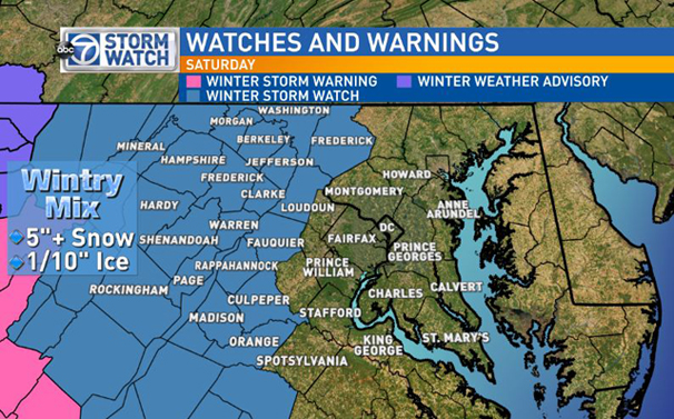
Even though D.C. is not under a watch, warning or advisory (as of this writing), between 1 inch to 3 inches of snow is possible. This is not a predominately snow event, with sleet and ice expected by midday. Ice accumulations may reach 1/10 inch to 1/4 inch, on top of the snow, before changing over to all rain by 8 p.m. to 9 p.m. Saturday.
The StormWatch7 weather team expects this next storm system to cause treacherous road conditions come mid- to late-day Saturday. With the recent cold, the roads will become slick quick, so please use extra caution if you have to be out. Find more updates throughout the day on the ABC 7 Facebook page and ABC7 News.

