Showers are possible this Easter Sunday after summer-like temperatures hit the D.C. region Saturday. The area hadn’t been this warm this time of year in over a decade.
Even though Saturday’s temperatures were in the 80s, the evening hours might bring some precipitation along Interstate 66 and other surrounding rural areas of the region, but most of the area should stay dry, according to WTOP Meteorologist Mike Stinneford.
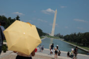
Make sure to bring your umbrellas to your Easter plans. While the showers might not affect your Saturday evening, rain is expected on Sunday.
“A couple of showers are possible tonight. A strong cold front will bring showers and thunderstorms to our area Easter Sunday,” Stinneford said.
However, Stinneford said the rain is not expected to start before “sunrise services” for the holiday.
Monday will be mostly to partly sunny, along with seasonal temperatures, with highs in the 50s. But enjoy the warmer weather while it lasts.
By Tuesday, the weather will cool back down, with highs in the 50s. Stinneford warned to “watch out for freezing temperatures” since there could even be a risk of frost as temperatures fall into the 20s to lower 30s.
The cold weather could continue into Wednesday morning with temperatures in the 50s.
- Listen to WTOP online and on the radio at 103.5 FM or 107.7 FM.
- Current traffic conditions
- Weather forecast
- Closings and Delays: DC-area schools make decisions for Monday instruction
- Sign up for WTOP email alerts
- Get custom alerts with the WTOP app for Apple and Android phones
Full forecast
SATURDAY NIGHT:
Increasing clouds
Temperatures: 65-70
Winds: South 5-15 mph
Clouds will increase after sunset and give way to spotty showers after midnight.
SUNDAY:
Showers, breezy
Temperatures: 70s to 60s
Winds: Northwest 10-15, Gusts 25 mph
Our next weather maker will move in just in time for the Easter holiday with soggy, mild weather. Plan for a steady rain with a rumble of thunder or two possible. Rainfall amounts will range from around a half inch to an inch.
MONDAY:
Lingering showers end, mostly to partly sunny
Highs: 50s
Winds: Northwest 10-20 mph
Early morning showers will taper off from west to east before sunrise and give way to sunny skies and a return to seasonable temperatures.
TUESDAY:
Mostly sunny
High: 55-60
Winds: Northwest 10-15 mph
Cooler temperatures settle in as high pressure moves in. Temperatures could get close to freezing early for areas north and west of the Beltway.
WEDNESDAY:
Sunny, breezy
Highs: 50-55
Winds: Northwest 5-15 mph; Gusts: 20-25 mph
Sunny and cooler conditions continue.
Current conditions
Get breaking news and daily headlines delivered to your email inbox by signing up here.
© 2026 WTOP. All Rights Reserved. This website is not intended for users located within the European Economic Area.