After Sunday’s icy snowstorm, have your warmest winter gear ready for the next several days because it’s going to be cold — really cold.
Temperatures will have dropped between 5 to 10 degrees Tuesday morning, according to 7 News First Alert Chief Meteorologist Veronica Johnson. But beware of the Arctic freeze: Wind chills will make it feel as if it’s 5 to 10 degrees below zero.
“That’s about as low as I’ve seen it in quite some time,” Johnson said.
The National Weather Service issued a cold weather advisory for the D.C. region, from 7 p.m. Tuesday until 11 a.m. Wednesday, warning of dangerously low temperatures.
Johnson urged people to dress in layers and bundle up with gloves and boots.
“This really is the kind of cold you have to respect,” she said.
- Listen to WTOP online and on the radio at 103.5 FM or 107.7 FM.
- Current traffic conditions
- Weather forecast
- Closings and Delays
- Sign up for WTOP email alerts
Despite the bitter cold start, Tuesday will bring plenty of sunshine, and temperatures will climb to the lower to mid 20s. With such frigid temperatures, it may be best to wait until those midday highs to shovel your steps, driveways and sidewalks.
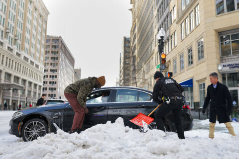
However, it won’t be warm enough to melt the ice and snow covering the D.C. region, and some area roadways will remain difficult to travel after hundreds of snowplows worked Monday to clear main and secondary roads.
Commuter routes are well-plowed, but caution is advised on turn lanes and side roads — they may not be as clear. Keep an eye out for pedestrians, since several sidewalks are still buried in snow.
Metro
Metro suspended all bus service at 12 a.m. Tuesday because of the weather. It said routes will be restored as roads become passible.
Metrorail service will resume at 6 a.m. Tuesday and operate on a weekend schedule, with trains running every 15 to 30 minutes. Metro said service frequency is expected to increase throughout the day.
Check WMATA’s website before traveling for route-specific service information.
Closures
Many schools and offices across the D.C. region will be closed Tuesday as cleanup from the weekend storm continues, School districts in Maryland and Virginia are shuttered. D.C. Public Schools are closed, and the federal government will not open. See the full list of closures.
Looking ahead
Wednesday brings another chance for snow in the evening and high wind gusts during the afternoon, Highs will reach the mid 20s as brutal cold conditions continue.
Forecast
COLD WEATHER ADVISORY IN EFFECT FROM 7PM UNTIL 11 AM WEDNESDAY
TUESDAY:
Partly Cloudy
Temperatures: 20s to 10s
Winds: Southwest 5-15 mph
Temperatures are set to tumble this evening as cloud cover gradually thins. The big story will be temperatures and wind chills with a cold weather advisory starting at 7 p.m. for most of the D.C. area.
TUESDAY NIGHT:
COLD WEATHER ADVISORY
Clearing Skies, Very Cold
Temps: Single Digits/Low Teens
Wind Chills: -10 to 0
Winds: Southwest 5 mph
A cold weather advisory has been issued overnight for feels like or wind chill below zero.
WEDNESDAY:
Partly to Mostly Cloudy
Highs: 23-30
Winds: Northwest 5-15 mph
Day 5 of subfreezing temperatures. Clouds will increase during the afternoon with high temperatures in the mid 20s. Similar to days past, daytime snowmelt will lead to a nighttime refreeze.
THURSDAY:
Partly Cloudy
Highs: 23-28
Winds: Northwest 5-15 mph
Cold weather advisories are likely for the morning hours with subzero windchills possible. Morning temperatures will be in the single digits to low teens with afternoon highs back into the mid 20s.
FRIDAY:
Partly Cloudy
Highs: 23-28
Winds: Northwest 5-15 mph
Single digit air temperatures are expected with subzero morning windchills. The intense cold continues with afternoon high temperatures remaining 20 degrees below average for late January.
WEEKEND OUTLOOK:
The overall pattern looks favorable for a winter storm setup along the East Coast this weekend, based on how similar setups have behaved in the past. The big-picture ingredients are there — but in a pattern this sensitive, the final outcome still comes down to the details. Forecast guidance is still hinting at a more organized coastal storm, but there’s also a realistic chance it stays mostly offshore and never really locks in. That’s why the next day or two of updates will matter, as newer data helps the models handle the setup more confidently.
Current conditions
Get breaking news and daily headlines delivered to your email inbox by signing up here.
© 2026 WTOP. All Rights Reserved. This website is not intended for users located within the European Economic Area.