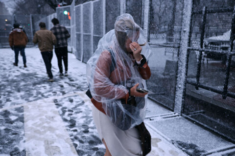

Bone-chilling temperatures blew into the D.C. area Monday ahead of Donald Trump’s inauguration. Here’s what you need to know for Monday.
Siberian cold air blows into D.C. for President-elect Donald Trump’s inauguration, prompting a cold weather advisory that will have Monday night temperatures feeling as low as -5.
Much of Monday will prove blustery, with the sun occasionally poking out.
7News Senior Meteorologist Brian van de Graaff said that while temperatures will remain in the 20s for Inauguration Day, it’s going to feel “like the low teens when you factor in brisk northwest winds.”
The National Weather Service said northwest winds will blow 15 to 20 mph, with gusts up to 30 mph.
By nightfall, temperatures will drop as a low as 8 degrees. A cold weather advisory will be in effect from 7 p.m. until 10 a.m. Tuesday, according to the National Weather Service.
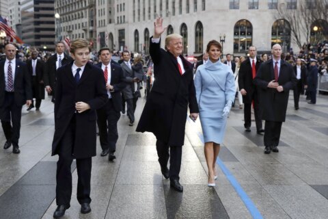
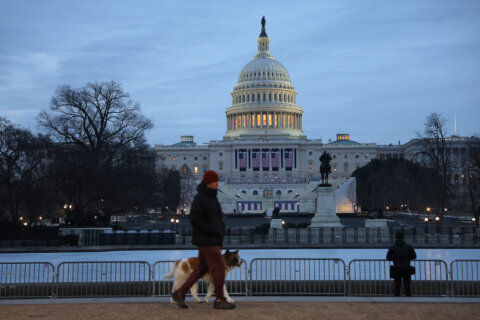
Due to the expected freezing temperatures, the 60th inauguration was moved inside the U.S. Capitol and the inaugural parade will now be taking place at Capital One Arena in D.C.
If the forecast holds, the inauguration would be by far the coldest since former President Ronald Reagan’s second inauguration in 1985, when the swearing-in ceremony had to be held indoors and the parade was canceled.
Temperatures won’t get above freezing again until Friday afternoon, WTOP Meteorologist Chad Merrill said.
- Listen to WTOP online and on the radio at 103.5 FM or 107.7 FM.
- Current traffic conditions
- Closings and Delays
- Sign up for WTOP alerts
7 News First Alert Forecast
MLK DAY & INAUGURATION DAY: Sunny to partly cloudy, blustery.
Highs: 20-29
Wind Chills: 5-10
Winds: Northwest 10-20, Gusts: 25 mph
This will be the coldest Inauguration since Reagan’s in 1985 when the high was 7 degrees. High temperatures this Inauguration Day will reach the 20s; however, it will feel like the low teens when you factor in brisk northwest winds. Dry weather is expected with added clouds midday.
MONDAY NIGHT: COLD WEATHER ADVISORY: Clear early, clouds by dawn.
Lows: 8-15
Winds: Northwest 5-10 mph
Plan for a dangerously cold night ahead with low temperatures in the single digits and low teens. A Cold Weather Advisory is in effect from 7 p.m. until 10 a.m. Tuesday for wind chills as low as 5 degrees below zero.
TUESDAY: Mostly cloudy, very cold.
Highs: 18-25
Wind Chills: 5-15
Winds: Northwest 3-8 mph
Cloudier skies will keep temperatures locked in the teens and 20s Tuesday afternoon with winds chills anywhere from 5 to 15 degrees.
WEDNESDAY: Mostly sunny, very cold.
Highs: near 20
Wind Chills: 5-15
Winds: Northwest 5-10 mph
Wednesday will be the last of the super cold air, and will also be the coldest day of the week. Temperatures will start in the single digits and barely climb out of the teens, with wind chills below zero in the morning and only climbing to the single digits.
Extended Outlook: Temperatures will be higher by next weekend on into the mid to upper 40s. The end of January and first half of February isn’t looking as cold.
Current conditions
Get breaking news and daily headlines delivered to your email inbox by signing up here.
© 2025 WTOP. All Rights Reserved. This website is not intended for users located within the European Economic Area.