
Kate Vogel’s job is to help the Maryland Department of Natural Resources document flooding across the state and come up with strategies to minimize the effects of climate change.
Now, Vogel, a coastal resilience planner with Maryland’s DNR, is asking for the public’s help.
“We are asking for you to take photos of any type of flooding that you see,” she told WTOP.
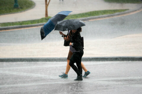
And that flooding doesn’t have to be catastrophic to make an impact.
“Maybe it’s your storm drains are overflowing, maybe your driveway’s disappeared,” Vogel said.
By downloading the My Coast Maryland app and posting photos, the public is helping Vogel, scientists and staffers across a range of Maryland agencies “to predict; will this happen again in the future? And what will the extent of the impact be, so that we can plan accordingly and start to do some resilience project planning.”
Vogel said the My Coast app “is going to be the most effective and powerful tool if we get more reports” so that more data can be accumulated.
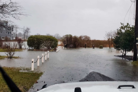
Dozens of people from areas affected by Tuesday’s flooding posted images showing varying degrees of flooding and storm damage, said Vogel.
“We’ve received tons of reports,” Vogel said.
While photos posted to the website connect to weather data, Vogel said the users’ names are not included on the site.
“Your data is kept private.”
When Maryland agencies can help communities and county governments identify patterns in flooding from data gleaned from the app — timing, severity and frequency — they then can come up with strategies to limit the damage done by climate change.
In some cases, said Vogel, solutions are “going to look like living shorelines with native grasses and native vegetation” that can help limit erosion and subsequent flooding.
In other cases, Vogel said, communities and structures near areas with more severe flooding could be “hardened” with structural barriers such as riprap, the rocky structures usually found along shorelines or bridge abutments.
Vogel said she’d like to see more data from Charles, Montgomery and Baltimore counties, among others. The hope is that users from all across the state will contribute reports, helping planners see possible patterns statewide.
You can find more information online about the app, how to use it, and how state agencies plan on using the data.
Get breaking news and daily headlines delivered to your email inbox by signing up here.
© 2024 WTOP. All Rights Reserved. This website is not intended for users located within the European Economic Area.