
Listen live to the latest weather and traffic forecast on the 8s.
Severe storms rolled through the D.C. area Monday, bringing torrential rain and flooding to roadways, and prompting tornado warnings earlier in the afternoon, which have since expired. Here’s what you need to know.
While most of the warning have expired, a flood watch for most of the region remains in effect until 2 a.m. Tuesday.
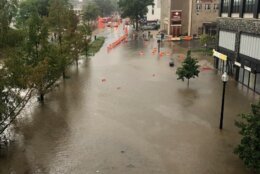
Water rescues, flooded roads as downpours slow afternoon commute
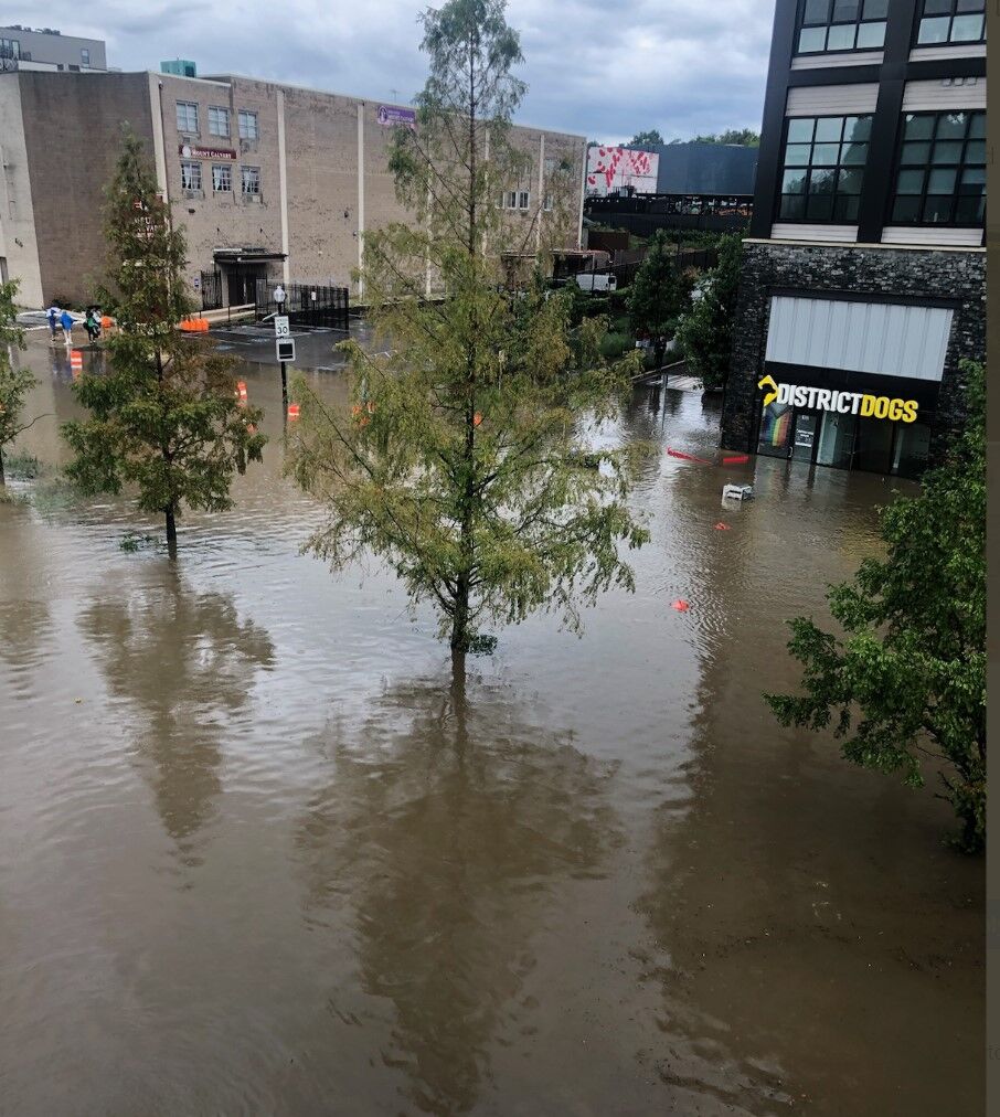
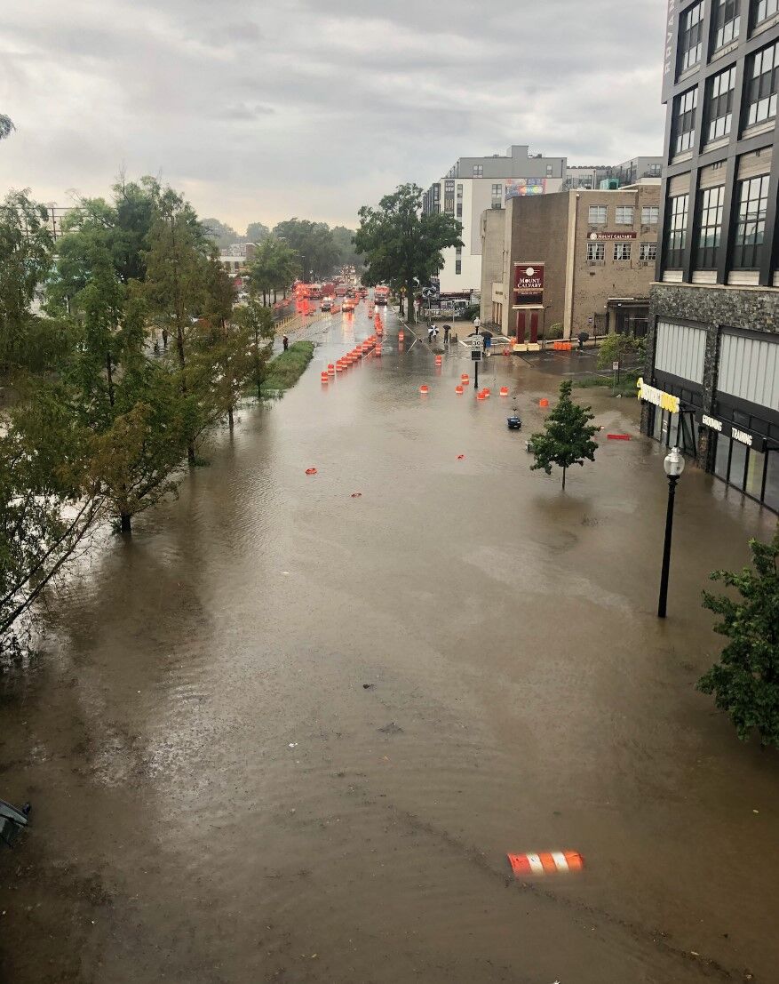
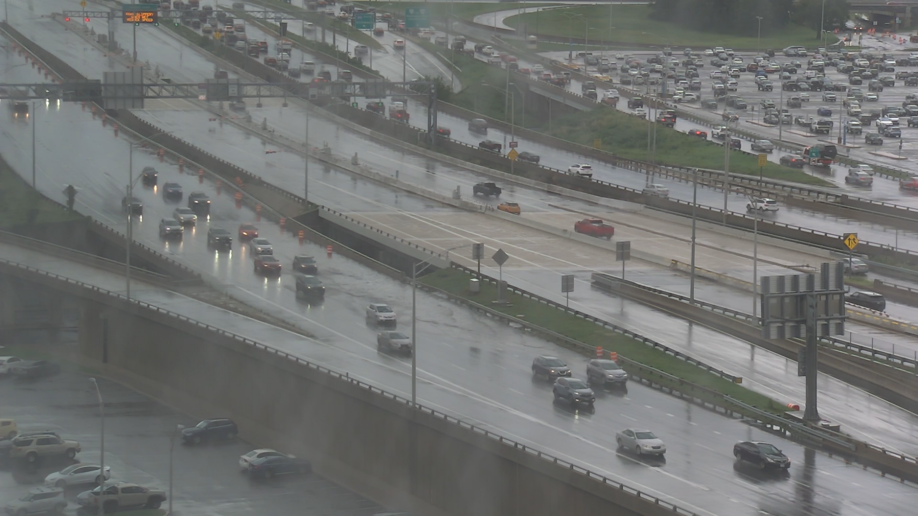
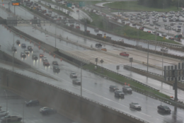
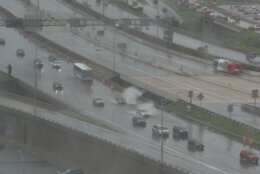
The heavy rain inundated roadways across the region, including in Northeast D.C. where the WTOP Traffic center reported water rescues near the Rhode Island Avenue Metro, with crews using inflatable boats.
D.C. Fire and EMS said crews responded to several vehicles stuck in the water in that area, with everyone accounted for and no reported injuries.
D.C. Fire and EMS also responded to pet business District Dogs, rescuing dogs and puppies from the doggy day care and boarding facility.
WTOP’s Mike Murillo, who reported from Northeast D.C., described the rescues as a “heart-wrenching scene,” with some pets reunited with their owners and some pet owners crying as they wait for their dogs.
In a news conference Monday afternoon, D.C. Fire and EMS Chief John Donnelly said several dogs were killed in the flooding.
“The walls gave in and District Dogs flooded, and as a result of that, we’ve had some fatalities,” Donnelly said. None of the employees were seriously hurt.
Megan Smith ran to District Dogs from a work meeting and was reunited with her pet Juniper.
“I saw a puddle on the floor and a stream of water. I saw the water just continually rise 3 to 4 feet,” Smith said.
Donnelly said some 20 people were rescued from underneath the bridge on Rhode Island Avenue, as well as some vehicles that were recovered.
This is not the first time District Dogs has had to deal with flooding. A year ago, the business was inundated with about 3 feet of water inside the building.
In Old Town Alexandria in Virginia, Alexandria police urged caution even though the storm has subsided. “There is still debris, down trees, traffic lights temporarily out and rising water levels can be hazardous,” Alexandria police said in a tweet.
Heavy rain and wind in Old Town blew our screen door open. It’s a #tornado warned storm. Be careful #DMV! @capitalweather @HillaryHowardDC @NWS @MatthewCappucci you are missing a doozy of a storm! @WTOP pic.twitter.com/k8VqtrVRLD
— David Biderman (@biderman) August 14, 2023
Southbound George Washington Parkway in Alexandria was blocked due to flooding at First Street. At the intersection of Route 7 and Daingerfield Road, a few inches deep of water was reported. In Fairfax County, Burke Road is closed in several locations due to high water. Prosperity Avenue was closed at Accotink Creek due to several feet of water over the roadway. In Springfield, the intersection of Essex and Middlesex avenue were blocked due to flooding.
In Maryland, blown down trees were reported on northbound Md. 295 Baltimore-Washington Parkway at Md. 450 Annapolis Road. And a vehicle was stranded in several feet of standing water in the 4600 block of Upshur Street.
- Listen to WTOP online and on the radio at 103.5 FM or 107.7 FM.
- Current traffic conditions
- Weather forecast
- Closings and Delays
- Sign up for WTOP alerts
Severe storms barrel through the region
The severe thunderstorms began popping up around the region shortly before 4 p.m. Some of them triggered tornado warnings for parts of Arlington and Fairfax counties and the City of Alexandria in Virginia that have since expired. The National Weather Service warned of flying debris, damage to roofs and windows that could occur and urged anyone in those areas to seek shelter.
The weather service said thunderstorms were bringing heavy rain of between 1 to 3 inches.
The weather service said heavy rain could result in the flooding of rivers, streams and other low-lying and flood-prone areas.
The rain is expected to last overnight but the risk of severe weather should fade by midnight.
The workweek started off steamy with humid conditions and feels like temperatures in the mid to upper 90s on Monday afternoon.
The next chance for rain and storms is Tuesday with the highest likelihood being for areas along and east of Interstate 95, Whelan said.
The weather should dry out on Wednesday.
Forecast
MONDAY NIGHT: Chance rain, storms. Winds: Light. Lows in the low to upper 70s.
TUESDAY: Partly to mostly cloudy. Chance rain, storms. Heat Index: Mid 90s. Winds: West 10-15 mph. Highs near 90s.
WEDNESDAY: Partly to mostly sunny. Winds: Northwest 5-10 mph. Highs in the mid 80s.
Current weather
Outages


