Mother Nature is rolling out the red carpet to spring weather in the D.C. area this week, with thunder, wind and record heat in the cards.
Though some may feel as though it’s too soon for afternoon rumbles and milder temperatures, the spring-like conditions aren’t unheard of for late February in the D.C. region.
Heat
Record winter warmth happens occasionally in D.C., so that’s not out of the ordinary.
Take Thursday’s forecast high in the upper 70s to low 80s.
The previous record we are challenging on Thursday occurred just last year when Reagan National Airport climbed to 77 degrees.
Thunder
What about thunder rumbles in February? A front heading for the Mid-Atlantic Coast Tuesday afternoon promises to trigger a thunderstorm or two from D.C. north into Pennsylvania.
One or two storms from Philadelphia to New York City could actually generate gusty winds.
The National Weather Service in Sterling, Virginia, issued a wind advisory for much of the D.C. area until 7 p.m. Tuesday, warning of sustained winds from the west of 20-35 mph with gusts up to 50 mph.
A Wind Advisory is in effect through 7pm for much of the area. Expect sustained westerly winds at 20-35 mph with gusts up to 50 mph. Use caution if driving a high profile vehicle and bring in any loose items that may be outdoors. #MDwx #VAwx #WVwx #DCwx pic.twitter.com/dKN7Q4Y1fc
— NWS Baltimore-Washington (@NWS_BaltWash) February 21, 2023
Turns out, February thunderstorms have happened in the past in D.C.
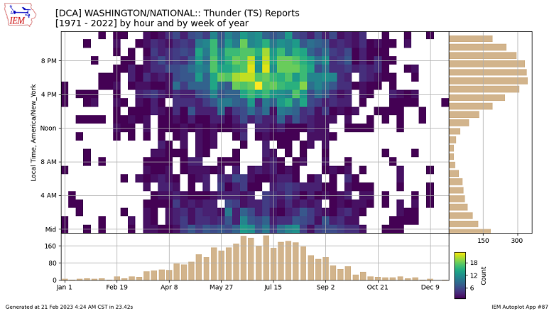
Digging back through observations at Reagan National Airport since the early 1970s, thunder has been noted in late February (specifically, during the year’s eighth week) in eight previous years. Those years include 1990, 1998, 2000, 2003, 2007, 2012, 2016 and 2017.

Snowfall in those winters was quite variable, so thunder in February can’t be connected to a snowless winter in D.C.
Historically, thunderstorms are most common between 4 and 8 p.m. from mid-June to mid-July.
Stay tuned to WTOP for the latest on the changeable weather with forecast on the 8’s.


