As if Mother Nature hasn’t dished out a few chilly days so far this month, here’s another reason to cheer on a potential White Christmas: a major Arctic outbreak just in time for Christmas week.
We are halfway through December, and would you believe it that the average temperature for the first 15 days of the month in D.C. is exactly in line with the last 30-year average of 43.3 degrees!
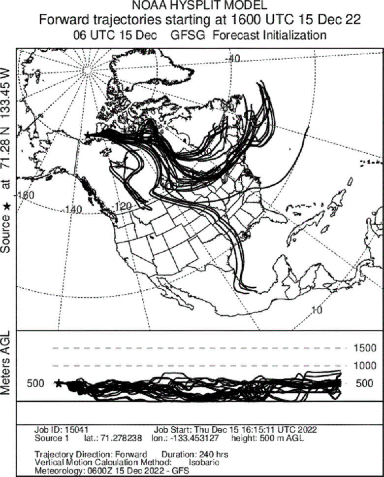
The jet stream, or zone of upper-level winds, is set to channel a pocket of bitterly cold air bottled up in the Arctic south into the Central and Eastern U.S next week.
The image below shows the trajectory of the wind flow next week, with the air heading for the East Coast coming straight out of the Arctic.

The cold wave is likely to move across D.C. on Dec. 23. While D.C.’s temperatures are already a notch below average so far this week, we could dig into the record books just in time for Christmas.
The top five analogs or best historical matches to the upcoming Arctic chill include December 1958, 1962, 1989, 2000 and 1985.
The third best-matched analog year, 1989, was a record-breaker in the nation’s capital. Christmas Eve 1989 was the coldest ever in the nation’s capital with a high temperature of 23 degrees and an average temperature of 16.5 degrees.
Of those five top best-matched years, D.C. had at least trace amounts of snow on the ground on Christmas Day in 1962, 1985 and 1989. Three out of five isn’t bad from a statistical standpoint.
There is upside risk for a winter storm to develop on the heels of the Arctic blast and bring snow just in time for Christmas Day this year.
The colder than average temperatures are likely to linger through New Year’s Day, too.


